Arctic Retreat
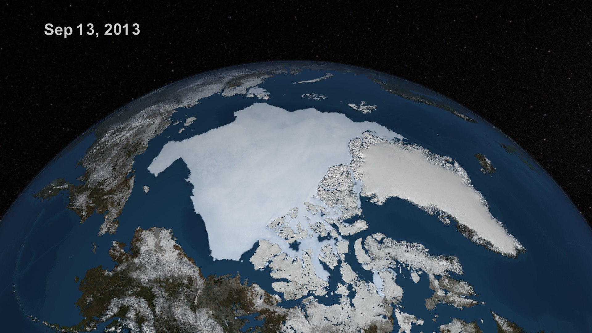
Since 1979, satellites have continuously monitored the ice that covers the Arctic Ocean. This space-based view allows scientists to measure the extent of the sea ice and track year-round changes in its size. On September 13, 2013, Arctic sea ice reached its annual minimum extent, covering 1.97 million square miles, or about half the total area of the United States. This is the sixth lowest extent on record, measuring 432,000 square miles less than the 30-year average calculated from 1981-2010. Sea ice forms in the Arctic when air and ocean temperatures are sufficiently cold for saltwater to freeze. As a result, growth takes place during the fall and winter months while melting occurs in spring and summer. Watch the video to see a visualization that shows changes to Arctic sea ice leading up to this year's minimum extent.

How much sea ice is left in the Arctic following this year's melt?
This visualization shows sea ice and land cover changes from May 16 to Sept. 13, 2013.
The 2013 Arctic sea ice minimum extent is shown in comparison to the 30-year average (yellow line).
A mixture of Arctic sea ice appears in this image taken by NASA's Aqua satellite on Sept. 13, 2013.
Arctic sea ice meets open ocean in this image taken by NASA's Terra satellite on Sept. 13, 2013.
For More Information
See NASA.gov
Credits
Please give credit for this item to:
NASA's Goddard Space Flight Center
Sea ice images courtesy of NASA Worldview
-
Animators
-
Cindy Starr
(Global Science and Technology, Inc.)

-
Alex Kekesi
(Global Science and Technology, Inc.)
-
Cindy Starr
(Global Science and Technology, Inc.)
-
Producer
- Jefferson Beck (USRA)
-
Scientist
- Josefino Comiso (NASA/GSFC)
-
Writer
- Kayvon Sharghi (USRA)
Related
- ID: 4104
Release date
This page was originally published on Thursday, September 26, 2013.
This page was last updated on Wednesday, May 3, 2023 at 1:51 PM EDT.