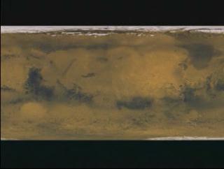
Viking Texture Zoom Down (Slow)
This animation is a set up visualization. Using the
Viking data, the camera zooms down slowly towards the area where there
might be hidden water channels.

Video slate image reads, "MOLA
Zoom down to hidden channel overlayed on a Gravity Map".
For More Information
Credits
Please give credit for this item to:
NASA/Goddard Space Flight Center
Scientific Visualization Studio
-
Animator
- Stuart A. Snodgrass (Global Science and Technology, Inc.)
-
Scientist
- David Smith (NASA/GSFC)
Missions
This page is related to the following missions:Series
This page can be found in the following series:Datasets used
-
[MGS: MOLA]
ID: 59 -
[Viking]
ID: 130
Note: While we identify the data sets used on this page, we do not store any further details, nor the data sets themselves on our site.
Alternate Versions
- ID: 1098
Release date
This page was originally published on Monday, June 19, 2000.
This page was last updated on Wednesday, May 3, 2023 at 1:58 PM EDT.