Aerial Superhighway
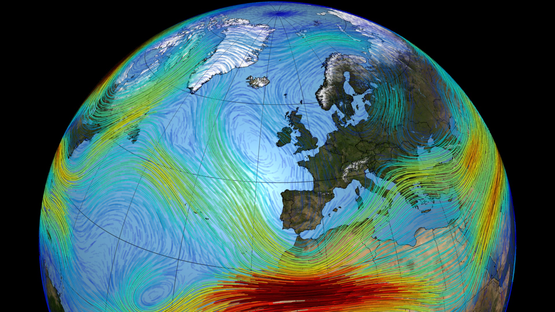
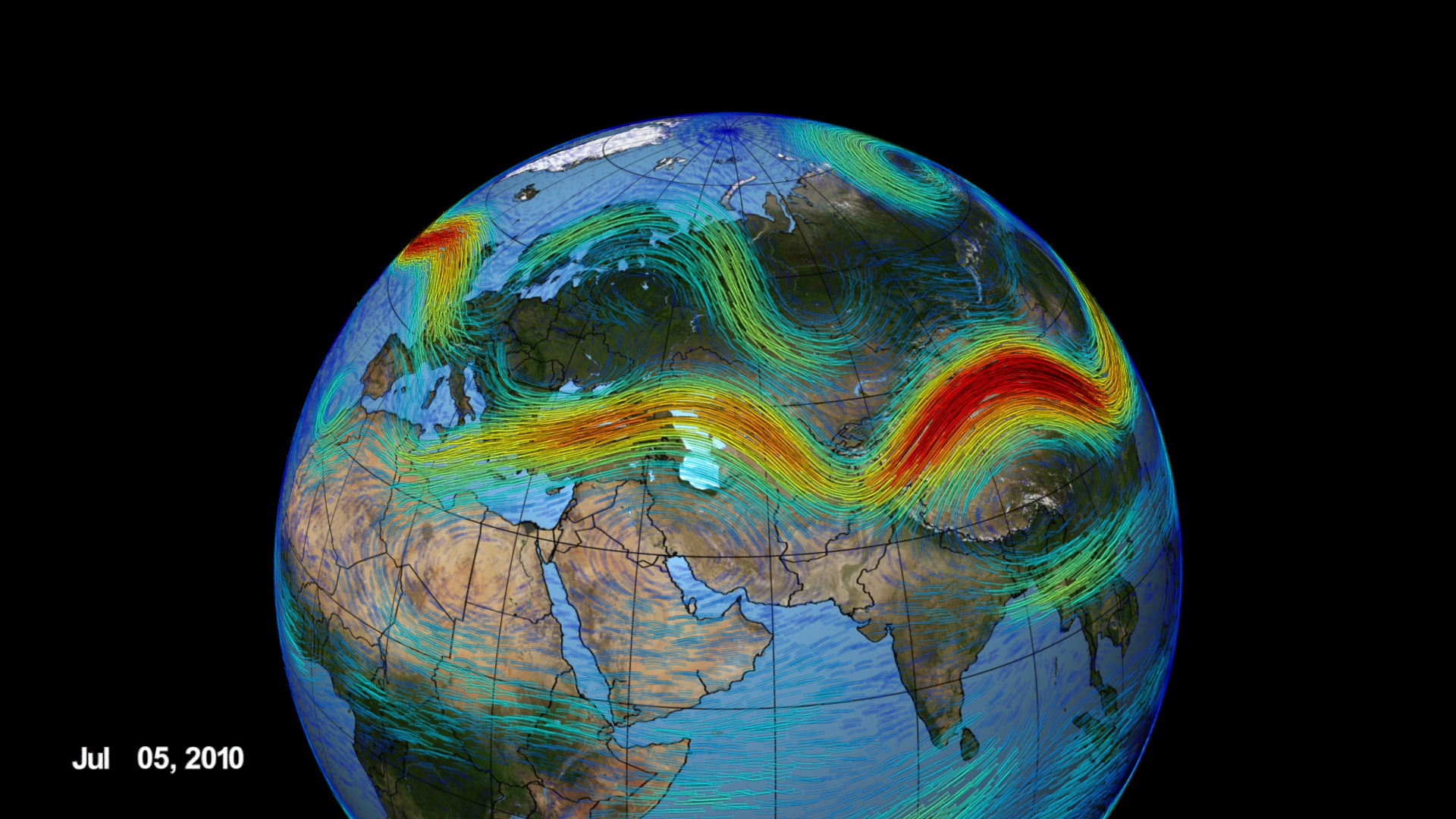
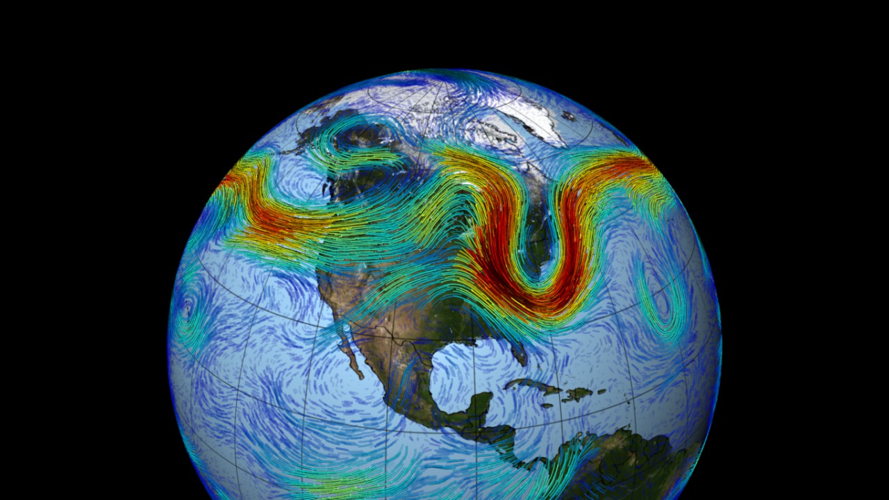
Meandering around the planet like a rollicking roller coaster in the sky, the Northern Hemisphere's polar jet stream is a fast-moving belt of westerly winds that traverses the lower layers of the atmosphere. The jet is created by the convergence of cold air masses descending from the Arctic and rising warm air from the tropics. Deep troughs and steep ridges emerge as the denser cold air sinks and deflects warm air regions north, giving the jet stream its wavy appearance. This pattern propagates across the mid-latitudes of North America, Europe and Asia, as pockets of cold air sporadically creep down from the Arctic—creating contrasting waves and flows that accelerate eastward due to Earth's rotation. The visualization below uses weather and climate observations from NASA's MERRA dataset to model 30 days of the jet stream's whirling journey over North America.

The polar jet stream, as you've never seen it before.
The polar jet stream can travel at speeds greater than 100 mph. Here, the fastest winds are colored red; slower winds are blue.
The polar jet stream is strongest in winter when the temperature difference between warm and cold air in the Northern Hemisphere is at its highest.
Narrow cold air pockets sinking from the Arctic sometimes pinch off warmer air flowing along the jet stream as seen in this sequence.
Banded cirrus clouds running perpendicular to the jet stream—a telltale feature photographed by an astronaut aboard Space Shuttle Discovery.
Credits
Please give credit for this item to:
NASA's Goddard Space Flight Center
-
Animators
- Trent L. Schindler (USRA)
-
Greg Shirah
(NASA/GSFC)

- Horace Mitchell (NASA/GSFC)
-
Producer
- Jefferson Beck (USRA)
-
Writer
- Kayvon Sharghi (USRA)
Related
- ID: 4171
 Visualization
 - ID: 4148
 Visualization
 - ID: 3864
 Visualization
Release date
This page was originally published on Tuesday, February 7, 2012.
This page was last updated on Wednesday, May 3, 2023 at 1:53 PM EDT.