Valles Marineris Flyover (Long Version)
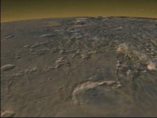
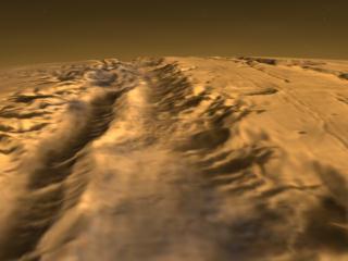
This view of Valles Marineris was constructed by combining the Viking color texture with MOLA altimetry data. There is no vertical exaggeration applied to the surface displacement.
Valles Marineris Flyover
\".")
Video slate image reads, "Valles Marineris Flyover
Altitude about 100 kilometers, MOLA Elevation with Viking texture
(longer version)".
For More Information
Credits
Please give credit for this item to:
NASA/Goddard Space Flight Center
Scientific Visualization Studio
-
Animators
- Tom Bridgman (Global Science and Technology, Inc.)
- Stuart A. Snodgrass (Global Science and Technology, Inc.)
- Randall Jones (Global Science and Technology, Inc.)
-
Scientist
- David Smith (NASA/GSFC)
Missions
This page is related to the following missions:Series
This page can be found in the following series:Datasets used
-
[MGS: MOLA]
ID: 59 -
[Viking]
ID: 130
Note: While we identify the data sets used on this page, we do not store any further details, nor the data sets themselves on our site.
Alternate Versions
- ID: 1093
 Visualization
 - ID: 1101
 Visualization
Release date
This page was originally published on Thursday, March 9, 2000.
This page was last updated on Wednesday, May 3, 2023 at 1:58 PM EDT.