Guided Tour of LIMA Flyover
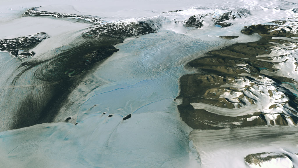
In 2007, more than 1,100 Landsat 7 images were used to create the first ever, high-resolution, true color map of Antarctica. The Landsat Image Mosaic of Antarctica (LIMA) is a virtually cloud-free, 3-D view of Antarctica's frozen landscape produced by NASA, working with the National Science Foundation, the U.S. Geological Survey and the British Antarctic Survey.
Visualizers stitched together Landsat 7 satellite imagery acquired in 1999 and 2001 with a digital elevation model and field data measurements.
Portion of longer video flying over Antarctica, using data from the Landsat Image Mosaic of Antarctica (LIMA). Selected as one of the "Top Ten Stories of Landsat's 40 Years," LIMA is the first ever, high-resolution, true color map of the Antarctic continent.
This guided tour of the area surrounding McMurdo Station in Antarctica uses the Landsat Image Mosaic of Antarctica (LIMA). It's a great way to experience the frozen continent without any risk of frostbite.
This is a narrated version of entry #3482: Landsat Image Mosaic of Antarctica Flyover of McMurdo Station and Dry Valleys.
For complete transcript, click here.
This video is also available on our YouTube channel.
Version of the guided tour of the area surrounding McMurdo Station in Antarctica using the Landsat Image Mosaic of Antarctica (LIMA) created for the National Science Foundation Visualization Competition.
For More Information
See the following sources:
Credits
Please give credit for this item to:
NASA/Goddard Space Flight Center
U.S. Geological Survey
Landsat is a joint program of NASA and USGS:
http://landsat.usgs.gov
http://www.nasa.gov/landsat
-
Animator
- Lori Perkins (NASA/GSFC)
-
Video editors
- Michelle Williams (UMBC)
- Michael Randazzo (Advocates in Manpower Management, Inc.)
-
Narrator
- Laura Motel (UMBC)
-
Producers
- Michelle Williams (UMBC)
- Andrew Freeberg (NASA/GSFC)
- Jefferson Beck (UMBC)
- Ryan Fitzgibbons (UMBC)
-
Scientist
- Bob Bindschadler (NASA/GSFC)
-
Writer
- Maria Frostic (UMBC)
Missions
This page is related to the following missions:Series
This page can be found in the following series:Datasets used
-
[Landsat]
ID: 47 -
LIMA (Landsat Image Mosaic of Antarctica) [Landsat-7: ETM+]
ID: 599Mosaicing to avoid clouds produced a high quality, nearly cloud-free benchmark data set of Antarctica for the International Polar Year from images collected primarily during 1999-2003.
This dataset can be found at: http://lima.nasa.gov/
See all pages that use this dataset
Note: While we identify the data sets used on this page, we do not store any further details, nor the data sets themselves on our site.
Related
- ID: 10732
 Produced Video
Used as a Source In
- ID: 14116

Release date
This page was originally published on Tuesday, April 7, 2009.
This page was last updated on Wednesday, May 3, 2023 at 1:54 PM EDT.