September 17, 2003 - (date of web publication)
Hurricane Isabel Powering Toward the U.S.
NASA satellites capture many different perspectives of Hurricane Isabel. Twice a day, every day, two satellites fly over the planet capturing highly detailed images of the Earth.
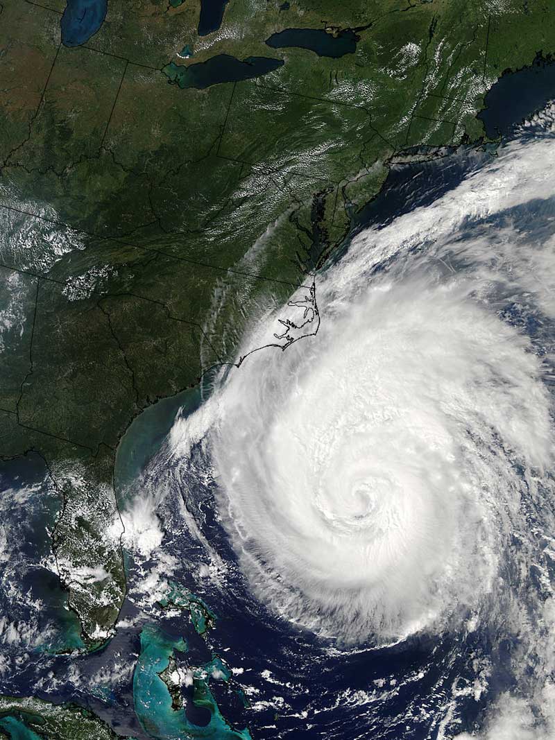
Click here for a high resolution version of image above
Credit: NASA/MODIS Land Rapid Response Team
This animated sequence shows eight days of high-resolution images of Hurricane Isabel. These images are so detailed that you can see the wind vortices inside the eye. These images were captured September 8, 10,11,12, 14, 15, 16, and 17, 2003. NASA's Moderate Resolution Imaging Spectroradiometer (MODIS) instruments onboard NASA's Terra and Aqua satellites acquired the data for these images. Click here to view the animated seqence provided by the Scientific Visualization Studio (SVS).
Here is another view of Isabel on September 17th from the SeaWiFS (Sea-viewing Wide Field-of-View Sensor) instrument.
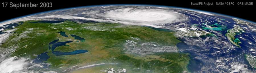
Click here for a high resolution version of image above
Credit: NASA/Orbimage*
Three different high resolution images from the animation above:
High resolution from animation - Image 1
High resolution from animation - Image 2
High resolution from animation - Image 3
Click here to get a movie of Isabel's progression through September 18, 2003
More stories pertaining to Isabel
NASA Looks at the Heat Engine Driving Hurricane Isabel, September 16, 2003
September 16, 2003 view of Isabel
September 15, 2003 view of Isabel
September 12, 2003 view of Isabel
September 11, 2003 view of Isabel
For more information contact:
Rani D. Chohan
Goddard Space Flight Center
Greenbelt, MD 20771
Phone: 301-286-2483
* NOTE: All SeaWiFS images and data presented on this web site are for research and educational use only. All commercial use of SeaWiFS data must be coordinated with GeoEye (Orbimage became GeoEye and then In January 2013, DigitalGlobe and GeoEye combined to become one DigitalGlobe.).