Hurricane Isabel
|
|
|
|
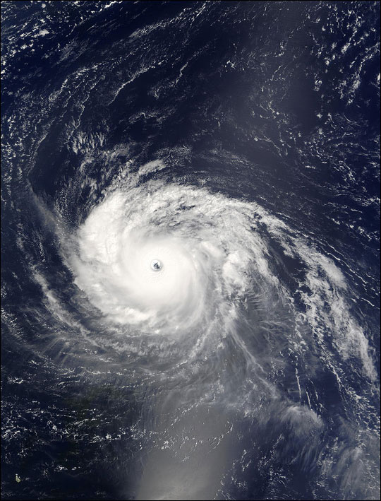
Hurricane Isabel northeast of the Lesser Antilles, above (early the morning of Sept. 12, 2003) |
|

The MODIS instrument onboard NASA's Terra satellite captured this bird's-eye view of Hurricane Isabel at 14:15 UTC on September 11, 2003. In this image Isabel is located at 530 miles east-northeast of the northern Leeward Islands and was packing maximum sustained winds near 150 mph. This takes Isabel 5 mph short of a category 5 storm on the Saffir-Simpson scale.
Images courtesy: MODIS Land Rapid Response Team at NASA GSFC.
Click here for high resolution version of left image
Click here for high resolution version of right image
Click here for animation
Click here for TV resolution image
For more information contact:
Rani D. Chohan
Goddard Space Flight Center
Greenbelt, MD 20771
Phone: 301-286-2483
September 11, 2003 view of Isabel