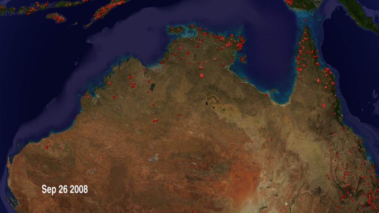
2008 Northern Australia Fire Observations
The fires that these data show include - savanna fires, wildfires, managed fires, agricultural fires, and thermal anomalies associated with power plants or gas flares. Fires occur around the world at different times of the year.
MODIS is entering its 10th year of data collection and we are using the data to study the global distribution of fires and document changed in fire regimes due to climate or land use change.
These fire data are used by Australian fire managers and scientists. Dr Chris Justice and the MODIS team participated in the NAILSMA experiment. NAILSMA was commissioned by the Northern Australia Land and Water Taskforce to convene a forum to bring together key Indigenous water experts from across the north of Australia to discuss their water interests and issues. This part of Northern Australia is an important area in terms of biodiversity and fire is an integral ecosystem process. We are interested in applying these data and other data from the MODIS instrument to better understand the occurence of fire and its characteristics in the Northern Territories with respect to emissions of trace gases into the atmosphere an the imacts of fire on the ecosystem.

Visualization Credits
Greg Shirah (NASA/GSFC): Animator
Michelle Williams (UMBC): Producer
Chris Justice (University of Maryland): Scientist
Louis Giglio (SSAI): Scientist
Inbal Becker Reshef (University of Maryland): Scientist
NASA/Goddard Space Flight Center Scientific Visualization Studio
https://svs.gsfc.nasa.gov/3624
Missions:
Landsat
QuikSCAT
Shuttle Radar Topography Mission - SRTM
Terra
Tropical Rainfall Measuring Mission - TRMM
Data Used:
SRTM/SIR-C
Terra/MISR
Gridded Population of the World (Version 3 Beta)
Data Compilation - SEDACEarth Probe/TOMS/Aerosol Index
10-meter DEM
USGSGTOPO30
Model - USGSQuikSCAT/SeaWinds/Wind
Terra and Aqua/MODIS/Fire Location
2001/10/01 - 2002/09/30Fire location data courtesy of MODIS Rapid Response Project (NASA/GSFC and University of Maryland - http://rapidfire.sci.gsfc.nasa.gov)
Terra/MODIS/NDVI
This item is part of these series:
Fires
Multisensor Fire Observations
Agriculture Animations - Fires
Goddard TV Tape:
G2008-042HD -- HD Fires, Ozone, and Air Quality RT
Keywords:
DLESE >> Atmospheric science
SVS >> Biscuit
DLESE >> Forestry
SVS >> HDTV
SVS >> Hayman
DLESE >> Natural hazards
SVS >> Rodeo
GCMD >> Earth Science >> Biosphere >> Ecological Dynamics >> Fire Occurrence
GCMD >> Earth Science >> Human Dimensions >> Natural Hazards >> Fires
GCMD >> Location >> Australia
SVS >> GOES
SVS >> For Educators
SVS >> Forest Fires
NASA Science >> Earth
GCMD >> Earth Science >> Human Dimensions >> Natural Hazards >> Wildfires
GCMD keywords can be found on the Internet with the following citation: Olsen, L.M., G. Major, K. Shein, J. Scialdone, S. Ritz, T. Stevens, M. Morahan, A. Aleman, R. Vogel, S. Leicester, H. Weir, M. Meaux, S. Grebas, C.Solomon, M. Holland, T. Northcutt, R. A. Restrepo, R. Bilodeau, 2013. NASA/Global Change Master Directory (GCMD) Earth Science Keywords. Version 8.0.0.0.0


