Earth
ID: 3206
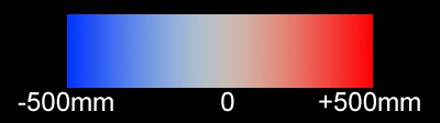
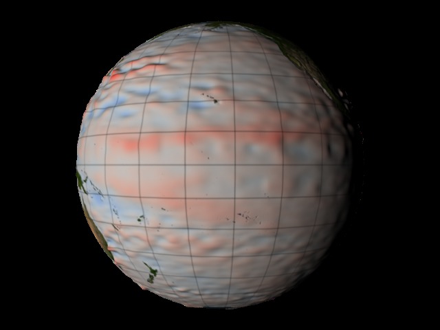
This visualization shows the relative sea level around the Earth. Sea level is represented by both color (blue=low, red=high) and bumpiness. The range is -500 mm to +500 mm.


TOPEX/JASON Sea Level
Related

For More Information
Visualization Credits
Greg Shirah (NASA/GSFC): Lead Animator
Akiko Hayashi (NASA/JPL CalTech): Scientist
Michael Starobin (HTSI): Writer
Akiko Hayashi (NASA/JPL CalTech): Scientist
Michael Starobin (HTSI): Writer
Please give credit for this item to:
NASA/Goddard Space Flight Center Scientific Visualization Studio
NASA/Goddard Space Flight Center Scientific Visualization Studio
Short URL to share this page:
https://svs.gsfc.nasa.gov/3206
Data Used:
Note: While we identify the data sets used in these visualizations, we do not store any further details nor the data sets themselves on our site.
This item is part of this series:
Sea Level NSU
Keywords:
GCMD >> Earth Science >> Oceans >> Sea Surface Topography >> Sea Surface Height
NASA Science >> Earth
GCMD keywords can be found on the Internet with the following citation: Olsen, L.M., G. Major, K. Shein, J. Scialdone, S. Ritz, T. Stevens, M. Morahan, A. Aleman, R. Vogel, S. Leicester, H. Weir, M. Meaux, S. Grebas, C.Solomon, M. Holland, T. Northcutt, R. A. Restrepo, R. Bilodeau, 2013. NASA/Global Change Master Directory (GCMD) Earth Science Keywords. Version 8.0.0.0.0
https://svs.gsfc.nasa.gov/3206
Data Used:
Jason-1/Altimeter/Sea Surface Height
1992/10/10 to 2005/05/06TOPEX/Poseidon/Sea Surface Height
1992/10/10 to 2005/05/06This item is part of this series:
Sea Level NSU
Keywords:
GCMD >> Earth Science >> Oceans >> Sea Surface Topography >> Sea Surface Height
NASA Science >> Earth
GCMD keywords can be found on the Internet with the following citation: Olsen, L.M., G. Major, K. Shein, J. Scialdone, S. Ritz, T. Stevens, M. Morahan, A. Aleman, R. Vogel, S. Leicester, H. Weir, M. Meaux, S. Grebas, C.Solomon, M. Holland, T. Northcutt, R. A. Restrepo, R. Bilodeau, 2013. NASA/Global Change Master Directory (GCMD) Earth Science Keywords. Version 8.0.0.0.0


