Earth
ID: 2908
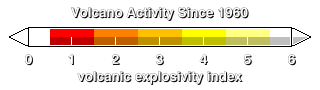
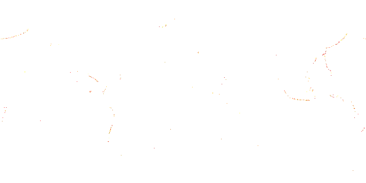
This animation represents cumulative global volcanic activity over a 36-year span, from 1960 through 1995. Volcanoes occur near but not on tectonic plate boundaries. If a plate boundary is a convergent boundary, where one plate is subducting under another, then volcanoes occur on the top plate, over the area where rock from the subducting plate has melted, is rising, and has broken through to the surface. The Mt. St. Helens eruption is visible in this animation starting in March, 1980.
Volcano Activity from 1960 through 1995 (WMS)
Visualization Credits
Horace Mitchell (NASA/GSFC): Lead Animator
Eric Sokolowsky (GST): Animator
Tom Watters (Smithsonian/Air and Space): Scientist
Eric Sokolowsky (GST): Animator
Tom Watters (Smithsonian/Air and Space): Scientist
Please give credit for this item to:
NASA/Goddard Space Flight Center Scientific Visualization Studio
NASA/Goddard Space Flight Center Scientific Visualization Studio
Short URL to share this page:
https://svs.gsfc.nasa.gov/2908
Data Used:
Note: While we identify the data sets used in these visualizations, we do not store any further details nor the data sets themselves on our site.
This item is part of this series:
WMS
Keywords:
DLESE >> Geology
DLESE >> Natural hazards
SVS >> Volcano
GCMD >> Earth Science >> Solid Earth >> Volcanoes
SVS >> For Educators
SVS >> Fault Boundaries
SVS >> Ring of Fire
NASA Science >> Earth
GCMD keywords can be found on the Internet with the following citation: Olsen, L.M., G. Major, K. Shein, J. Scialdone, S. Ritz, T. Stevens, M. Morahan, A. Aleman, R. Vogel, S. Leicester, H. Weir, M. Meaux, S. Grebas, C.Solomon, M. Holland, T. Northcutt, R. A. Restrepo, R. Bilodeau, 2013. NASA/Global Change Master Directory (GCMD) Earth Science Keywords. Version 8.0.0.0.0
https://svs.gsfc.nasa.gov/2908
Data Used:
Airborne Topographic Mapper
Global Volcanism Program also referred to as: Volcano Activity
Smithsonian Institute - 1960/01/01 - 1995/12/31This item is part of this series:
WMS
Keywords:
DLESE >> Geology
DLESE >> Natural hazards
SVS >> Volcano
GCMD >> Earth Science >> Solid Earth >> Volcanoes
SVS >> For Educators
SVS >> Fault Boundaries
SVS >> Ring of Fire
NASA Science >> Earth
GCMD keywords can be found on the Internet with the following citation: Olsen, L.M., G. Major, K. Shein, J. Scialdone, S. Ritz, T. Stevens, M. Morahan, A. Aleman, R. Vogel, S. Leicester, H. Weir, M. Meaux, S. Grebas, C.Solomon, M. Holland, T. Northcutt, R. A. Restrepo, R. Bilodeau, 2013. NASA/Global Change Master Directory (GCMD) Earth Science Keywords. Version 8.0.0.0.0


