Earth
ID: 12874
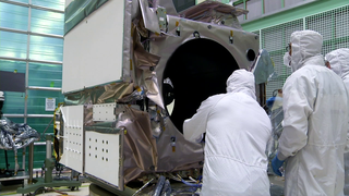
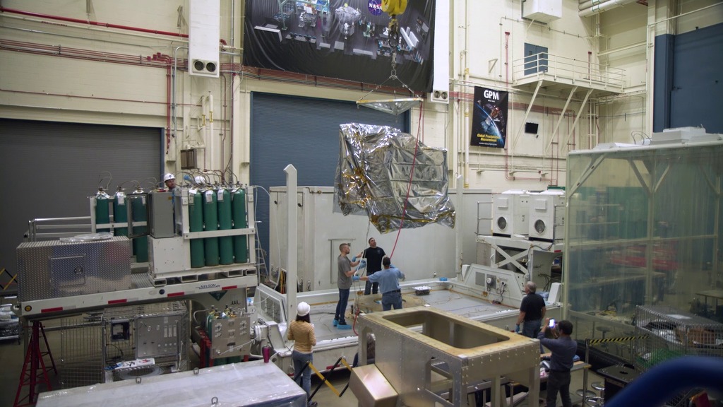
The Ice, Cloud and land Elevation Satellite-2 is slated to launch in September to measure the height of Earth’s surface, particularly the changing polar ice. To do that, it uses a laser instrument called the Advanced Topographic Laser Altimeter System, or ATLAS, that precisely times how long it takes light particles to bounce off Earth and return to the satellite.
NASA Space Laser Heads on a Road Trip
ATLAS was designed, built and tested at NASA’s Goddard Space Flight Center in Greenbelt, Maryland. The spacecraft bus, with its solar panels, navigation components and more, was built at Orbital ATK’s facility in Gilbert, Arizona. To deliver the instrument safely to the spacecraft for assembly and testing, the ATLAS team developed special procedures for packing, transporting and monitoring the sensitive hardware.
Source Material
Credits
Ryan Fitzgibbons (USRA): Lead Producer
Ryan Fitzgibbons (USRA): Lead Videographer
Ryan Fitzgibbons (USRA): Lead Editor
Ryan Fitzgibbons (USRA): Lead Videographer
Ryan Fitzgibbons (USRA): Lead Editor
Please give credit for this item to:
NASA's Scientific Visualization Studio
NASA's Scientific Visualization Studio
Short URL to share this page:
https://svs.gsfc.nasa.gov/12874
Mission:
Ice, Cloud, and land Elevation Satellite-2 (ICESat-2)
This item is part of this series:
Narrated Movies
Keywords:
SVS >> HDTV
SVS >> Hyperwall
SVS >> Atlas
NASA Science >> Earth
https://svs.gsfc.nasa.gov/12874
Mission:
Ice, Cloud, and land Elevation Satellite-2 (ICESat-2)
This item is part of this series:
Narrated Movies
Keywords:
SVS >> HDTV
SVS >> Hyperwall
SVS >> Atlas
NASA Science >> Earth


