Planets and Moons
ID: 12279

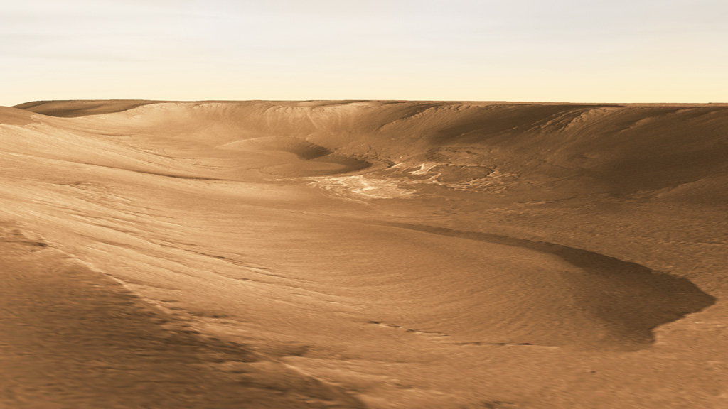
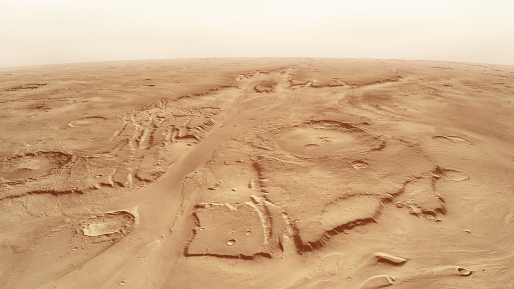
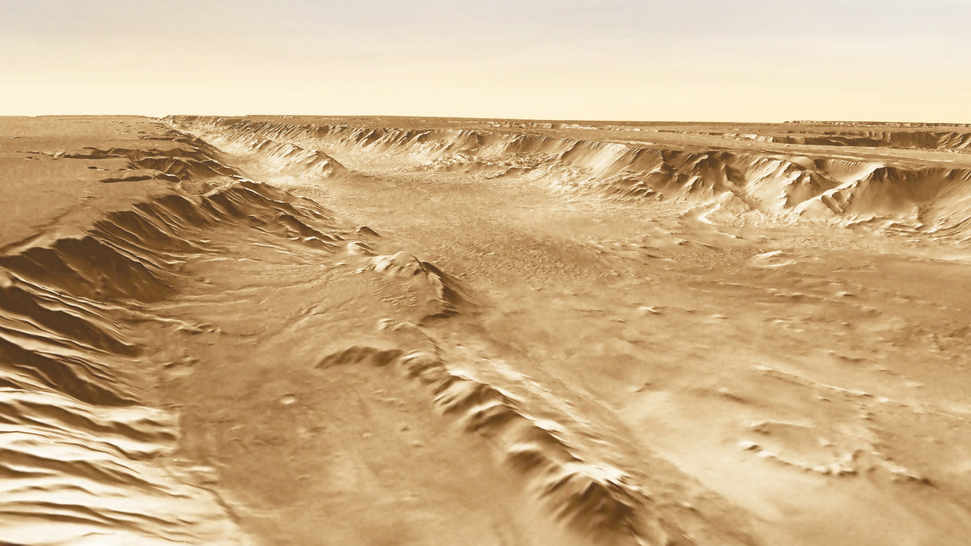
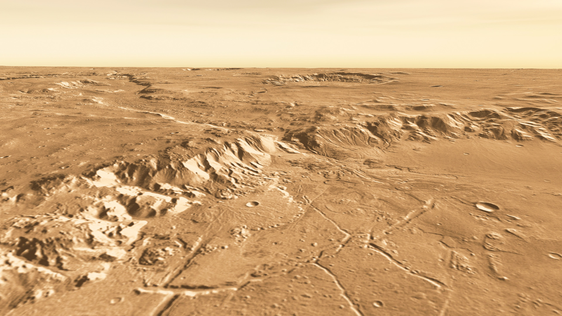
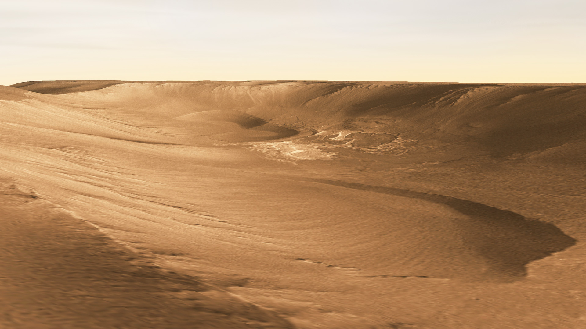
Scientists estimate water covered a significant portion of Mars early in its history. Today, dry lakebeds, deep valleys and sandy plains all point to areas where water once flowed. Such landforms are captured in images taken by the THEMIS instrument aboard NASA’s Mars Odyssey spacecraft. Since its 2001 arrival, the orbiter has made more than 60,000 laps around the Red Planet, and collected more than 400,000 photos of the Martian landscape. The spacecraft’s survey has helped scientists locate features that likely formed in the presence of water, such as Ravi Vallis, a 125-mile-long channel carved by a massive flood. Identifying these environments has informed the landing sites of robotic missions and will aid future human explorers searching the planet for signs of life. Explore the images to learn more.


Magnificent Desiccation
Story Credits
Scientist:
Shane Byrne (The University of Arizona/LPL)
Writer:
Alison Takemura (USRA)
Lead Writer:
NASA Viz Team
Shane Byrne (The University of Arizona/LPL)
Writer:
Alison Takemura (USRA)
Lead Writer:
NASA Viz Team
Please give credit for this item to:
NASA's Goddard Space Flight Center
Images courtesy of NASA/JPL/Arizona State University/R. Luk
NASA's Goddard Space Flight Center
Images courtesy of NASA/JPL/Arizona State University/R. Luk
Short URL to share this page:
https://svs.gsfc.nasa.gov/12279
Keywords:
SVS >> App
NASA Science >> Planets and Moons
https://svs.gsfc.nasa.gov/12279
Keywords:
SVS >> App
NASA Science >> Planets and Moons


