Earth
ID: 11874
NASA has a variety of resources for reporters covering 2016's Atlantic Ocean and Eastern and Central Pacific hurricane seasons, including scientific animations in a resource reel that look inside hurricanes and daily updates with satellite data. The Atlantic Ocean hurricane season begins June 1 and runs through Nov. 30. This year, activity in the Atlantic basin began unusually early, with the development in January of Hurricane Alex in the eastern Atlantic. Alex officially became a hurricane on Jan. 14, 2016 and the National Hurricane Center said it was the earliest hurricane to form in the Atlantic since 1938. Like the Atlantic, activity in the Central Pacific started early when the first tropical cyclone, Pali, developed in January and on the 11th became the earliest hurricane ever recorded. NASA satellite imagery on NASA's Hurricane page covered both storms from birth to death. The NASA Hurricane page has covered all worldwide tropical cyclones in every ocean basin since 2005.
NASA Hurricane Resources Available for 2016 Atlantic Hurricane Season
Link to gallery Hurricane and Typhoon Resource Page. Includes a section for named storms between 1988-2007 including Hurricane Katrina in 2005. Gallery page also includes the following sections: hurricane resources; TRMM 3D hurricane products; narrated hurricane products and hurricanes sea surface temperature connections.
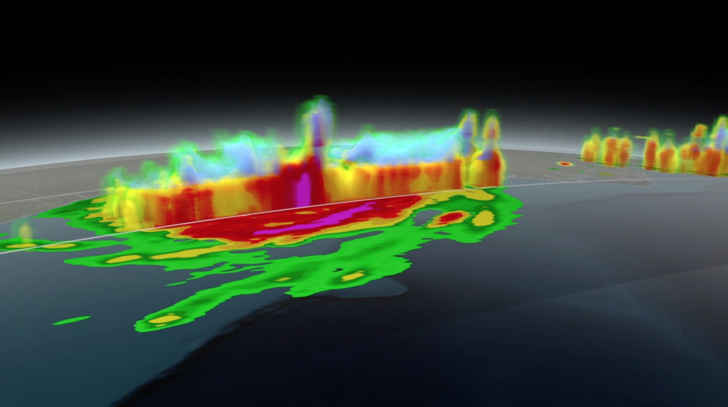
Gallery resource page for the Global Precipitation Measurement (GPM) mission. Includes 3D scans of recent storms like Hurricane Bertha and Super Typhoon Maysak. It also includes IMERG visualizations, beauty passes of the satellite and edited features.
Gallery resource page for the Tropical Rainfall Measuring Mission (TRMM).
Video file for the RapidScat mission. More information about RapidScat can be found HERE.
Link to video for the Cyclone Global Navigation Satellite System, or CYGNSS mission. More about the mission HERE.
Hurricane Resource Page
NASA Hurricane Resources Available for 2016 Atlantic Hurricane Season
Link to gallery Hurricane and Typhoon Resource Page. Includes a section for named storms between 1988-2007 including Hurricane Katrina in 2005. Gallery page also includes the following sections: hurricane resources; TRMM 3D hurricane products; narrated hurricane products and hurricanes sea surface temperature connections.
Gallery resource page for the Global Precipitation Measurement (GPM) mission. Includes 3D scans of recent storms like Hurricane Bertha and Super Typhoon Maysak. It also includes IMERG visualizations, beauty passes of the satellite and edited features.
Gallery resource page for the Tropical Rainfall Measuring Mission (TRMM).
Video file for the RapidScat mission. More information about RapidScat can be found HERE.
Link to video for the Cyclone Global Navigation Satellite System, or CYGNSS mission. More about the mission HERE.
For More Information
Credits
Michelle Handleman (USRA): Lead Producer
Michael Randazzo (Advocates in Manpower Management, Inc.): Lead Editor
Michael Randazzo (Advocates in Manpower Management, Inc.): Lead Editor
Please give credit for this item to:
NASA's Goddard Space Flight Center
NASA's Goddard Space Flight Center
Short URL to share this page:
https://svs.gsfc.nasa.gov/11874
Missions:
Global Precipitation Measurement (GPM)
Tropical Rainfall Measuring Mission - TRMM
Keywords:
SVS >> GPM
SVS >> Global Precipitation Measurement
SVS >> HDTV
DLESE >> Natural hazards
GCMD >> Earth Science >> Atmosphere >> Atmospheric Phenomena >> Hurricanes
GCMD >> Earth Science >> Atmosphere >> Atmospheric Phenomena >> Typhoons
SVS >> Hurricane Katrina
SVS >> GOES
NASA Science >> Earth
SVS >> TRMM
SVS >> Hurricane Sandy
GCMD keywords can be found on the Internet with the following citation: Olsen, L.M., G. Major, K. Shein, J. Scialdone, S. Ritz, T. Stevens, M. Morahan, A. Aleman, R. Vogel, S. Leicester, H. Weir, M. Meaux, S. Grebas, C.Solomon, M. Holland, T. Northcutt, R. A. Restrepo, R. Bilodeau, 2013. NASA/Global Change Master Directory (GCMD) Earth Science Keywords. Version 8.0.0.0.0


