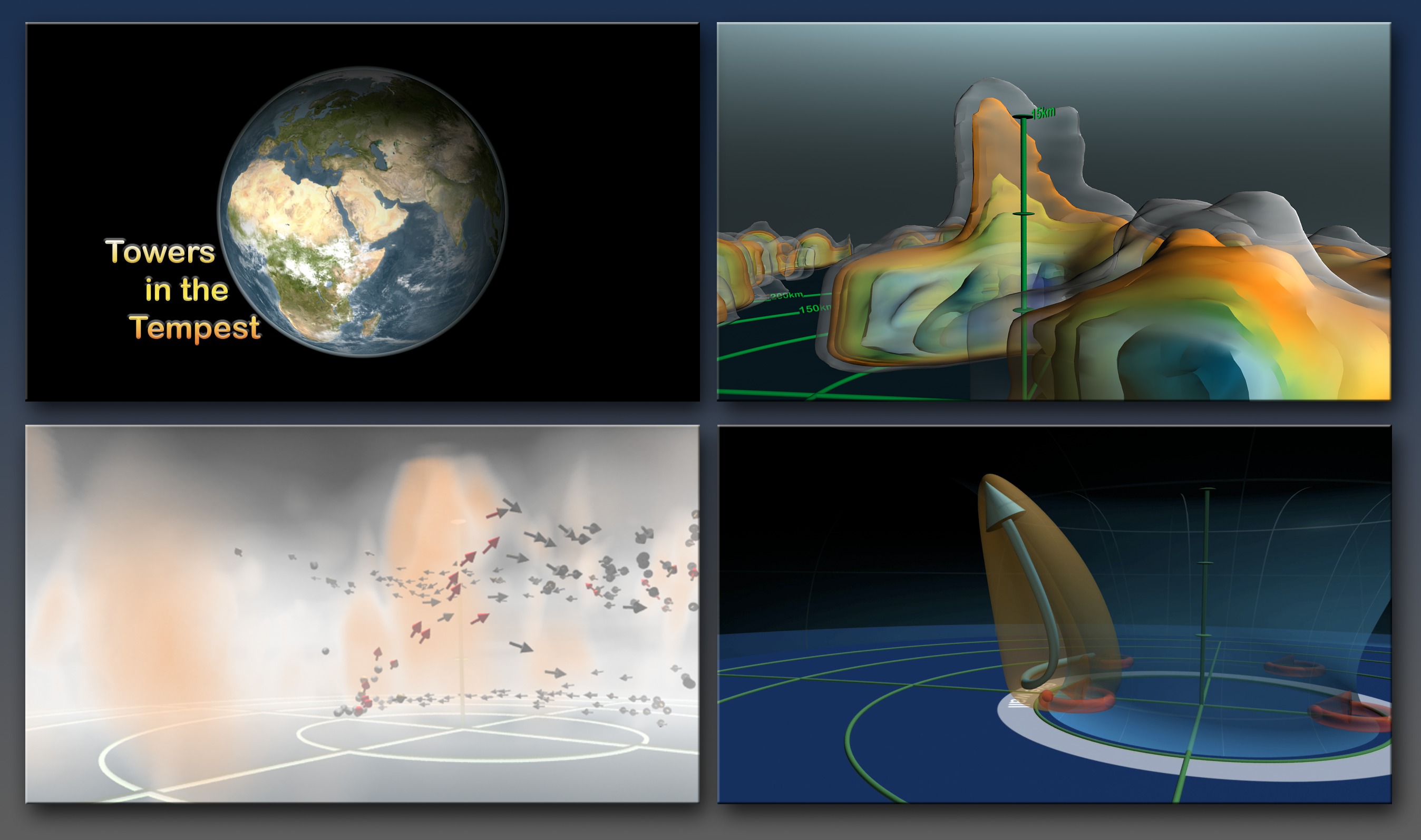
Towers In The Tempest
Massive accumulations of heat pulled from the top layers of tropical ocean water and set spinning due to planetary rotation form a hurricane's spiraling vortex. But powering the inside of these storms we find one of nature's most astounding natural engines: hot towers. Scientists discovered hot towers in recent years by observing storms from space and creating advanced supercomputer models to decipher how a hurricane sustains its winding movement. The models show that when air spirals inward toward the eye of a hurricane it collides with an unstable region of air at the eyewall, where the strongest winds are found, and suddenly deflects upwards. This rush of warm, moist air is accelerated by surrounding patches of convective clouds, called hot towers, which strengthen and propel the hurricane by keeping the vertical ring of clouds in motion. Watch the first video below as NASA researchers look under the hood of these cloud super-engines to reveal exciting findings about a hurricane's internal motor.

How cloud super-engines shift hurricanes into overdrive.
Want to know how hot towers form? Watch this video that uses supercomputer models to visualize these amazing structures.
The inside of Hurricane Ike on Sep. 10, 2008 is revealed using NASA's Tropical Rainfall Measuring Mission (TRMM) satellite.
See the hot tower (red) near the center of Hurricane Danielle on Aug. 27, 2010.
Understanding how hot towers power hurricanes results in improved storm forecasting models that will ultimately save lives.
The eyewall updraft (orange) sends air parcels (blue) higher in the atmosphere.
High-altitude towers--some as high as nine miles (15 km)--play a key role in transforming mediocre tropical storms into full-scale tempests.
Credits
Please give credit for this item to:
NASA's Goddard Space Flight Center Scientific Visualization Studio
-
Animators
- Greg Shirah (NASA/GSFC)
- Lori Perkins (NASA/GSFC)
- Alex Kekesi (Global Science and Technology, Inc.)
- James W. Williams (Global Science and Technology, Inc.)
- Horace Mitchell (NASA/GSFC)
- Marte Newcombe (Global Science and Technology, Inc.)
- Tom Bridgman (Global Science and Technology, Inc.)
- Helen-Nicole Kostis (USRA)
-
Visualizer
- Cindy Starr (Global Science and Technology, Inc.)
-
Video editor
- Stuart A. Snodgrass (Global Science and Technology, Inc.)
-
Narrator
- Horace Mitchell (NASA/GSFC)
-
Scientist
- Scott Braun (NASA/GSFC)
-
Project support
- Randall Jones (Global Science and Technology, Inc.)
- Joycelyn Thomson Jones (NASA/GSFC)
- Kevin Mahoney (CSC)
- John Jacobi (Global Science and Technology, Inc.)
-
Writer
- Kayvon Sharghi (USRA)
Release date
This page was originally published on Wednesday, July 28, 2010.
This page was last updated on Wednesday, May 3, 2023 at 1:54 PM EDT.
Related
- ID: 3413
 Visualization