Seeing Photosynthesis From Space
NASA scientists have discovered a new way to use satellites to measure what's occurring inside Earth's land plants at a cellular level.
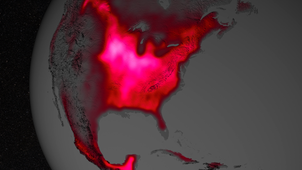
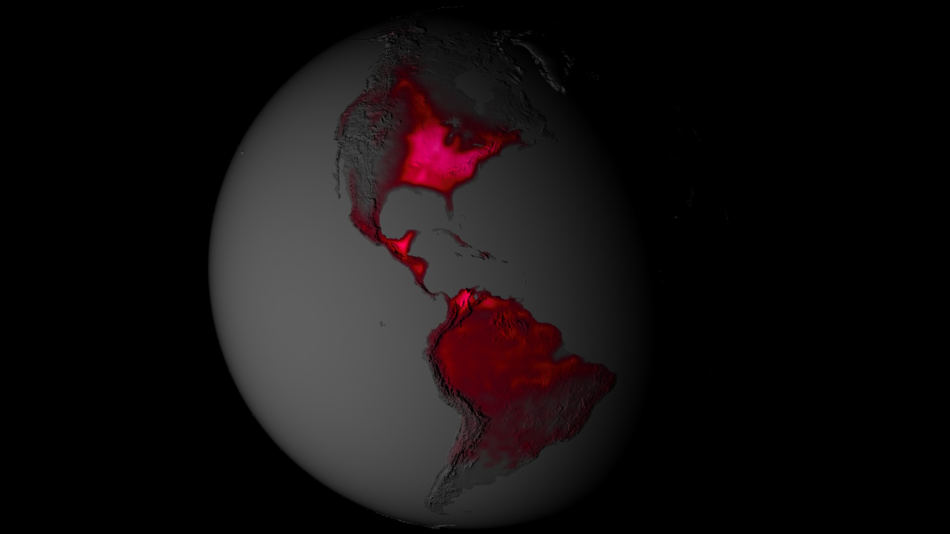
During photosynthesis, plants emit what is called fluorescence – a form of light invisible to the naked eye but detectable by satellites orbiting hundreds of miles above Earth. NASA scientists established a method to turn this satellite data into global maps of the subtle phenomenon in more detail than ever before.
The new maps – produced by Joanna Joiner of NASA's Goddard Space Flight Center in Greenbelt, Md., and colleagues – provide a 16-fold increase in spatial resolution and a 3-fold increase in temporal resolution over the first proof-of-concept maps released in 2011. Improved global measurements could have implications for farmers interested in early indications of crop stress, and ecologists looking to better understand global vegetation and carbon cycle processes.
"For the first time, we are able to globally map changes in fluorescence over the course of a single month," Joiner said. "This lets us use fluorescence to observe, for example, variation in the length of the growing season."
For complete transcript, click here.
Hi-res version of animation sequence seen in video.
Hi-res version of Earth rotation animation with star background.
For More Information
Credits
Please give credit for this item to:
NASA's Goddard Space Flight Center
-
Animators
- Tyler Chase (UMBC)
- Greg Shirah (NASA/GSFC)
-
Video editor
- Kayvon Sharghi (USRA)
-
Interviewee
- Joanna Joiner (NASA/GSFC)
-
Narration
- Kayvon Sharghi (USRA)
-
Narrator
- Kayvon Sharghi (USRA)
-
Producer
- Kayvon Sharghi (USRA)
-
Scientist
- Joanna Joiner (NASA/GSFC)
-
Videographer
- Rob Andreoli (Advocates in Manpower Management, Inc.)
-
Writer
- Kathryn Hansen (Wyle Information Systems)
Release date
This page was originally published on Wednesday, July 24, 2013.
This page was last updated on Wednesday, May 3, 2023 at 1:51 PM EDT.
Series
This visualization can be found in the following series:Tapes
This visualization originally appeared on the following tapes:-
Seeing Photosynthesis From Space
(ID: 2013069)
Wednesday, July 24, 2013 at 4:00AM
Related
- ID: 11583
- ID: 11322
 Produced Video
 - ID: 4086
 Visualization