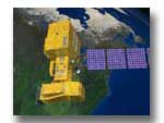
Zoom into the Superdome Caution: 1 MB file size
NASA's SUPERZOOM
Click here to download a movie of NASA's spectacular zoom into the Louisiana Superdome from orbit. (Caution: The file is approximately 1 MB in size.)
By carefully fusing image data from NASA's Terra and Landsat spacecraft, as well as the Space Imaging Corporation's Ikonos satellite, the space agency brings you this remarkable zoom into the Louisiana Superdome as captured in space. The scene is also something of a celebration for the space agency; 2002 marks the thirtieth anniversary of the highly successful Landsat program.
The development of this zoom has roots in important scientific research. The techniques necessary to manipulate this kind of image data about the Earth has provided critical tools for scientists to study important aspects of planetary change over time, land use issues, and the management of natural resources.
This Planet Earth
Want to see more? Click here to visit our special web page showcasing images from some of NASA's most successful remote sensing projects. There you can see how an integrated team of scientists and computing experts developed the Superbowl Zoom … and much, much more!
NASA is committed to the long-term study of the Earth via remote sensing, the study of the Earth from a distance. NASA's Earth Science Enterprise is dedicated to understanding the total Earth system and the effects of natural and human-induced changes on the global environment.
The "SuperZoom" was created and assembled by the Scientific Visualization Studio at NASA's Goddard Space Flight Center.
Credit: NASA and Space Imaging
More NASA Earth Science Links:
Earth Science Enterprise
Earth Observatory
Visible Earth
Goddard Home Page
Scientific Visualization Studio
For more information about the Superzoom contact:
Wade Sisler, NASA/Goddard Space Flight Center, Greenbelt, MD 20771
Support for this page was provided courtesy of Code 290, the Information Services and Advanced Technology (ISAT) Division
Responsible NASA Official:
Web Curator:

