September 15, 2003 - (date of web publication)
Hurricane Isabel - Latest Images
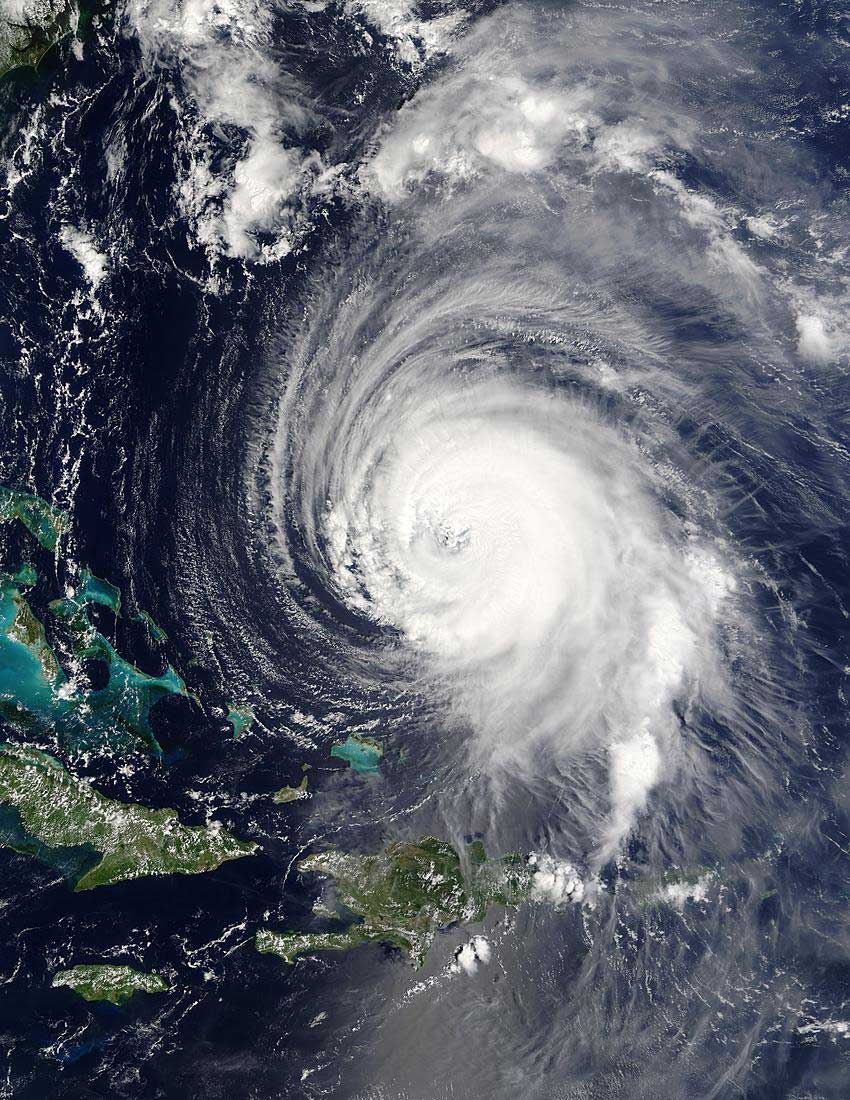
Hurricane Isabel East of the Bahamas
Image (above) courtesy: MODIS Land Rapid Response Team at NASA GSFC.
Click here for high resolution version of above image
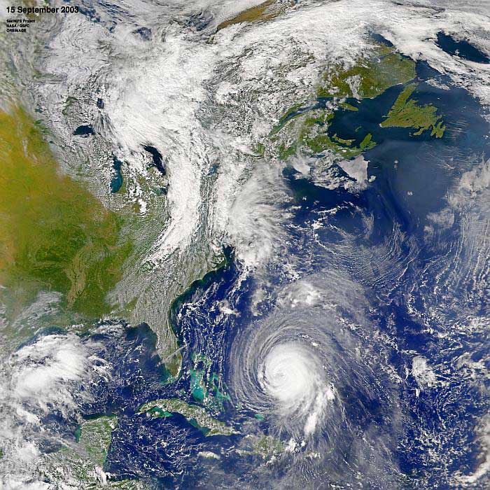
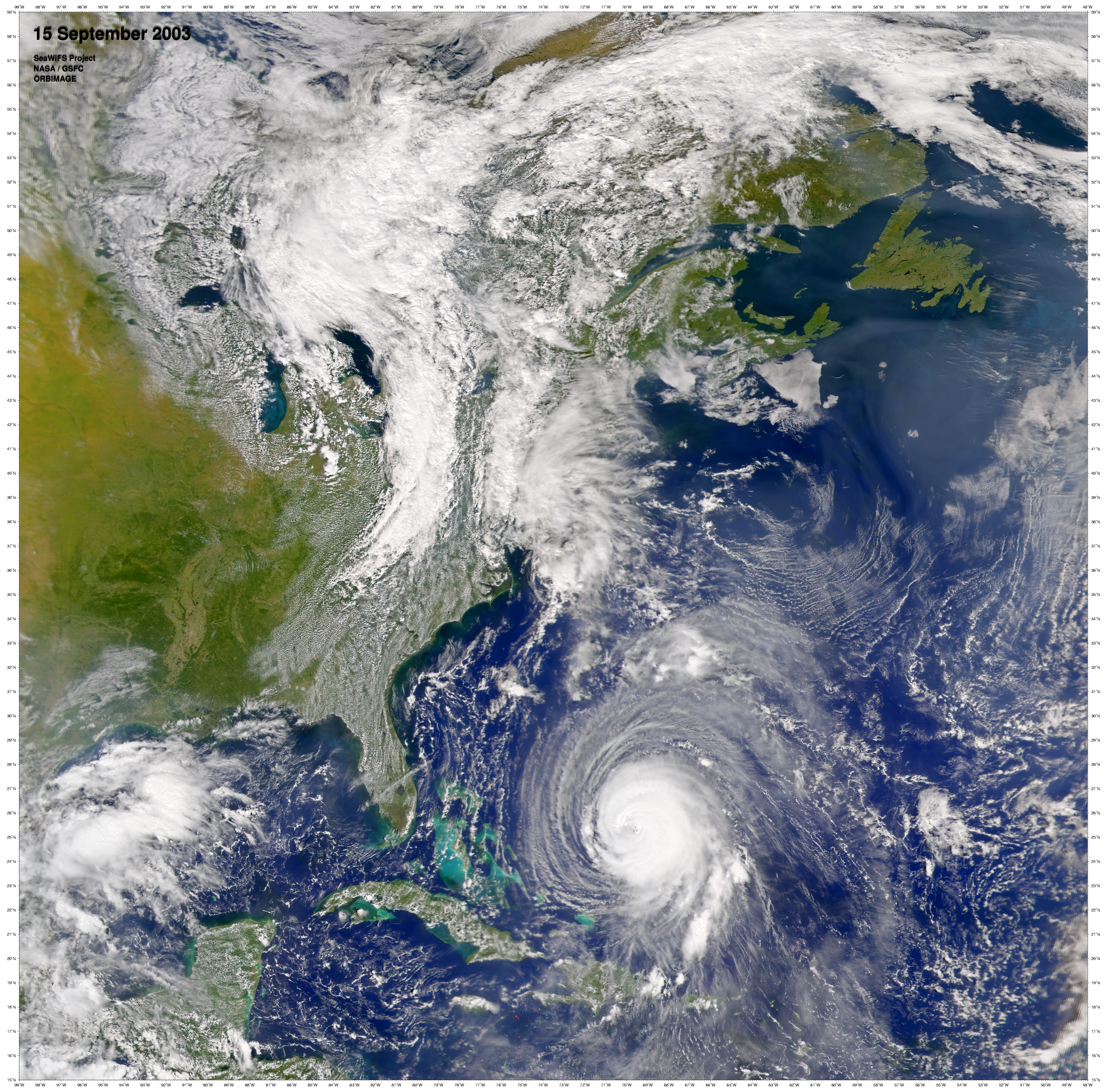
Today's (15 September 2003) SeaWiFS (Sea-viewing Wide Field-of-View Sensor) satellite pass shows where Hurricane Isabel was located at 16:40 UT (12:40 pm EDT)(above).
Image courtesy: NASA/Orbimage*
Click here for high resolution version of above image
Click here for animation 1/ Click here for animation 2
Click here for high resolution version
Image courtesy: MODIS Land Rapid Response Team at NASA GSFC.
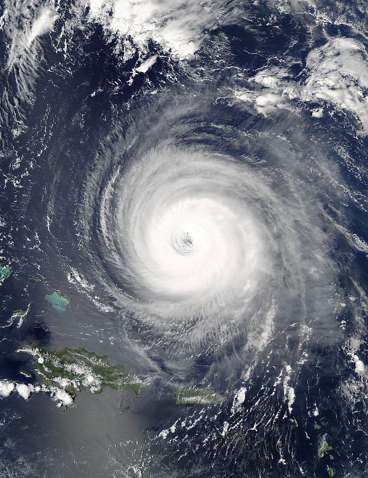
The Moderate Resolution Imaging Spectroradiometer (MODIS) instrument onboard NASA's Aqua satellite captured the top and bottom images of Hurricane Isabel September 14 and 15, 2003. In the bottom image Hurricane Isabel is approximately 400 mi north of Puerto Rico.
For more information contact:
Rani D. Chohan
Goddard Space Flight Center
Greenbelt, MD 20771
Phone: 301-286-2483
September 12, 2003 view of Isabel
September 11, 2003 view of Isabel
High resolution from Animation 1
High resolution from Animation 2
* NOTE: All SeaWiFS images and data presented on this web site are for research and educational use only. All commercial use of SeaWiFS data must be coordinated with GeoEye (Orbimage became GeoEye and then In January 2013, DigitalGlobe and GeoEye combined to become one DigitalGlobe.).