Seattle

Natural Color TM 542
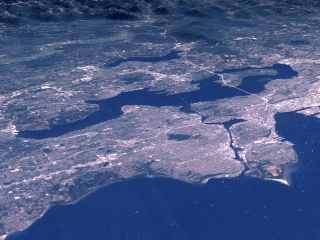
Seattle (Natural Color)
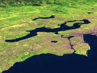
Seattle (TM 542)
Seattle and Puget Sound
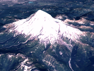
Mt. Rainier (Natural Color)
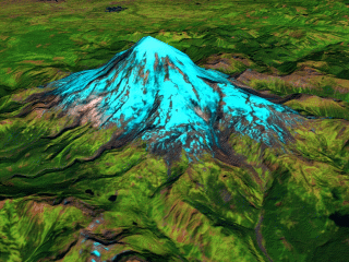
Mt. Rainier (TM 542)
Mt. Rainier

These scenes show Seattle, Washington and Mt. Rainier in the nearby Cascade Range as seen by the Landsat Thematic Mapper (TM) instrument. The shortwave infrared (TM band 5), infrared (TM band 4), and visible green (TM band 2) channels are displayed in the images as red, green, and blue respectively. In this combination, barren and/or recently cultivated land appears red to pink, vegetation appears green, water is dark blue, and artificial structures of concrete and asphalt appear dark grey or black. The natural color images combine TM bands 3, 2, and 1 and map them to red, green, and blue respectively.

Images: Seattle (Natural): GIF (36 k)
Seattle (TM 542): GIF (43 k)
Mt. Rainier (Natural): GIF (59 k)
Mt. Rainier (TM 542): GIF (67 k)
Seattle (Natural): JPEG (208 k)
Seattle (TM 542): JPEG (236 k)
Mt. Rainier (Natural): JPEG (268 k)
Mt. Rainier (TM 542): JPEG (286 k)
Seattle (Natural): Medium resolution TIFF (2.5 M)
Seattle (TM 542): Medium resolution TIFF (2.9 M)
Mt. Rainier (Natural): Medium resolution TIFF (3.4 M)
Mt. Rainier (TM 542): Medium resolution TIFF (3.9 M)
Seattle (Natural): High resolution TIFF (9.3 M)
Seattle (TM 542): High resolution TIFF (10.4 M)
Mt. Rainier (Natural): High resolution TIFF (13.0 M)
Mt. Rainier (TM 542): High resolution TIFF (14.3 M)

Technical notes:
Rendered: March 1999
Data source: Landsat 5 Thematic Mapper; USGS 3-arcsecond DTED
Data date: 22 June 1991
For: The Landsat Project Team and Goddard Public Affairs Office