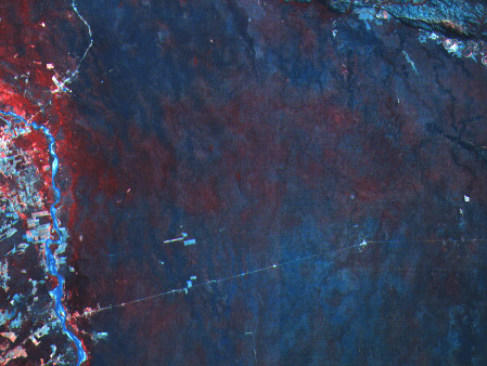
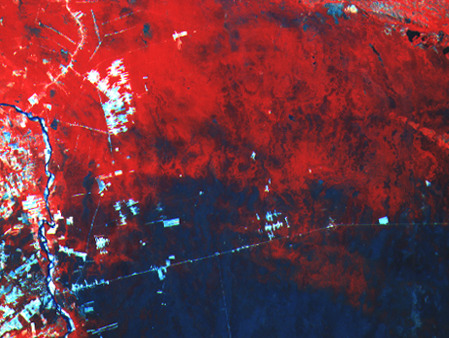
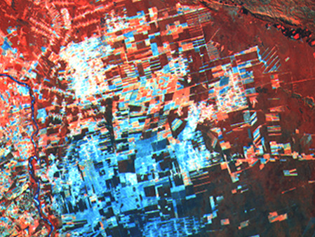
Deforestation in Bolivia (1975 - 1996)
The Landsat series of spacecraft has been imaging the earth since 1972.
This animation depicts a time series showing displacement of a tropical
dry forest with agricultural fields in Bolivia near Santa Cruz between
1975 to 1996. The channels used in this animation are visible, infrared
and near infrared. The green leaves in a deciduous forest are highly reflective
in the IR channel and appear bright red in the beginning of this animation.
The light blue color signifies the development of roads and agricultural
fields. | ||||
| ||||
|
LANDSAT Investigator: Dr. Compton Tucker Code: 923, Laboratory for Terrestrial Physics, Biospheric Sciences Branch
|