Earth
ID: 31174
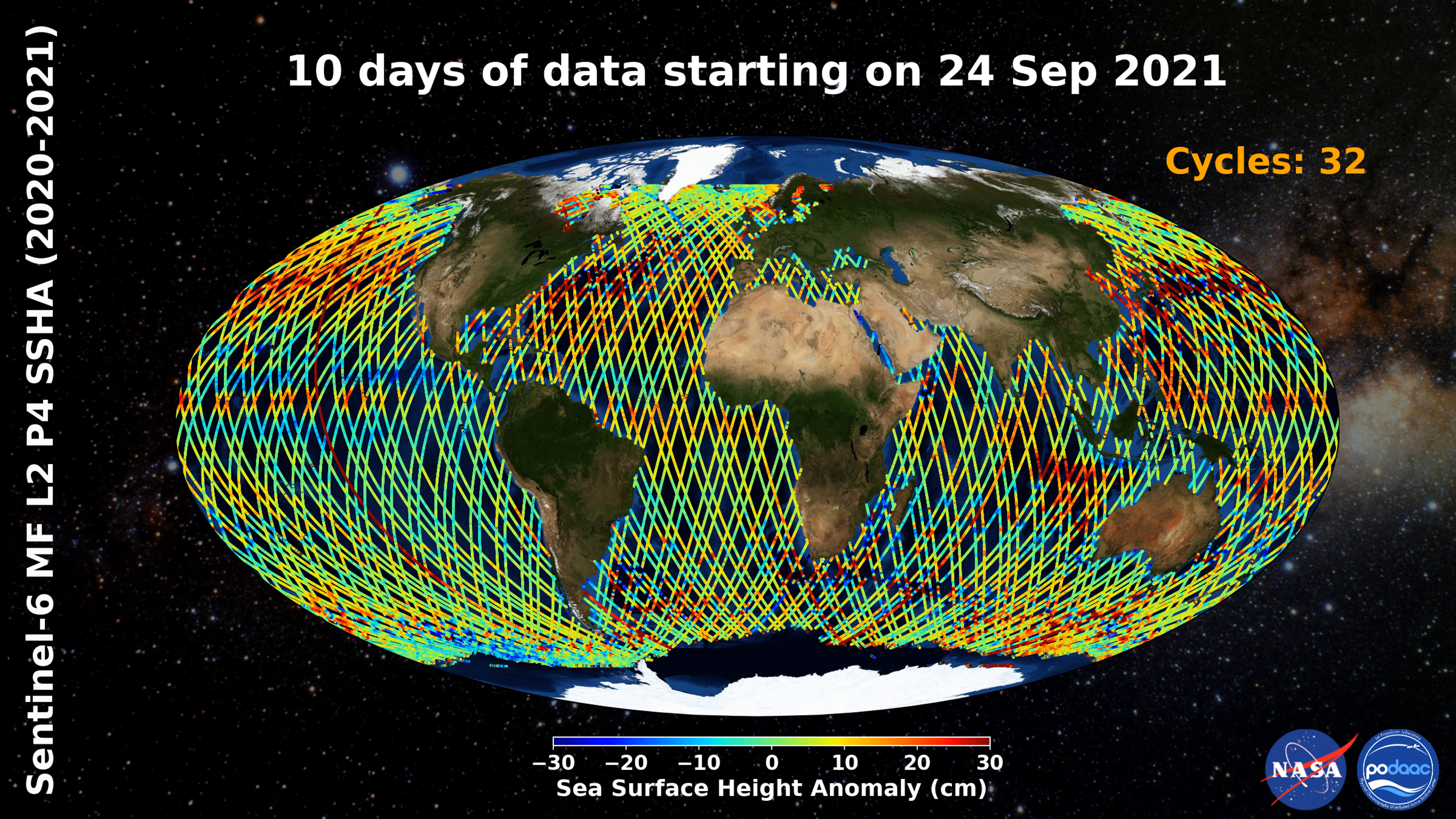
Along Track Sea Surface Height Anomaly data from Sentinel-6 MF are shown with rolling 10-day coverage in daily increments from December 7, 2020 to September 24, 2021.
Data shown in the animation are from the “Sentinel-6 MF Jason-CS L2 P4 Altimeter Low Resolution (LR) NRT Ocean Surface Topography” product, which is accessible on the PO.DAAC Web Portal: https://doi.org/10.5067/S6AP4-2LSNR (DOI:10.5067/S6AP4-2LSNR).
Note: At this time data prior to June 22, 2021 are subject to reprocessing in early 2022.
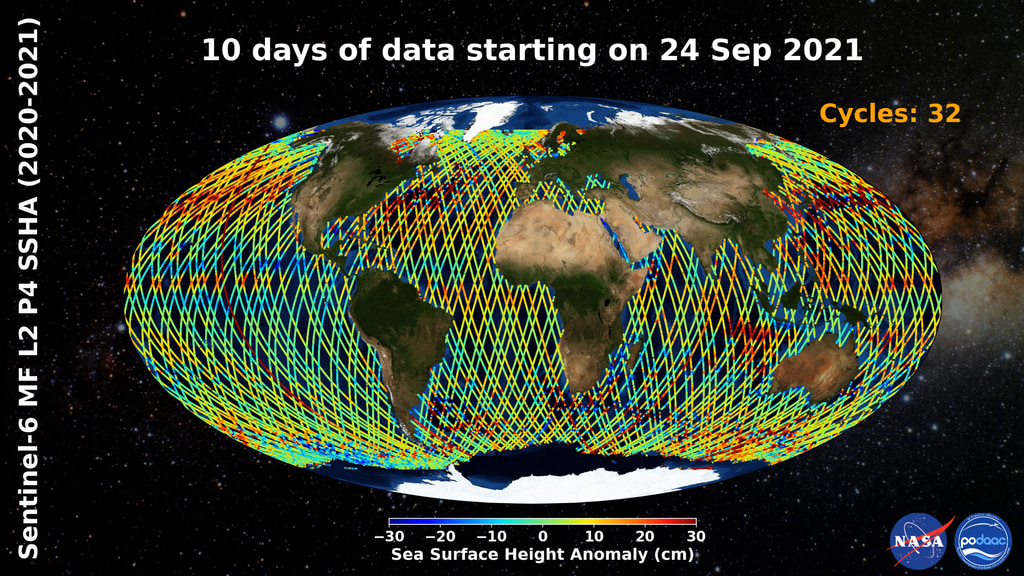
Sea Surface Height Anomaly from Sentinel-6 MF
Data shown in the animation are from the “Sentinel-6 MF Jason-CS L2 P4 Altimeter Low Resolution (LR) NRT Ocean Surface Topography” product, which is accessible on the PO.DAAC Web Portal: https://doi.org/10.5067/S6AP4-2LSNR (DOI:10.5067/S6AP4-2LSNR).
Note: At this time data prior to June 22, 2021 are subject to reprocessing in early 2022.
For More Information
Credits
Marit Jentoft-Nilsen: Lead Technical Support
Please give credit for this item to:
NASA Jet Propulsion Laboratory
NASA Jet Propulsion Laboratory
Short URL to share this page:
https://svs.gsfc.nasa.gov/31174
Data Used:
Note: While we identify the data sets used in these visualizations, we do not store any further details nor the data sets themselves on our site.
Keywords:
SVS >> HDTV
GCMD >> Earth Science >> Oceans >> Sea Surface Topography >> Sea Surface Height
SVS >> Hyperwall
NASA Science >> Earth
GCMD keywords can be found on the Internet with the following citation: Olsen, L.M., G. Major, K. Shein, J. Scialdone, S. Ritz, T. Stevens, M. Morahan, A. Aleman, R. Vogel, S. Leicester, H. Weir, M. Meaux, S. Grebas, C.Solomon, M. Holland, T. Northcutt, R. A. Restrepo, R. Bilodeau, 2013. NASA/Global Change Master Directory (GCMD) Earth Science Keywords. Version 8.0.0.0.0
https://svs.gsfc.nasa.gov/31174
Data Used:
Sentinel-6 Michael Freilich
Keywords:
SVS >> HDTV
GCMD >> Earth Science >> Oceans >> Sea Surface Topography >> Sea Surface Height
SVS >> Hyperwall
NASA Science >> Earth
GCMD keywords can be found on the Internet with the following citation: Olsen, L.M., G. Major, K. Shein, J. Scialdone, S. Ritz, T. Stevens, M. Morahan, A. Aleman, R. Vogel, S. Leicester, H. Weir, M. Meaux, S. Grebas, C.Solomon, M. Holland, T. Northcutt, R. A. Restrepo, R. Bilodeau, 2013. NASA/Global Change Master Directory (GCMD) Earth Science Keywords. Version 8.0.0.0.0


