Earth
ID: 31022
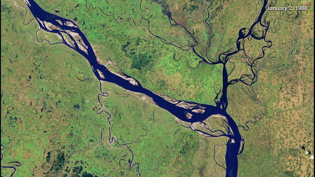
The Padma River is one of the major rivers of Bangladesh, as thousands of people rely on the river for transportation and farm irrigation. These natural-color satellite images from the Landsat satellites show the changes to the shape and width of the Padma since 1988. Each twist and zigzag tells a different geologic story about the river—often tied to erosion.
Over the past three decades, the river has changed from a relatively narrow, straight line to meandering to braided and, most recently, back to straight. In the image sequence, the most noticeable change occurs upstream near the Harirampur upazila region, which experienced the most erosion over the past three decades.
In recent years, Padma’s erosion rates have decreased, but that does not mean the area is free from erosion. Any disturbance in the ecosystem, such as floods, landslides, or construction, could influence the morphology of the river.
The Padma River
Over the past three decades, the river has changed from a relatively narrow, straight line to meandering to braided and, most recently, back to straight. In the image sequence, the most noticeable change occurs upstream near the Harirampur upazila region, which experienced the most erosion over the past three decades.
In recent years, Padma’s erosion rates have decreased, but that does not mean the area is free from erosion. Any disturbance in the ecosystem, such as floods, landslides, or construction, could influence the morphology of the river.
For More Information
Credits
Amy Moran (Global Science and Technology, Inc.): Lead Animator
Joshua Stevens (SSAI): Lead Data Visualizer
Kasha Patel (NASA/GSFC): Lead Writer
Joshua Stevens (SSAI): Lead Data Visualizer
Kasha Patel (NASA/GSFC): Lead Writer
Please give credit for this item to:
NASA's Goddard Space Flight Center
NASA's Goddard Space Flight Center
Short URL to share this page:
https://svs.gsfc.nasa.gov/31022
Keywords:
SVS >> HDTV
SVS >> Landsat
SVS >> River
GCMD >> Location >> Bangladesh
SVS >> Hyperwall
NASA Science >> Earth
GCMD keywords can be found on the Internet with the following citation: Olsen, L.M., G. Major, K. Shein, J. Scialdone, S. Ritz, T. Stevens, M. Morahan, A. Aleman, R. Vogel, S. Leicester, H. Weir, M. Meaux, S. Grebas, C.Solomon, M. Holland, T. Northcutt, R. A. Restrepo, R. Bilodeau, 2013. NASA/Global Change Master Directory (GCMD) Earth Science Keywords. Version 8.0.0.0.0


