Earth
ID: 11414

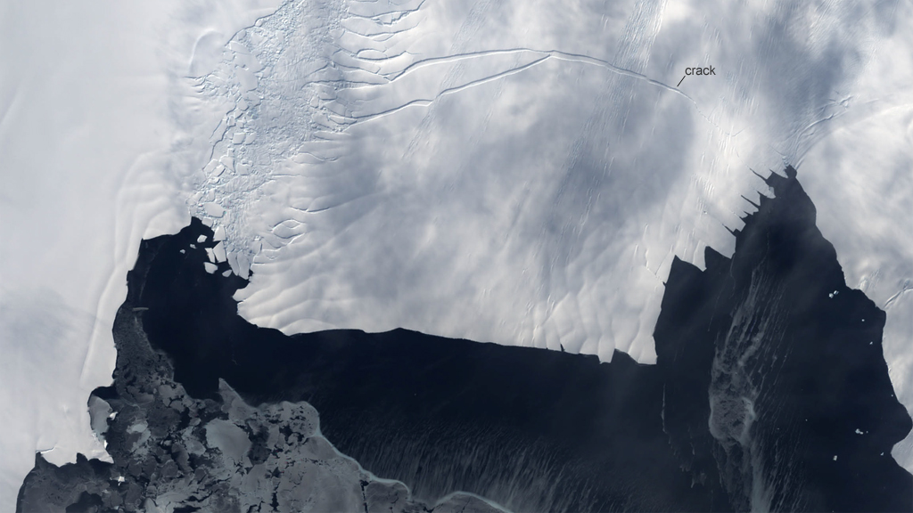
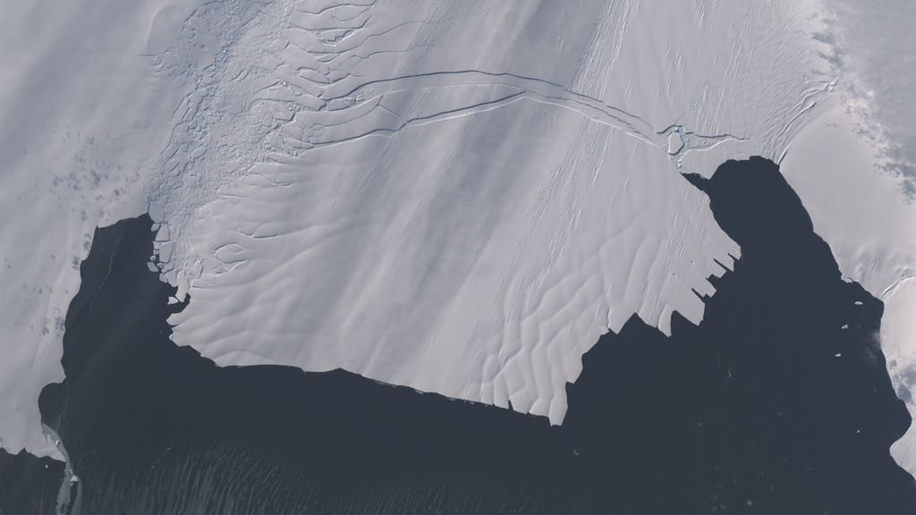
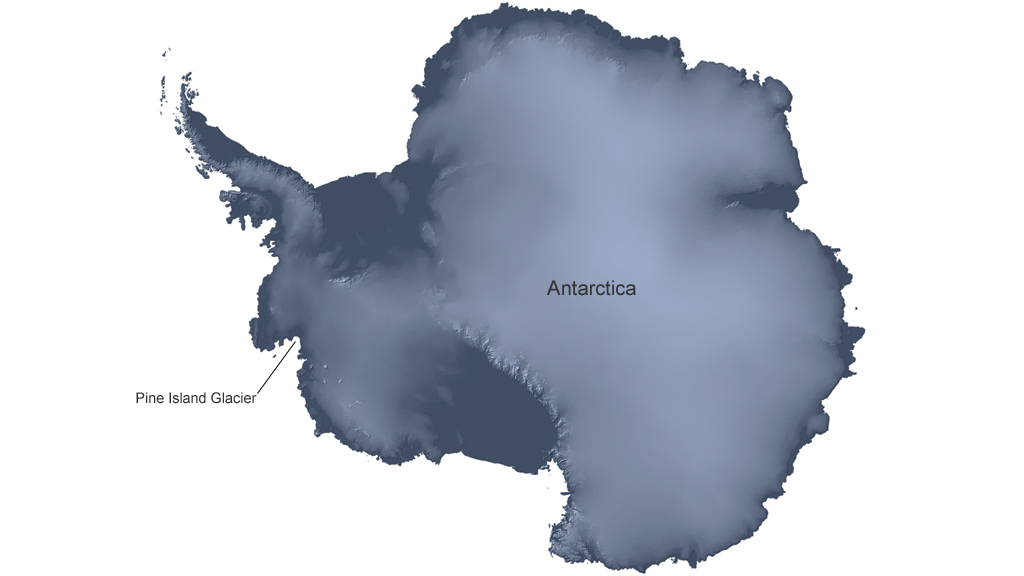
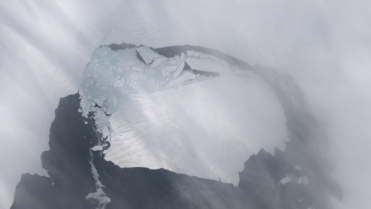
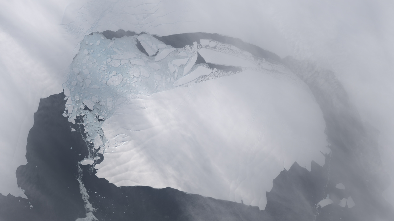
Over the course of two years, NASA satellites and airborne instruments tracked the birth of a new iceberg from Pine Island Glacier, the longest and fastest-moving glacier in West Antarctica. Scientists first discovered a large crack while flying over the glacier in October 2011. By July 2013, satellite images indicated that the crack had cut completely across the ice shelf to the southwestern edge, forming a chunk of ice about 21 miles wide and 12 miles long. New images now show that the iceberg, named B-31, is slowly moving away from the coast. Watch the video to see the iceberg separate from Pine Island Glacier.

An Iceberg Is Born
For More Information
Story Credits
Video Editor:
Holli Riebeek (Sigma Space Corporation)
Lead Writer:
Holli Riebeek (Sigma Space Corporation)
Holli Riebeek (Sigma Space Corporation)
Lead Writer:
Holli Riebeek (Sigma Space Corporation)
Please give credit for this item to:
NASA's Earth Observatory
Aqua and Terra images courtesy of NASA/GSFC/MODIS Rapid Response Team/Jeff Schmaltz
Landsat images courtesy of NASA/GSFC/Matt Radcliff and NASA Earth Observatory/Robert Simmon and Jesse Allen
Antarctica map courtesy of NASA Earth Observatory/Robert Simmon
NASA's Earth Observatory
Aqua and Terra images courtesy of NASA/GSFC/MODIS Rapid Response Team/Jeff Schmaltz
Landsat images courtesy of NASA/GSFC/Matt Radcliff and NASA Earth Observatory/Robert Simmon and Jesse Allen
Antarctica map courtesy of NASA Earth Observatory/Robert Simmon
Short URL to share this page:
https://svs.gsfc.nasa.gov/11414
Keywords:
SVS >> App
NASA Science >> Earth
https://svs.gsfc.nasa.gov/11414
Keywords:
SVS >> App
NASA Science >> Earth


