Wildland Fires Dashboard
Overview
Climate change continues to cause longer fire seasons and more severe wildfires. NASA's Earth observing satellites and its robust network of interagency partners work together to help communities manage the impacts of fire, and reduce risks before, during and after fire events.

Wildland Fires: Global View
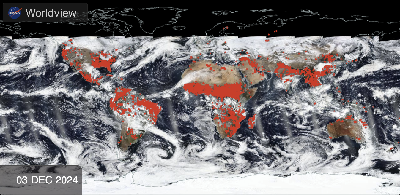
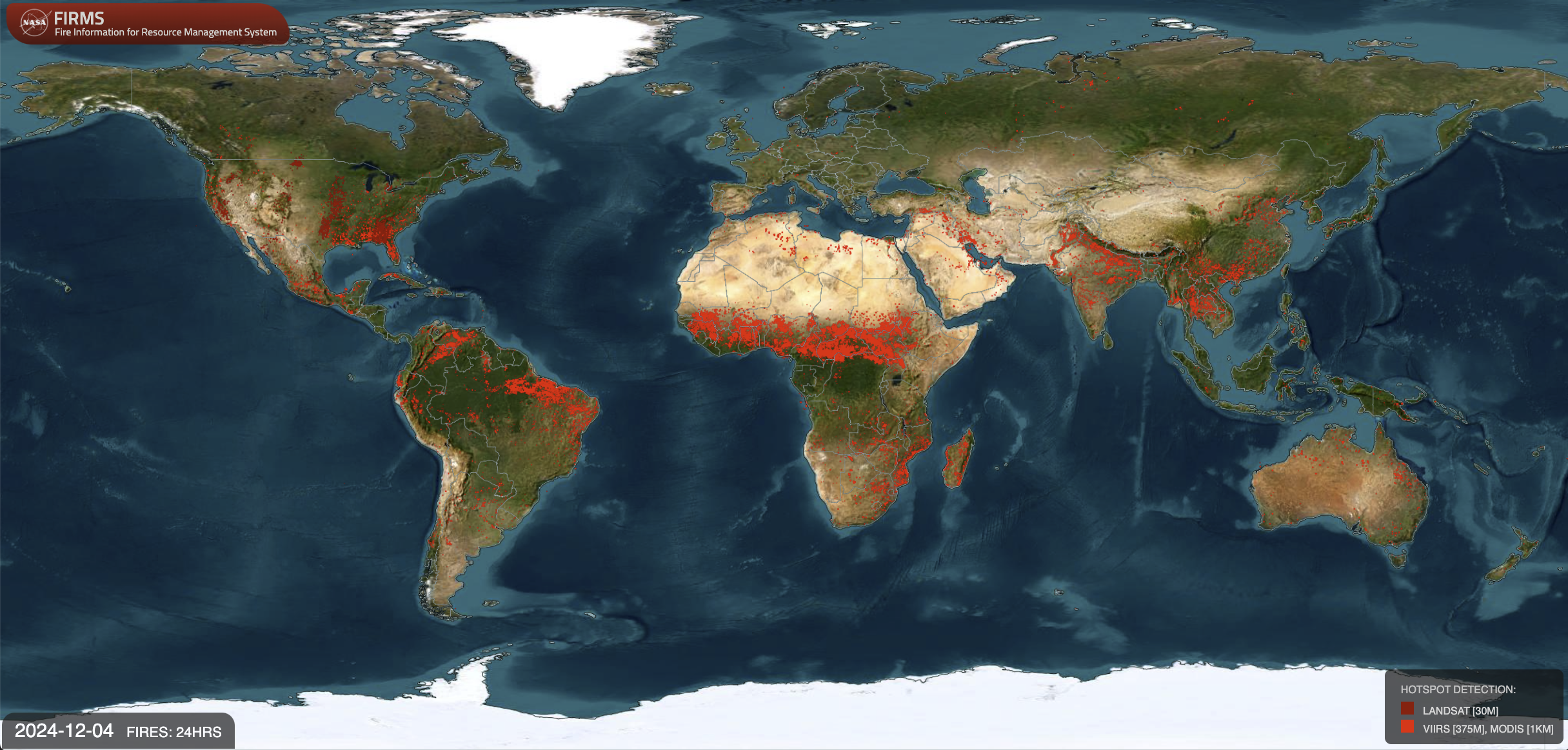
- ID: 5315 Visualization
Wildland Fires: US and Canada

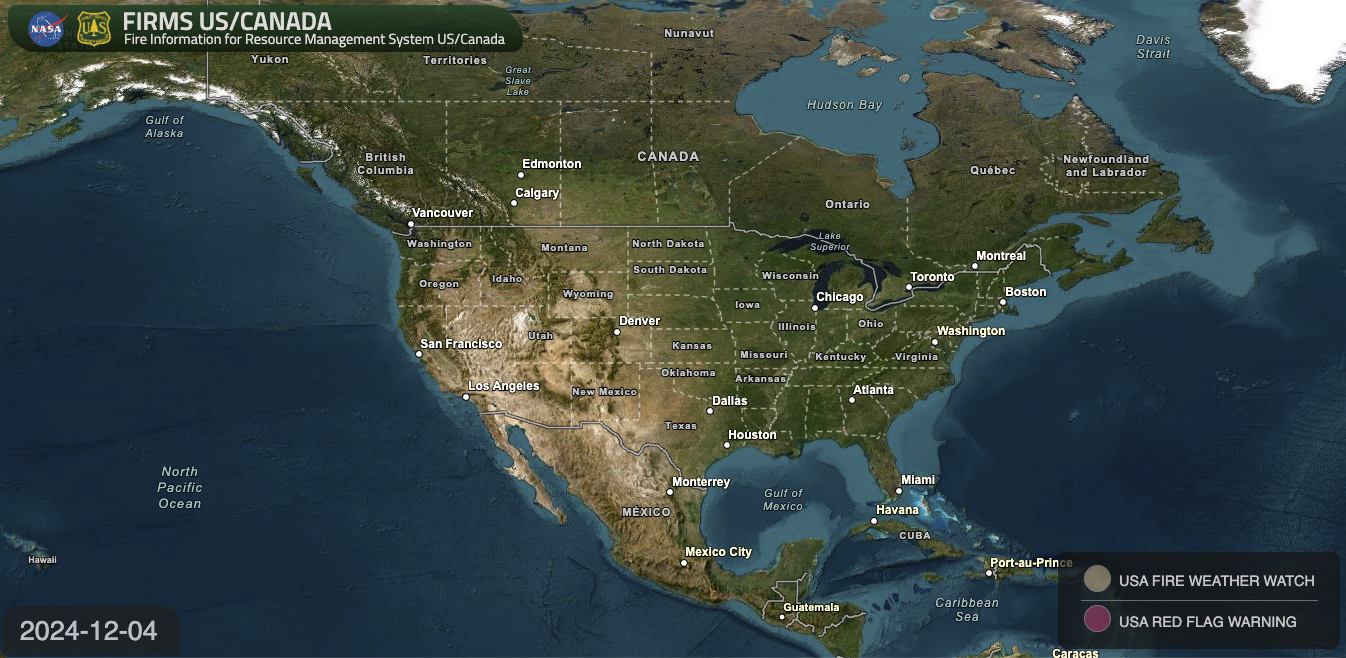
- ID: 5453 Visualization
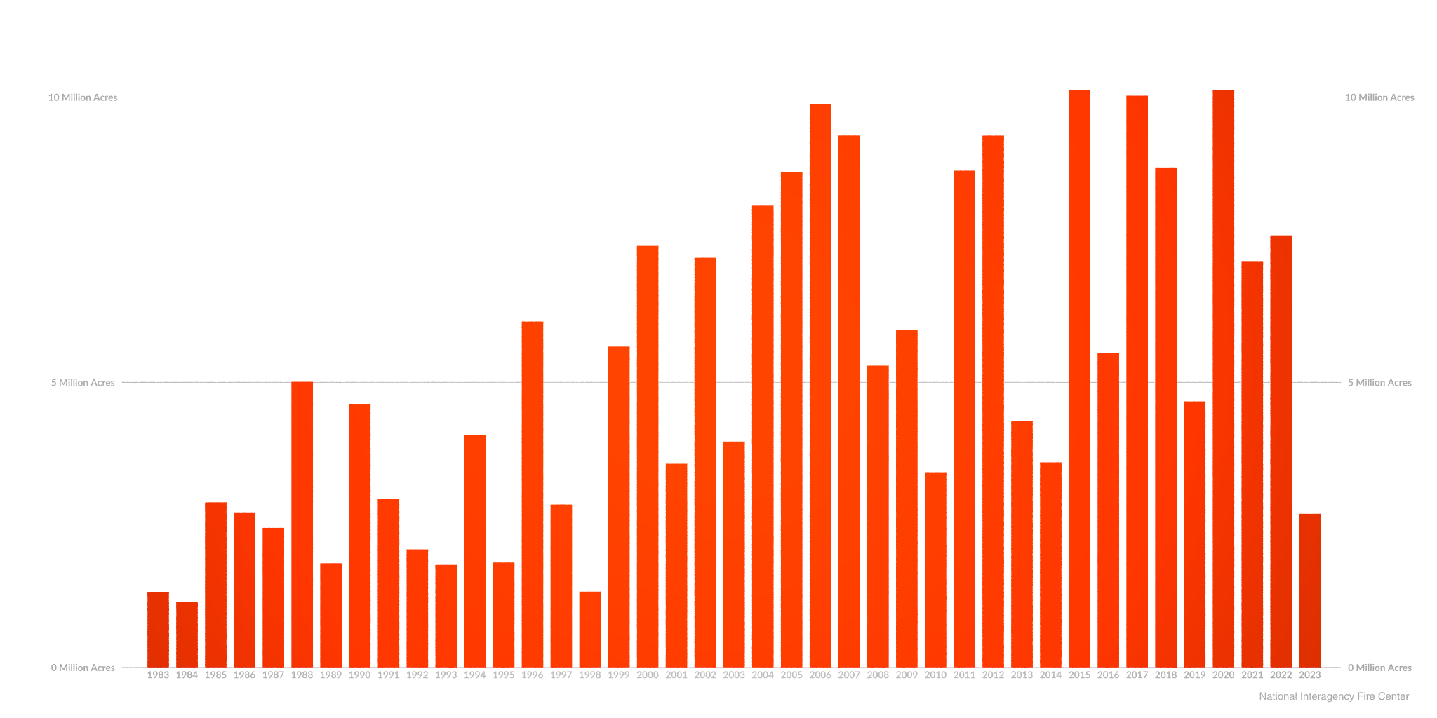
Annual Wildfire Burned Area in the United States
Go to this pageA graph of annual wildfire burned area in the United States between the years 1983 and 2024.
Side Circles
- ID: 5113 Visualization
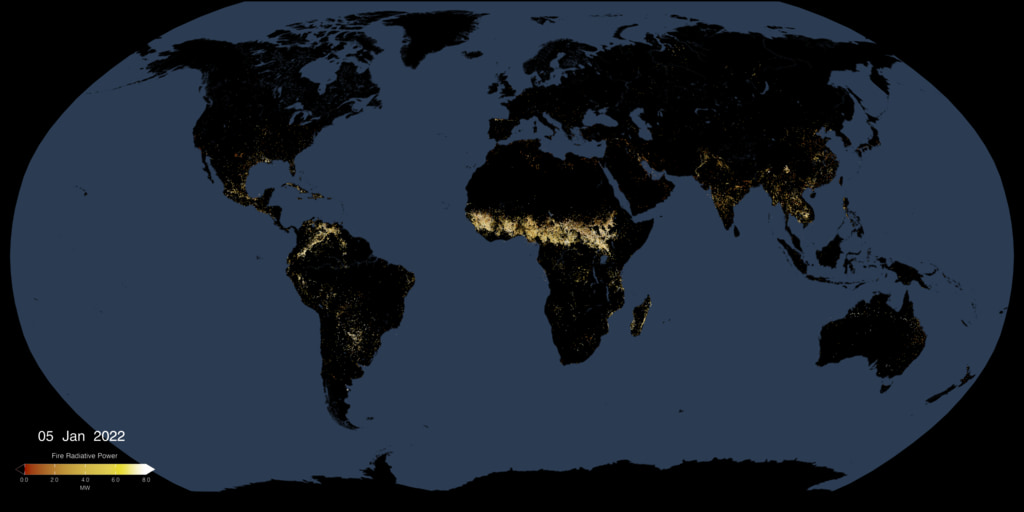
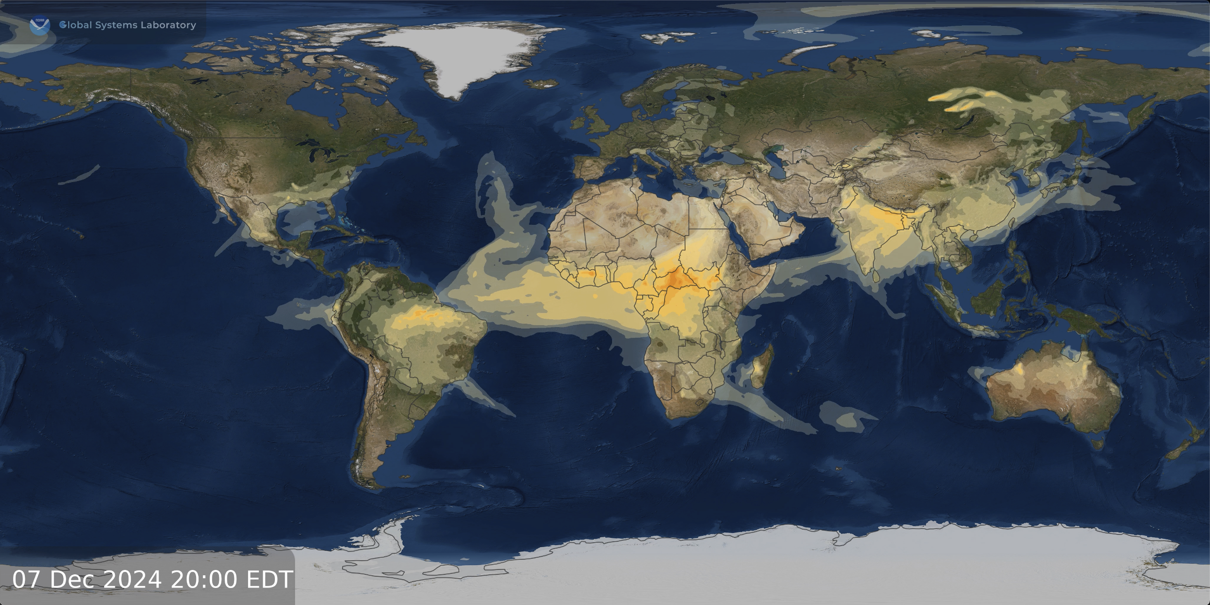
Active Fires As Observed by VIIRS, 2024-Present
Go to this pageThis animated visualization uses a moving five-day window of VIIRS measurments of fire radiative power (FRP), to present a view of fire intensities around the globe. || fires_frp_VIIRS.892_print.jpg (1024x512) [71.9 KB] || fires_frp_VIIRS.892_searchweb.png (320x180) [37.8 KB] || fires_frp_VIIRS.892_web.png (320x160) [33.5 KB] || fires_frp_VIIRS.892_thm.png (80x40) [4.3 KB] || fires_frp_VIIRS_2048p30.mp4 (4096x2048) [46.5 MB] || EIC (4096x2048) [824 Item(s)] || VIIRS_fires_latest.exr [7.0 MB] ||