Eclipses
Solar Eclipses seen from Earth
Total Solar Eclipse
Go to this pageOn Friday, 2008 August 01, a total eclipse of the Sun will be visible from within a narrow coridor that traverses half the Earth. This animation shows the Moon passing between the Earth and Sun. ||
Lunar Eclipses seen from Earth
LRO and the Lunar Eclipse of April 15, 2014: Shadow View
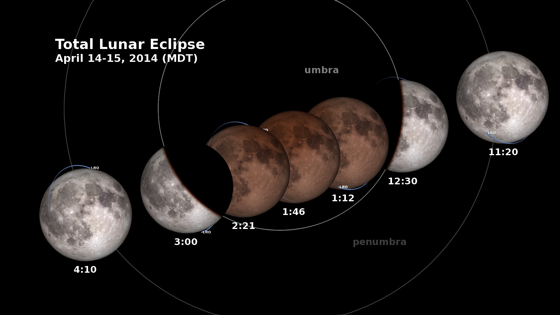
Go to this pageIn the early morning hours of April 15, 2014, the Moon enters the Earth’s shadow, creating a total lunar eclipse, the first of four that are visible in the Western Hemisphere in the next two years. This animation shows the changing appearance of the Moon as it travels into and out of the Earth’s shadow, along with the times at various stages. Versions of the animation have been created for each of the four time zones of the contiguous United States.All of North and South America will see this eclipse, and you won’t need special equipment to see it. Just stay up late, go outside and look up!The penumbra is the part of the Earth’s shadow where the Sun is only partially covered by the Earth. The umbra is where the Sun is completely hidden.The animation includes the position of the Lunar Reconnaissance Orbiter spacecraft. LRO is powered by sunlight, but during the eclipse, it will have to rely on its battery for almost three hours. ||
LRO at the June 15, 2011 Lunar Eclipse: Earth View
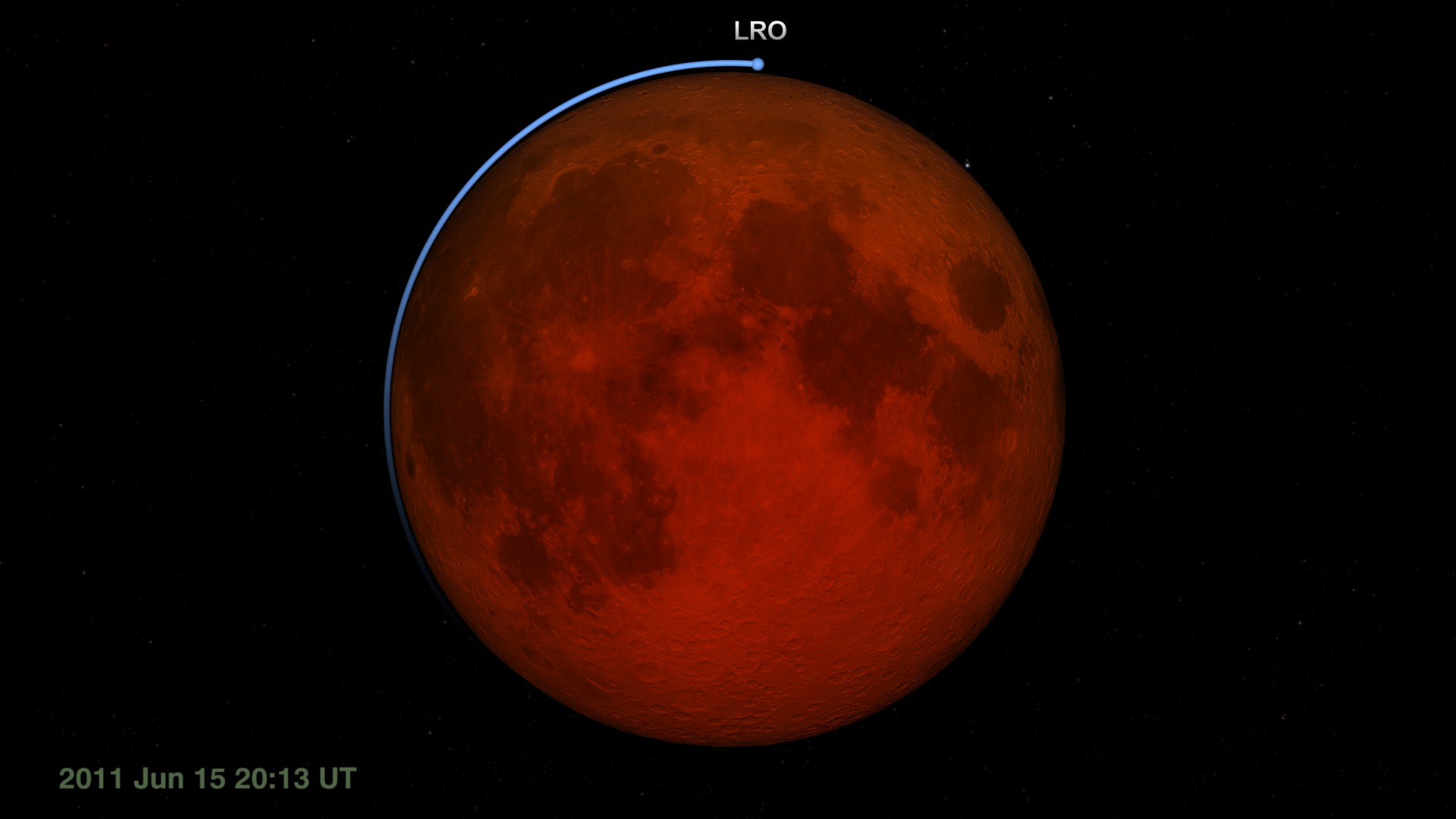
Go to this pageFor Lunar Reconnaissance Orbiter (LRO), the lunar eclipse on June 15, 2011 is likely to be the longest and darkest of its life. This matters because LRO relies on sunlight to power its systems and instruments. Although it spends half of every orbit on the night side of the Moon, each night side pass lasts only an hour. For the June 15 eclipse, LRO will be in the dark for more than twice as long.During a previous total eclipse, LRO hibernated, turning off all of its instruments to conserve its battery power until the Moon emerged from the Earth's shadow. For the June 15 event, LRO will leave on the Diviner Lunar Radiometry Experiment. Diviner will measure the cooling of the Moon's surface during the eclipse. This unique temperature record is expected to reveal information about the roughness and composition of the swath of lunar surface visible to Diviner's sensors during the eclipse.The visualization archived on this page shows the eclipse as it might appear through a telescope on Earth (except that you can't see LRO in such a telescope). Celestial north is up. As the Moon enters the umbra (the part of the shadow in which the Sun is completely blocked by the Earth), the shadowed side of the Moon appears black while the sunlit side remains bright. Only when the Moon is almost completely within the umbra is it possible to see the faint red glow of the shadowed side, some 10,000 times fainter than the sunlit Moon. The redness is sunlight filtered and refracted by Earth's atmosphere. The same effect reddens sunrises and sunsets on Earth.Other visualizations in this series depict the view of the eclipsefrom the Moon, where the event is a solar eclipsealong the shadow line, with the figures of the umbra, penumbra, and lunar and solar pathsflying above LRO as Diviner takes temperature measurementsA narrated piece that uses these visualizations is available in entry #10794. For an explanation of lunar eclipses, visit entry #10787. ||
Transits seen from Earth
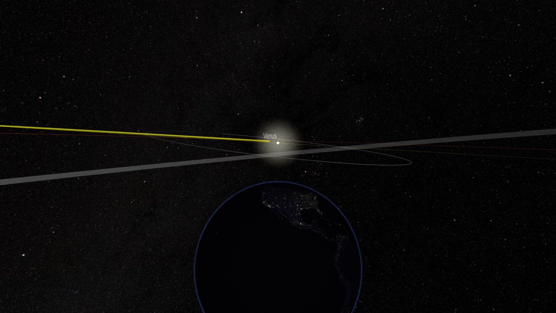
Venus Transit 2012 Composited Visuals
Go to this pageThese visualizations were generated by compositing the small field-of-view, high-cadence closeups of Venus with the full-disk, low-cadence imagery from Solar Dynamics Observatory (SDO). Two different instruments are used: the Helioseismic and Magnetic Imager (HMI) which sees light in the visible range, and the Atmospheric Imaging Assembly (AIA) which sees light in several wavelengths in the ultraviolet range. To find out more information about these instruments, check out The Atmospheric Imaging Assembly Tutorial.Some artifacts may be visible from the compositing, but you have to look pretty closely to see them.The color table threshold was raised for these images, reducing the amount of noise visible in the images. Note: There is an interesting artifact worthy of mention and clarification, and that is as Venus crosses the solar limb, the limb appears to be visible through the planet in some of the imagers (most notably the ultraviolet channels). Discussion with the scientists who built the imagers suggest this might be 'crosstalk' between the readouts of the four CCD panels that make up a complete image. It is an artifact of the imaging system. ||
Venus Transit - 2012
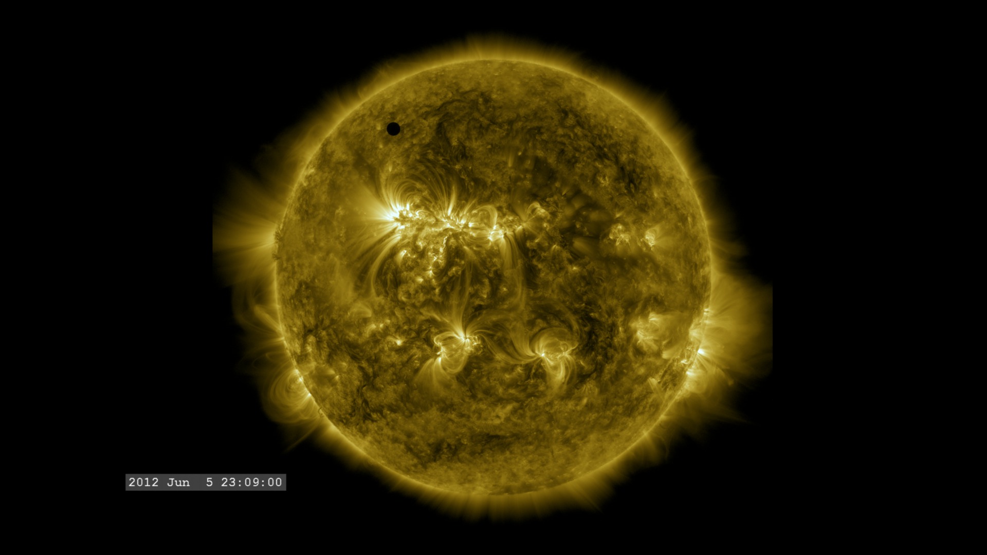
Go to this pageIt was your last chance for the next 105 years.A transit is when a planet passes directly between the Sun and the Earth and we see the planet as a small dot moving slowly across the face of the Sun. A Venus transit occurred in 2004 (see Venus Transit from GOES/SXI). Prior to that it was 1882. The last Venus transit occurred on June 5-6, 2012 and the next one won't occur until 2117 (See the NASA Eclipse Web Site).To understand the significance of these events, it helps to know the history of how the Venus transits provided one of the first estimates of the size of the Solar System, and eventually the Universe (see A Brief History of the Transit of Venus).In this visualization, there are a few things which should be noted. 1) The camera view is NOT from anywhere on the surface of the Earth, but corresponds to an observer positioned along the Earth-Sun line, but over the north pole of the Earth. This causes the path of Venus to cross the solar disk lower (closer to the solar equator) than it would appear to an observer on the surface of the Earth.2) The ephemeris used for computing the planetary positions was not the high-precision JPL ephemeris (DE-421), but a lower-precision approximation. Yet, when tracked in detail, the transit takes place only about five hours later. It was decided that since the view of the transit in this visual does not correspond to any actual location ON the Earth, it might be misleading to present high-precision timing of the event.This visualization was developed for conceptual illustration and not meant for precision scientific use. ||
Eclipses & Transits seen from Spacecraft
Lunar Transit from Solar Dynamics Observatory (2010)
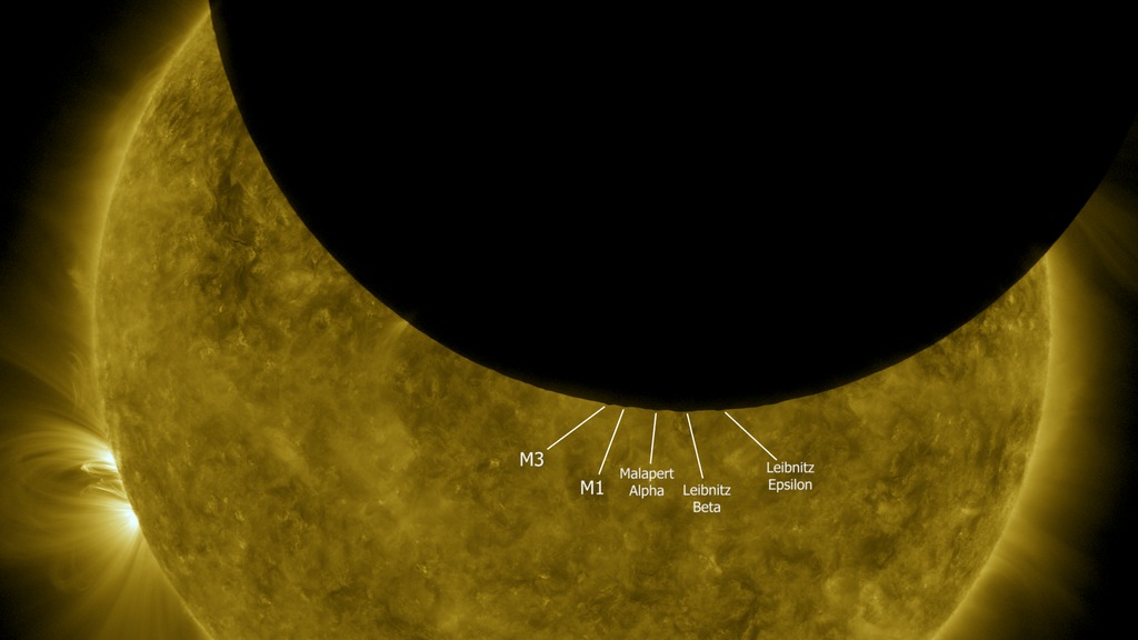
Go to this pageJust as we do on Earth, the Solar Dynamics Observatory satellite periodically crosses the Moon's shadow and experiences a solar eclipse. During the eclipse witnessed by SDO on October 7, 2010, the southern hemisphere of the Moon was silhouetted against the solar disk, revealing some especially prominent mountain peaks near the Moon's south pole. By using elevation data from Lunar Reconnaissance Orbiter to visualize the Moon from SDO's point of view, it's possible to identify these peaks. Although all of these are well-known features, all but one of them have no official names. The following list corresponds to the labels in the animation, from left to right.In his 1954 sketch of the lunar south pole, astronomer Ewen Whitaker labeled this feature "M3." It's a mountain about halfway between the craters Cabeus and Drygalski, at 83.2°S 68°W.Whitaker's "M1," a mountain on the northern rim of Cabeus, 83.4°S 33°W.A mountain on the southern rim of Malapert crater, about halfway between the centers of Malapert and Haworth. Whitaker labels this Malapert Alpha. It's also known as Mons Malapert or Malapert Peak. 85.8°S 0°E.Labeled Leibnitz Beta by Whitaker and now officially named Mons Mouton, this is part of the highlands adjacent to the northern rim of Nobile crater. 84°S 37°E. Part of the Leibnitz mountain range first identified by Johann Schröter in the late 1700s, unrelated to Leibnitz Crater on the lunar far side.A mountain near Amundsen crater, on the western (Earthward) rim of Hédervári crater, 82.2°S 75°E. Whitaker tentatively labels this Leibnitz Epsilon in his sketch.The Moon visualization uses the latest albedo and elevation maps from Lunar Reconnaissance Orbiter (LRO). ||
SDO: September 13, 2012 Earth Eclipse
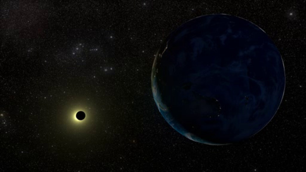
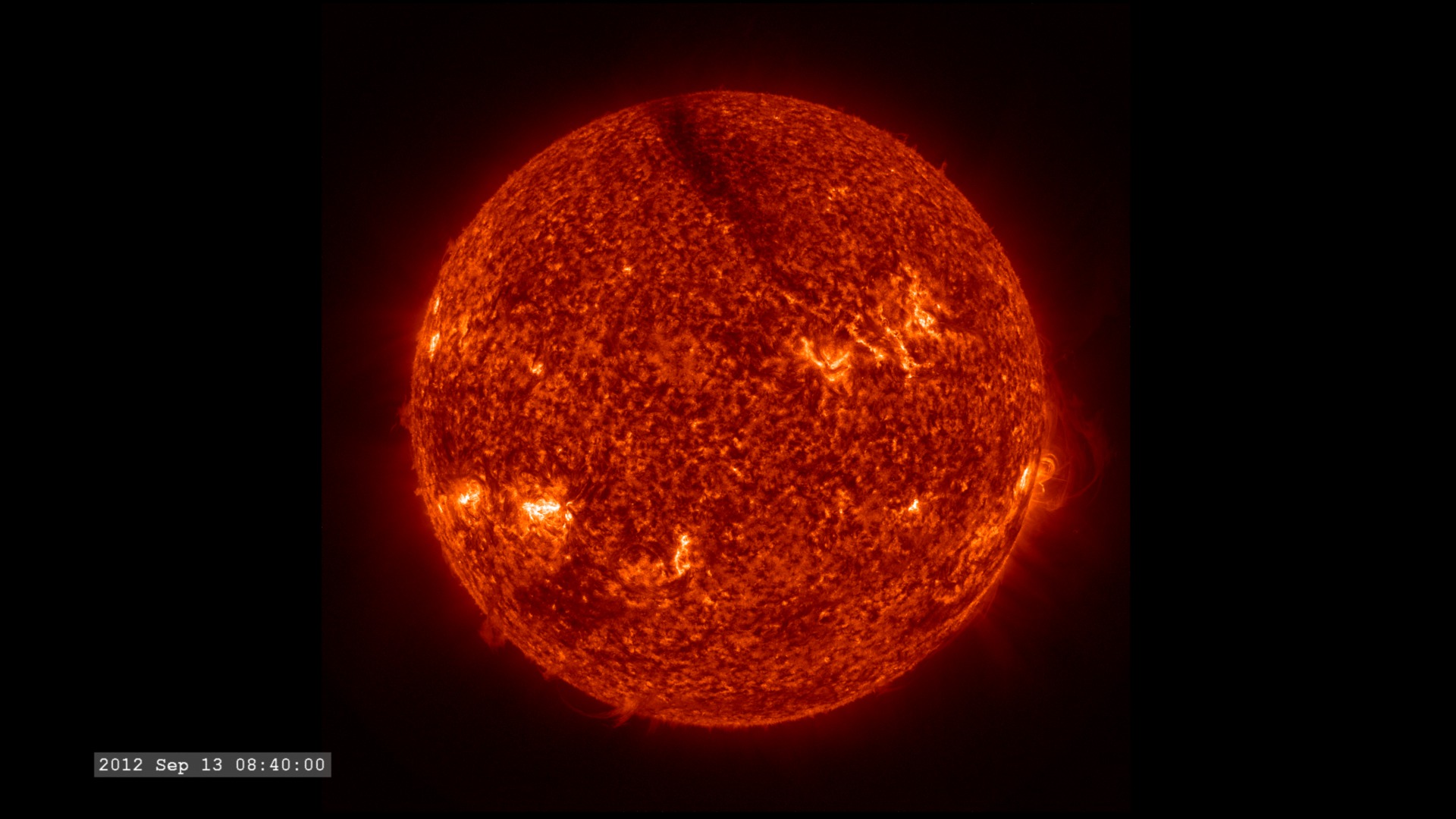
Go to this pageTwice a year, for three weeks near the equinox, NASA's Solar Dynamics Observatory (SDO) moves into its eclipse season — a time when Earth blocks its view of the sun for a period of time each day. Any spacecraft observing the sun from an orbit around Earth has to contend with such eclipses, but SDO's orbit is designed to minimize them as much as possible. On September 13, during the Fall 2012 eclipse season, SDO experienced on such eclipse followed by an unusually large, dark prominence that lifted up off the surface. The prominence was visible in extreme ultraviolet light with a wavelength of 304 angstroms. This wavelength highlights plasma with temperatures of around 50,000 Kelvin. The Atmospheric Imaging Assembly on NASA's Solar Dynamics Observatory captured the event at 4k resolution and a high imaging cadence of one image every 12 seconds. ||
Monster Prominences with an Earth Eclipse (September 16, 2012)
Go to this pageOn September 16, 2012 the sun had a beautiful prominence (see Wikipedia) that slowly twisted and dissipated over several hours. It was captured in 304 angstrom light by the Solar Dynamics Observatory's AIA instrument at 4k resolution and 12s imaging cadence. The prominence was immediately followed by one of the many eclipses that SDO experiences during September, when its orbit places the Earth between it and the sun. ||
