Earth
ID: 982
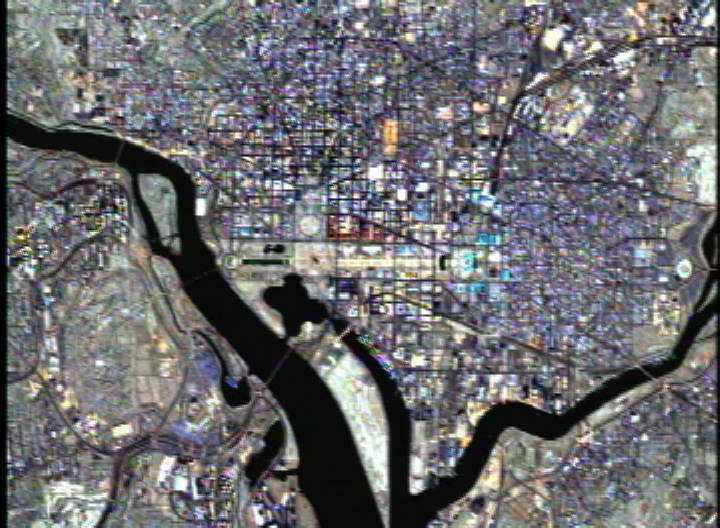
Washington, D.C. Landsat 7 15-Meter Data
Visualization Credits
Lori Perkins (NASA/GSFC): Lead Animator
Randall Jones (GST): Animator
Alex Kekesi (Global Science and Technology, Inc.): Animator
Darrel Williams (NASA/GSFC): Scientist
Randall Jones (GST): Animator
Alex Kekesi (Global Science and Technology, Inc.): Animator
Darrel Williams (NASA/GSFC): Scientist
Please give credit for this item to:
NASA/Goddard Space Flight Center Scientific Visualization Studio
NASA/Goddard Space Flight Center Scientific Visualization Studio
Short URL to share this page:
https://svs.gsfc.nasa.gov/982
Mission:
Landsat
Data Used:
Note: While we identify the data sets used in these visualizations, we do not store any further details nor the data sets themselves on our site.
This item is part of this series:
USCities
Keywords:
DLESE >> Physical geography
SVS >> Remote Sensing
SVS >> Washington DC
NASA Science >> Earth
https://svs.gsfc.nasa.gov/982
Mission:
Landsat
Data Used:
Landsat-7/ETM+
1999/06/01This item is part of this series:
USCities
Keywords:
DLESE >> Physical geography
SVS >> Remote Sensing
SVS >> Washington DC
NASA Science >> Earth


