Planets and Moons
ID: 5027
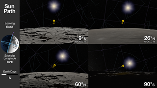
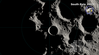
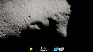
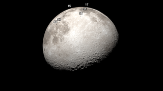
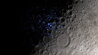
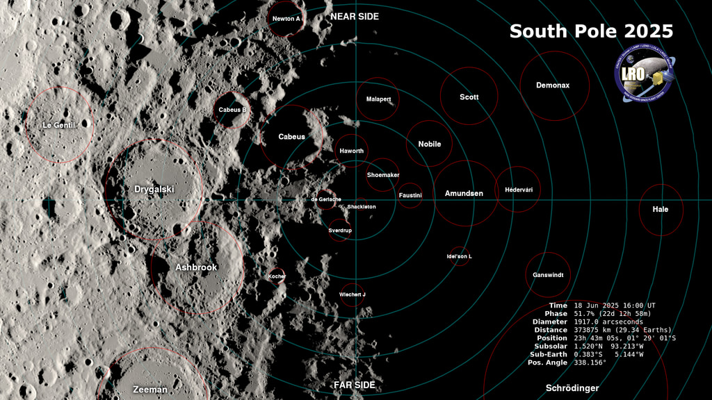
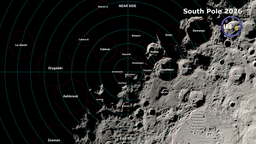
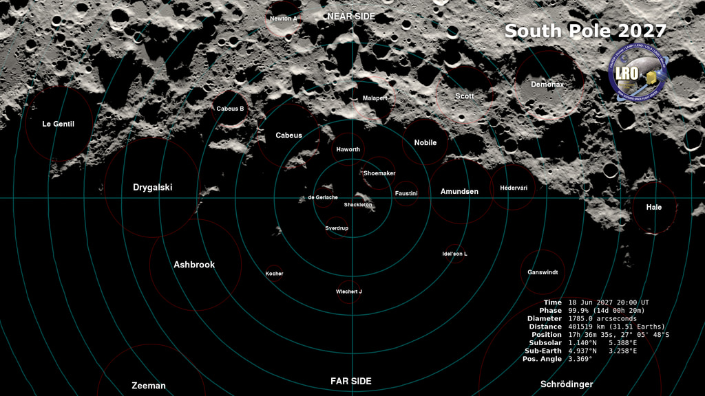
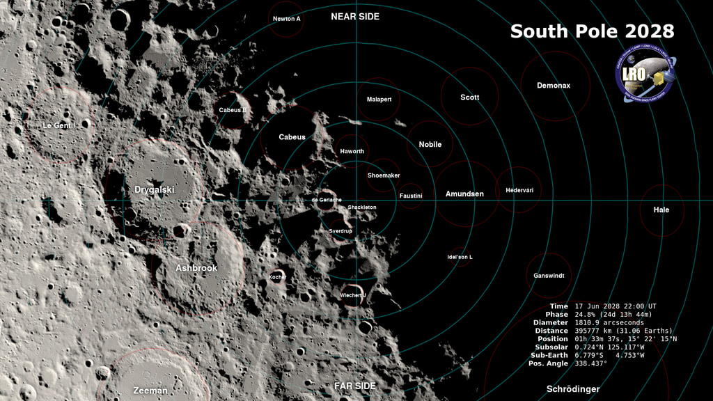
The visualizations on this page simulate the lighting at the South Pole of the Moon in the years 2025 to 2028 at two-hour intervals, a total of 17,532 time steps or frames. The field of view encompasses the area south of 80° south latitude.
Global terrain mapping by Lunar Reconnaissance Orbiter's laser altimeter, LOLA, makes it possible to simulate sunlight and shadow on the Moon at any date in the past or future. This will be vital for planning exploration of the lunar South Pole, where the low Sun angle and rugged terrain produce a uniquely challenging lighting environment.
Illumination at the Moon's South Pole to 80°S, 2025 to 2028
Global terrain mapping by Lunar Reconnaissance Orbiter's laser altimeter, LOLA, makes it possible to simulate sunlight and shadow on the Moon at any date in the past or future. This will be vital for planning exploration of the lunar South Pole, where the low Sun angle and rugged terrain produce a uniquely challenging lighting environment.
Related
Visualization Credits
Ernie Wright (USRA): Lead Visualizer
Noah Petro (NASA/GSFC): Scientist
Laurence Schuler (ADNET Systems, Inc.): Technical Support
Ian Jones (ADNET Systems, Inc.): Technical Support
Noah Petro (NASA/GSFC): Scientist
Laurence Schuler (ADNET Systems, Inc.): Technical Support
Ian Jones (ADNET Systems, Inc.): Technical Support
Please give credit for this item to:
NASA's Scientific Visualization Studio
NASA's Scientific Visualization Studio
Short URL to share this page:
https://svs.gsfc.nasa.gov/5027
Mission:
LRO (Lunar Reconnaissance Orbiter)
Data Used:
Note: While we identify the data sets used in these visualizations, we do not store any further details nor the data sets themselves on our site.
This item is part of this series:
The Moon
Keywords:
SVS >> HDTV
SVS >> Moon
SVS >> Hyperwall
SVS >> LRO
SVS >> Lunar Reconnaissance Orbiter
SVS >> Moon >> South Pole
NASA Science >> Planets and Moons
SVS >> Permanently Shadowed Regions
https://svs.gsfc.nasa.gov/5027
Mission:
LRO (Lunar Reconnaissance Orbiter)
Data Used:
LRO/LOLA/Digital Elevation Map also referred to as: DEM
JPL DE421 also referred to as: DE421
Ephemeris - NASA/JPL
Planetary ephemerides
This item is part of this series:
The Moon
Keywords:
SVS >> HDTV
SVS >> Moon
SVS >> Hyperwall
SVS >> LRO
SVS >> Lunar Reconnaissance Orbiter
SVS >> Moon >> South Pole
NASA Science >> Planets and Moons
SVS >> Permanently Shadowed Regions


