Earth
ID: 4950
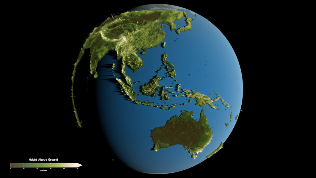
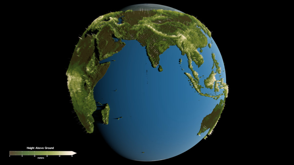
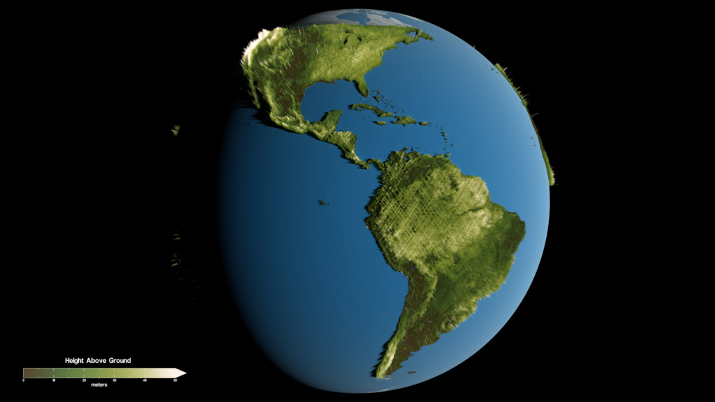
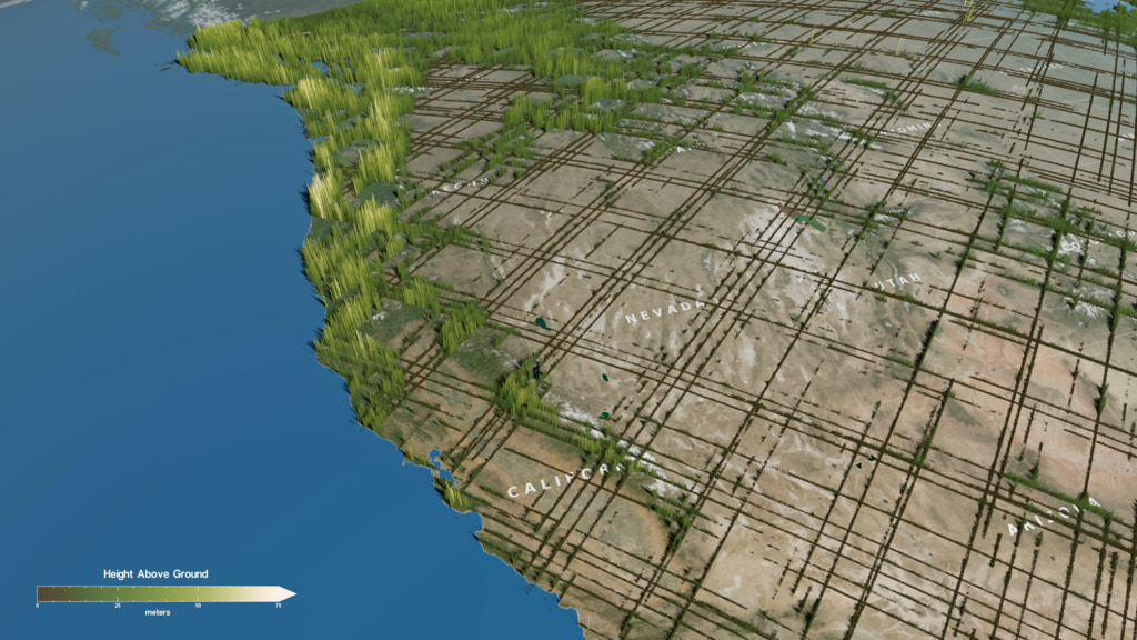
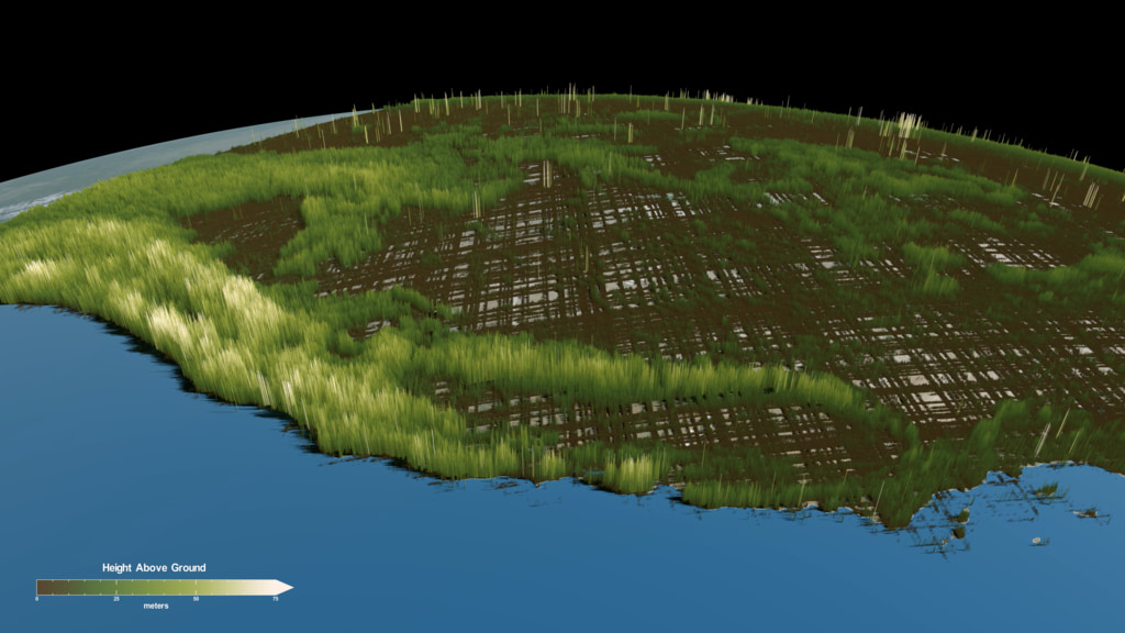
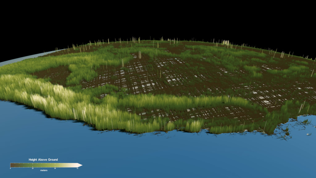
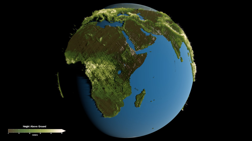
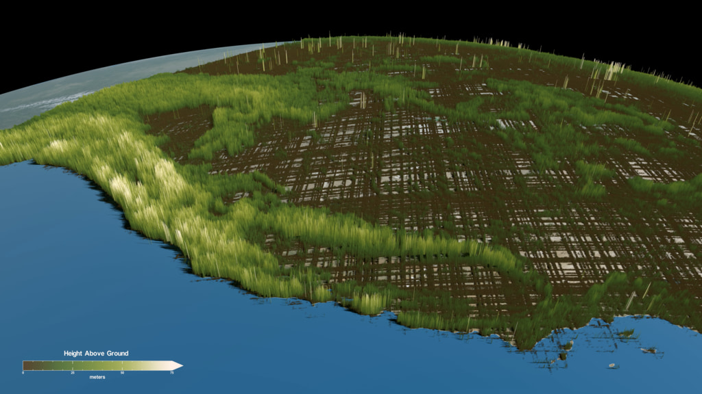
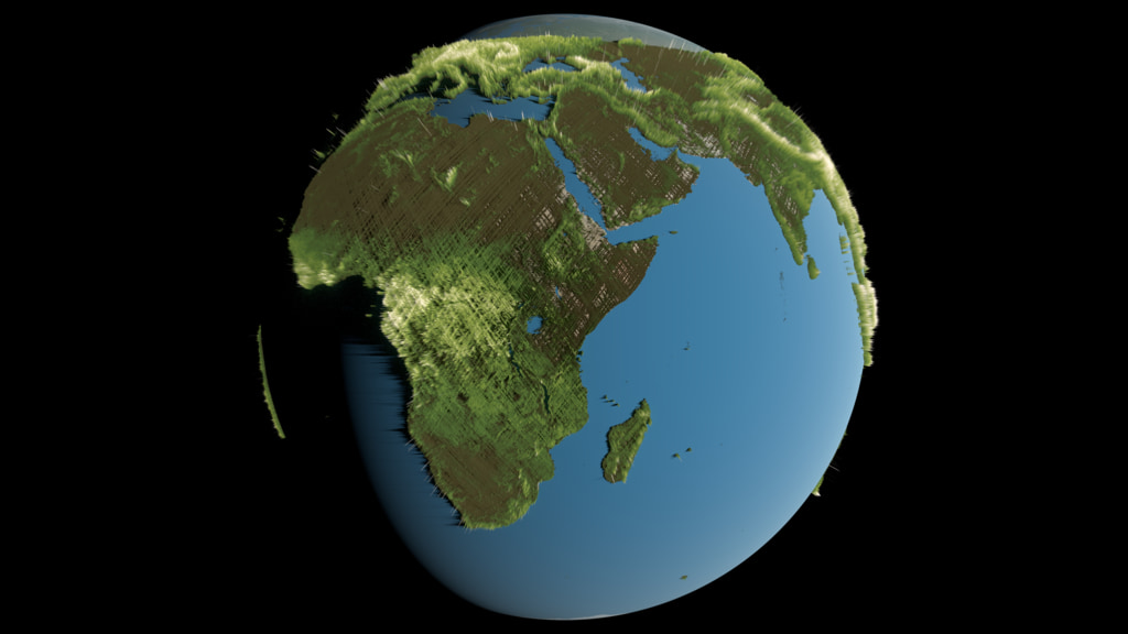
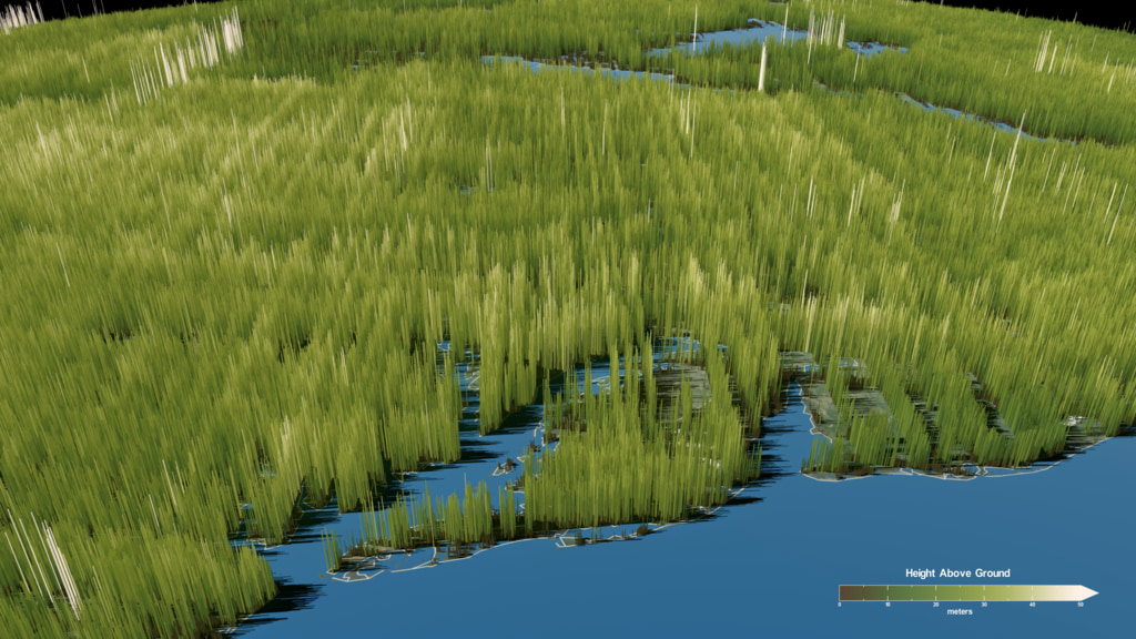
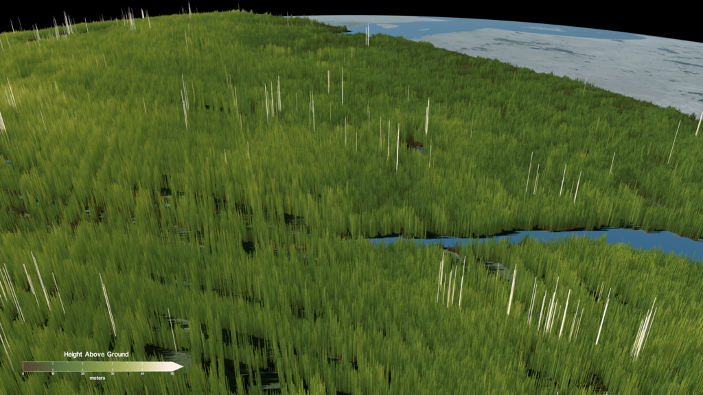
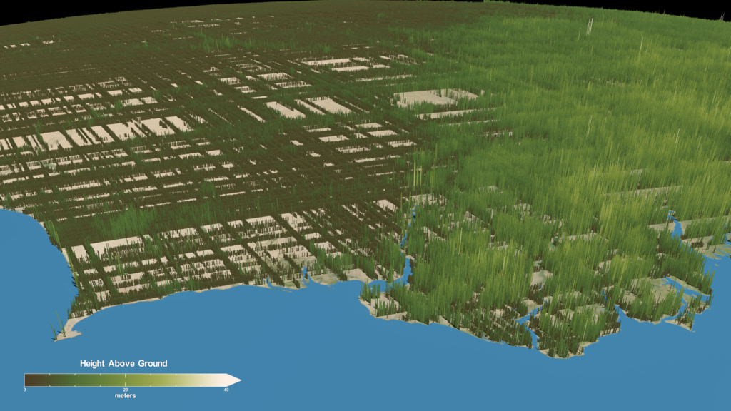
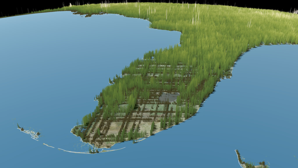
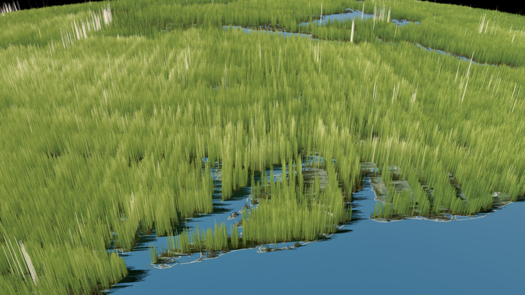
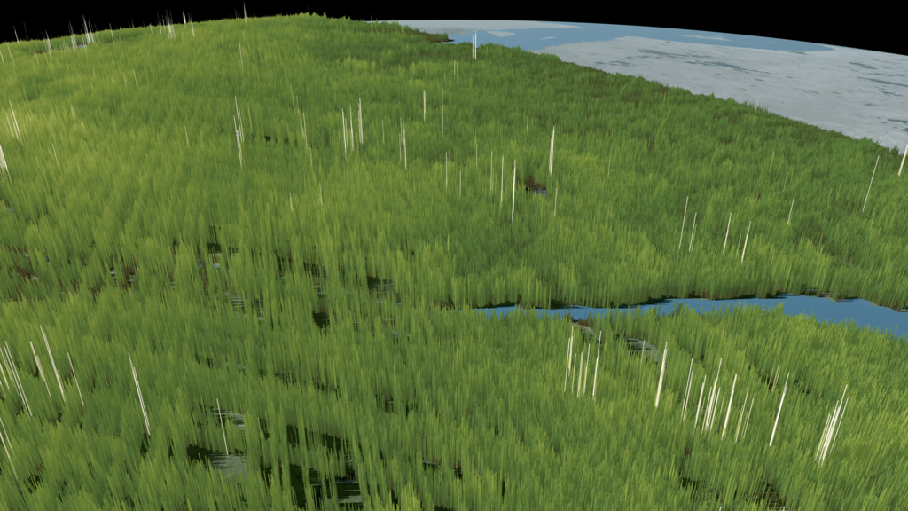
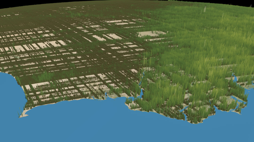
The Global Ecosystem Dynamics Investigation (GEDI) produces high resolution laser ranging observations of the 3D structure of the Earth. GEDI’s precise measurements of forest canopy height, canopy vertical structure, and surface elevation greatly advance our ability to characterize important carbon and water cycling processes, biodiversity, and habitat.
GEDI’s data on surface structure are also of immense value for weather forecasting, forest management, glacier and snowpack monitoring, and the generation of more accurate digital elevation models. GEDI provides the missing piece – 3D structure – in NASA’s observational assets which enables us to better understand how the Earth behaves as a system, and guides the actions we can take to sustain critical resources.
The GEDI instrument is a geodetic-class, light detection and ranging (lidar) laser system comprised of 3 lasers that produce 8 parallel tracks of observations. Each laser fires 242 times per second and illuminates a 25 m spot (a footprint) on the surface over which 3D structure is measured. Each footprint is separated by 60 m along track, with an across-track distance of about 600 m between each of the 8 tracks. GEDI expected to produce about 10 billion cloud-free observations during its nominal 24-month mission length.
To learn more, visit the GEDI webpage


GEDI Forest Height
GEDI’s data on surface structure are also of immense value for weather forecasting, forest management, glacier and snowpack monitoring, and the generation of more accurate digital elevation models. GEDI provides the missing piece – 3D structure – in NASA’s observational assets which enables us to better understand how the Earth behaves as a system, and guides the actions we can take to sustain critical resources.
The GEDI instrument is a geodetic-class, light detection and ranging (lidar) laser system comprised of 3 lasers that produce 8 parallel tracks of observations. Each laser fires 242 times per second and illuminates a 25 m spot (a footprint) on the surface over which 3D structure is measured. Each footprint is separated by 60 m along track, with an across-track distance of about 600 m between each of the 8 tracks. GEDI expected to produce about 10 billion cloud-free observations during its nominal 24-month mission length.
To learn more, visit the GEDI webpage
Used Elsewhere In

Visualization Credits
Lead Visualizer:
Kel Elkins (USRA)
Technical Support:
Laurence Schuler (ADNET Systems, Inc.)
Ian Jones (ADNET Systems, Inc.)
Visualizers:
Horace Mitchell (NASA/GSFC)
Greg Shirah (NASA/GSFC)
Scientists:
Temilola Fatoyinbo (NASA/GSFC)
Atticus Stovall (University of Maryland)
Kel Elkins (USRA)
Technical Support:
Laurence Schuler (ADNET Systems, Inc.)
Ian Jones (ADNET Systems, Inc.)
Visualizers:
Horace Mitchell (NASA/GSFC)
Greg Shirah (NASA/GSFC)
Scientists:
Temilola Fatoyinbo (NASA/GSFC)
Atticus Stovall (University of Maryland)
Please give credit for this item to:
NASA's Scientific Visualization Studio
NASA's Scientific Visualization Studio
Short URL to share this page:
https://svs.gsfc.nasa.gov/4950
Data Used:
Note: While we identify the data sets used in these visualizations, we do not store any further details nor the data sets themselves on our site.
Keywords:
DLESE >> Agricultural science
DLESE >> Forestry
SVS >> Lidar
GCMD >> Earth Science >> Agriculture >> Forest Science
SVS >> Hyperwall
SVS >> ISS
NASA Science >> Earth
GCMD keywords can be found on the Internet with the following citation: Olsen, L.M., G. Major, K. Shein, J. Scialdone, S. Ritz, T. Stevens, M. Morahan, A. Aleman, R. Vogel, S. Leicester, H. Weir, M. Meaux, S. Grebas, C.Solomon, M. Holland, T. Northcutt, R. A. Restrepo, R. Bilodeau, 2013. NASA/Global Change Master Directory (GCMD) Earth Science Keywords. Version 8.0.0.0.0
https://svs.gsfc.nasa.gov/4950
Data Used:
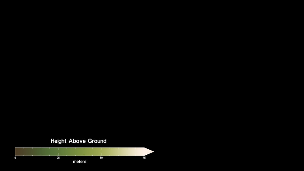
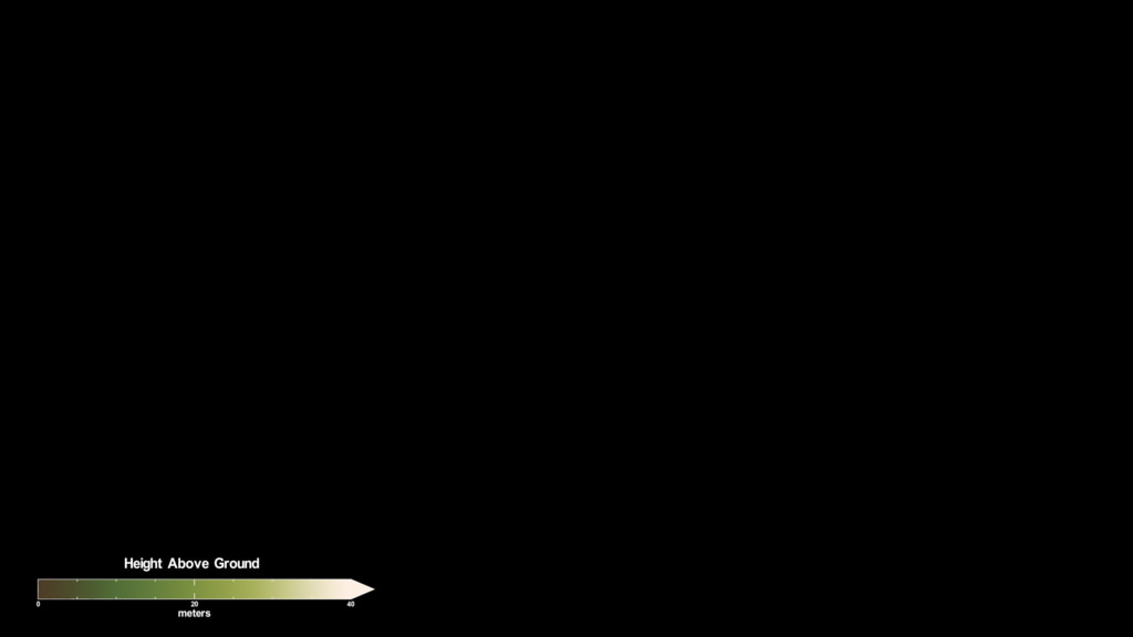
GEDI/Relative Height
RH100 or relative height is the 100th percentile of waveform energy relative to ground elevation. Derived from the L2B LIDAR metric RH100 data product.
Keywords:
DLESE >> Agricultural science
DLESE >> Forestry
SVS >> Lidar
GCMD >> Earth Science >> Agriculture >> Forest Science
SVS >> Hyperwall
SVS >> ISS
NASA Science >> Earth
GCMD keywords can be found on the Internet with the following citation: Olsen, L.M., G. Major, K. Shein, J. Scialdone, S. Ritz, T. Stevens, M. Morahan, A. Aleman, R. Vogel, S. Leicester, H. Weir, M. Meaux, S. Grebas, C.Solomon, M. Holland, T. Northcutt, R. A. Restrepo, R. Bilodeau, 2013. NASA/Global Change Master Directory (GCMD) Earth Science Keywords. Version 8.0.0.0.0


