Earth
ID: 4848
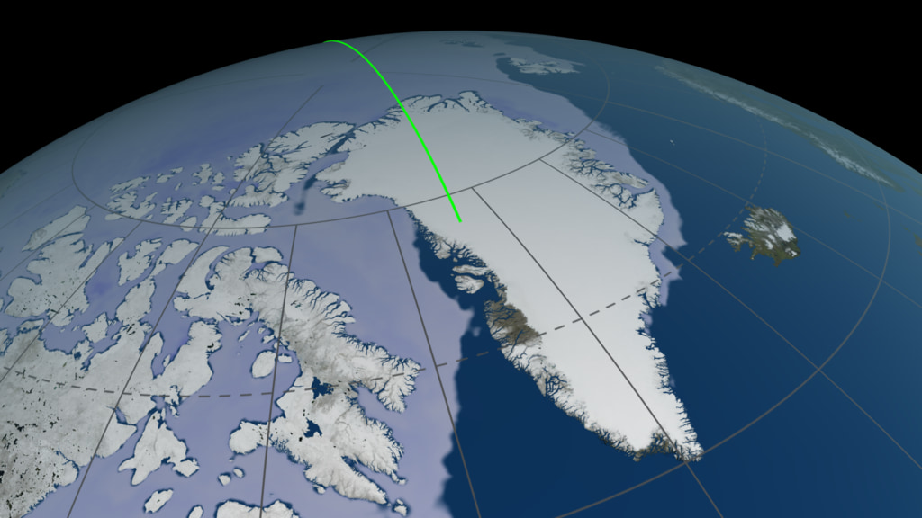
ICESat-2 (short for Ice, Cloud and land Elevation Satellite -2), launched Sept. 15, 2018, uses lasers and a very precise detection instrument to measure the elevation of Earth’s surface. ICESat-2 is in a polar orbit which provides high coverage near the poles where ice elevations are changing relatively quickly. This visualization shows one complete orbit ground track.
ICESat-2 Ground Track
Used Elsewhere In

Related
Visualization Credits
Kel Elkins (USRA): Lead Visualizer
Laurence Schuler (ADNET Systems, Inc.): Technical Support
Ian Jones (ADNET Systems, Inc.): Technical Support
Ryan Fitzgibbons (USRA): Lead Producer
Kaitlin Harbeck (SGT): Scientist
Thomas A. Neumann (NASA/GSFC): Scientist
Nathan T. Kurtz (NASA/GSFC): Scientist
Laurence Schuler (ADNET Systems, Inc.): Technical Support
Ian Jones (ADNET Systems, Inc.): Technical Support
Ryan Fitzgibbons (USRA): Lead Producer
Kaitlin Harbeck (SGT): Scientist
Thomas A. Neumann (NASA/GSFC): Scientist
Nathan T. Kurtz (NASA/GSFC): Scientist
Please give credit for this item to:
NASA's Scientific Visualization Studio
NASA's Scientific Visualization Studio
Short URL to share this page:
https://svs.gsfc.nasa.gov/4848
Data Used:
Note: While we identify the data sets used in these visualizations, we do not store any further details nor the data sets themselves on our site.
Keywords:
SVS >> Hyperwall
NASA Science >> Earth
SVS >> ICESat-2
https://svs.gsfc.nasa.gov/4848
Data Used:
ICESat-2/STK Ephemeris
EphemerisKeywords:
SVS >> Hyperwall
NASA Science >> Earth
SVS >> ICESat-2


