Earth
ID: 4306
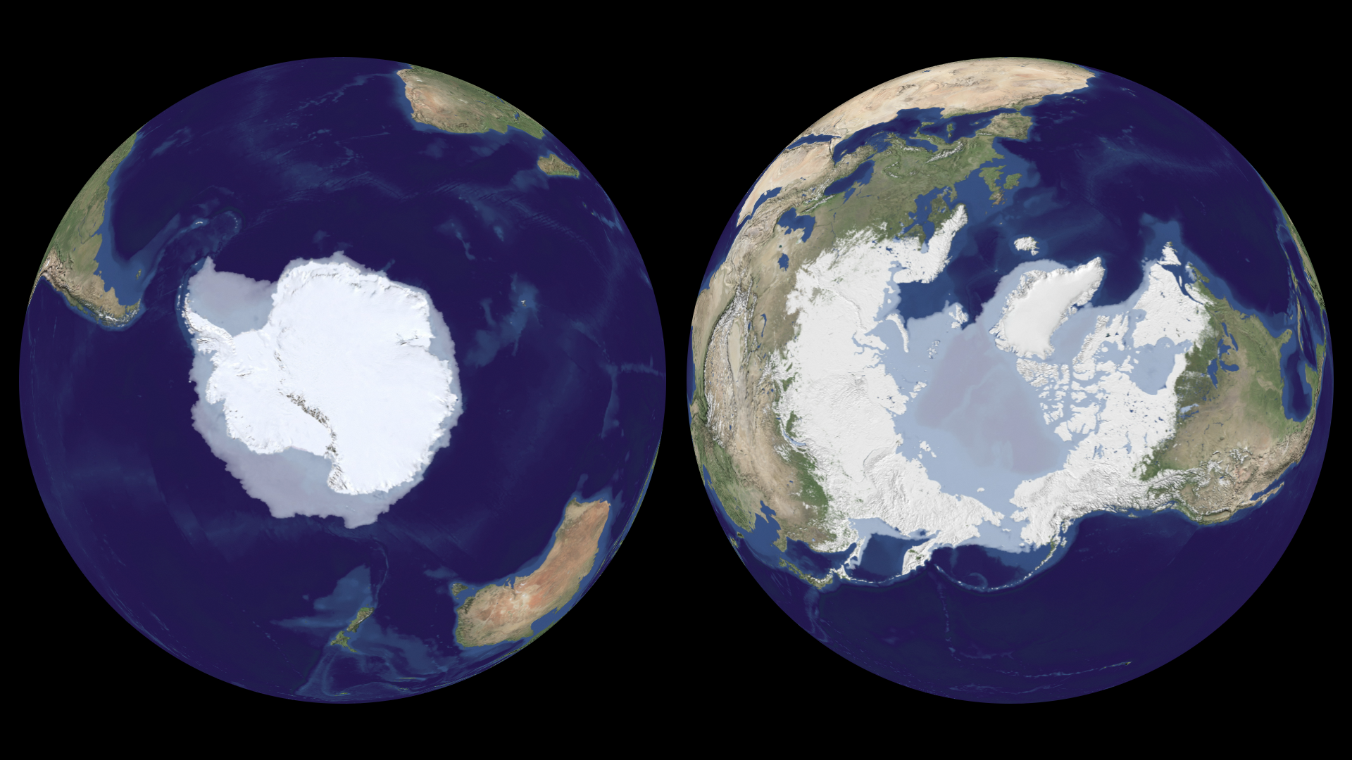
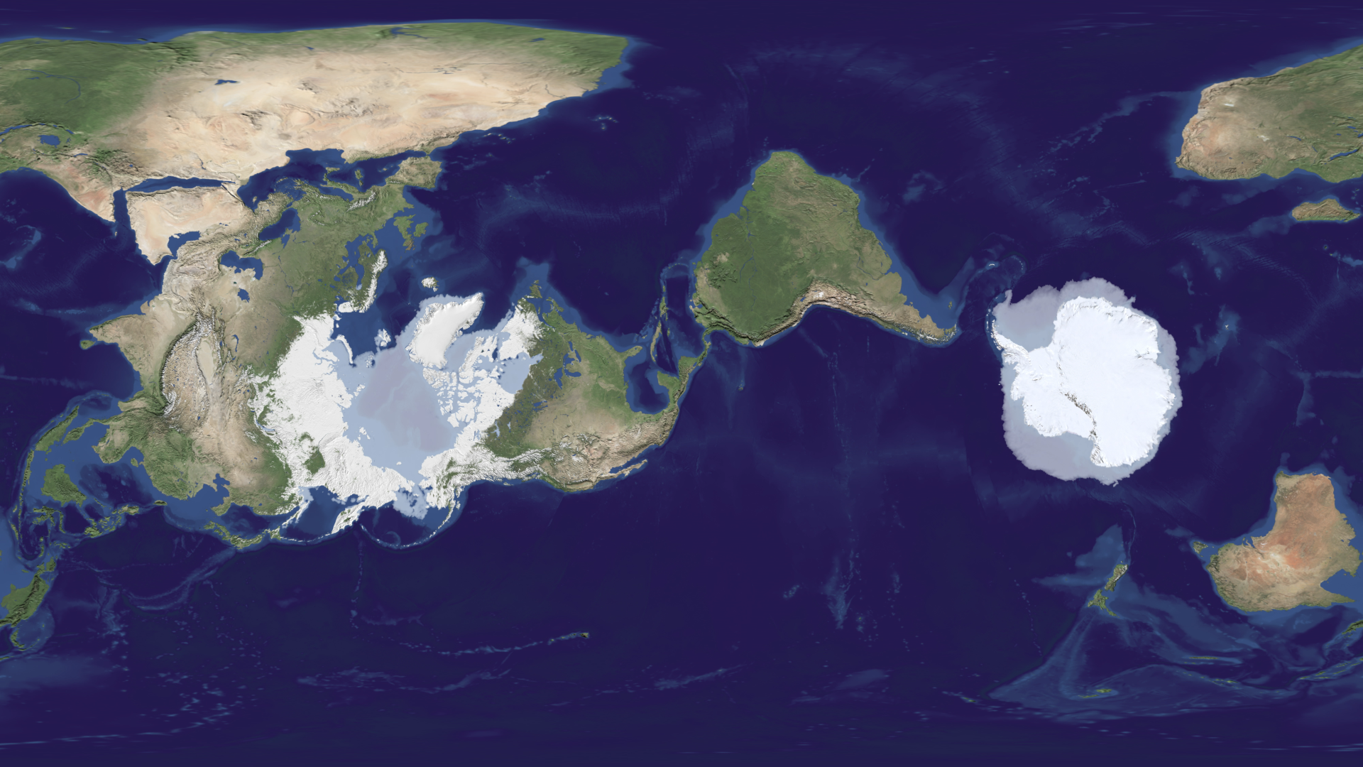
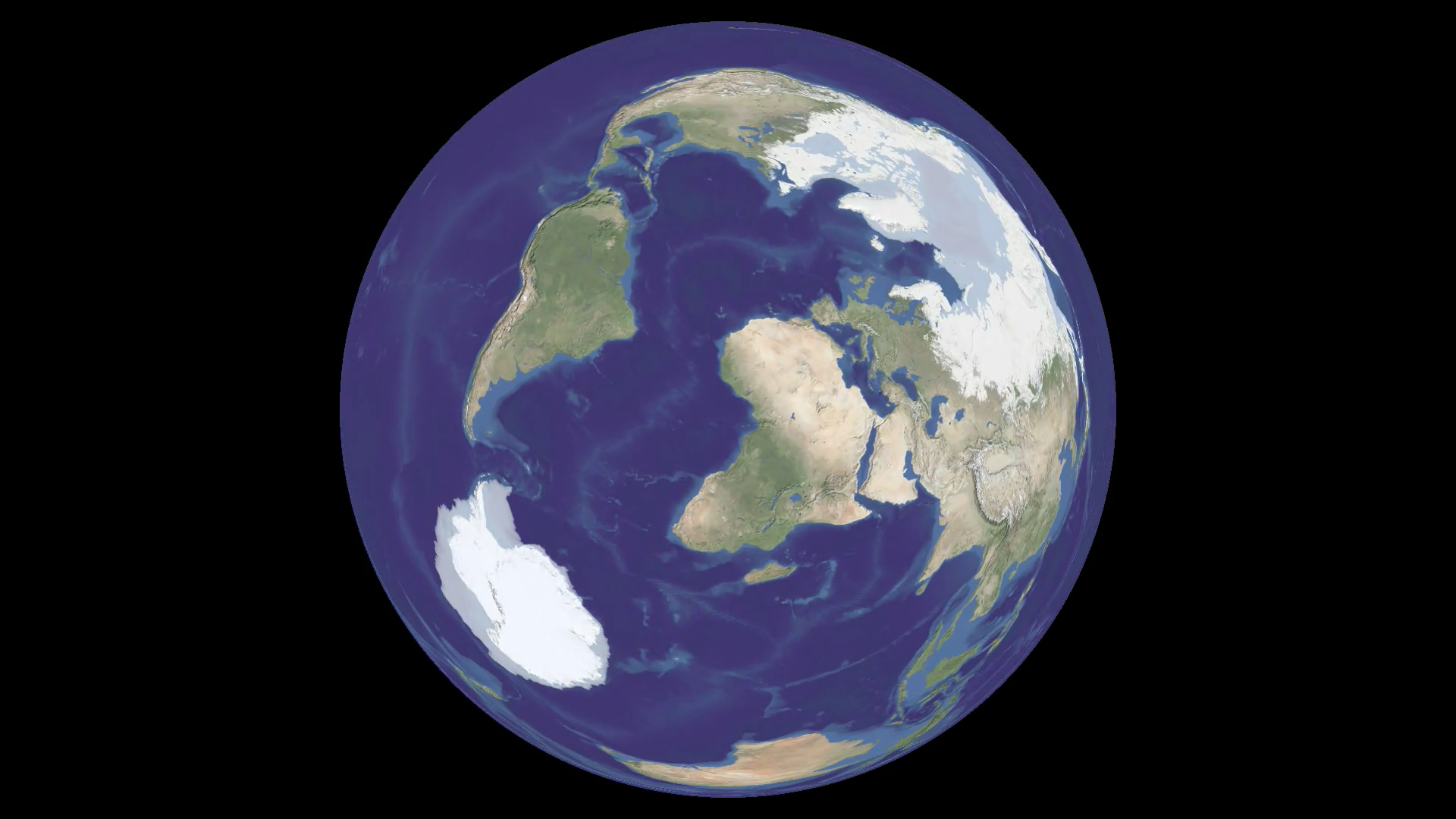
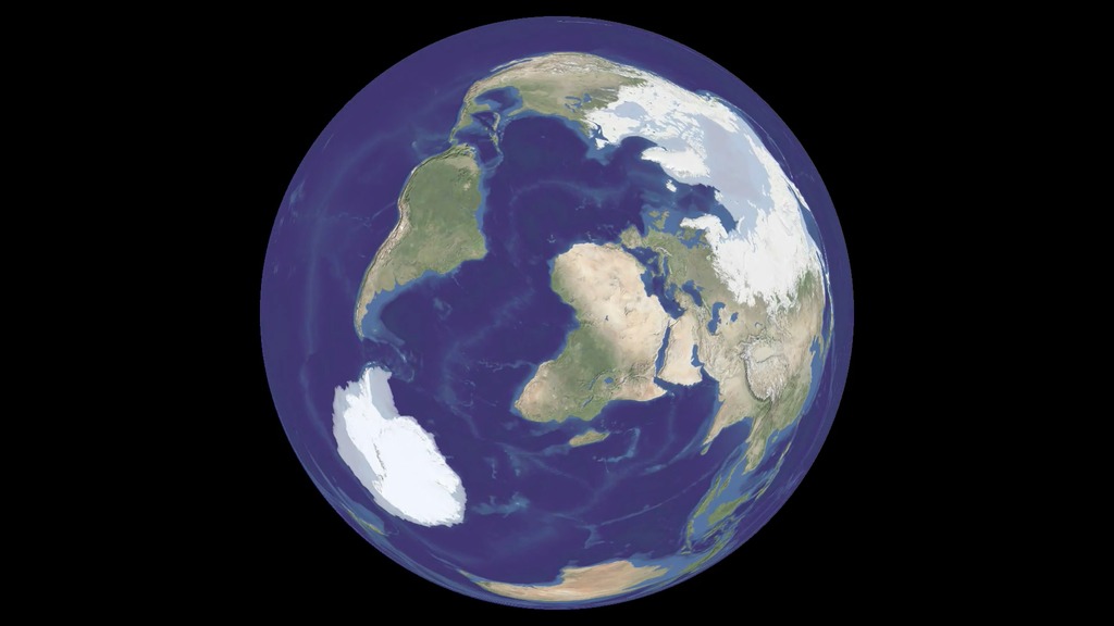
On March 27, 2009, NASA released FROZEN, a twelve-minute show about the Earth's frozen regions designed for Science On a Sphere. Science On a Sphere was created by NOAA and displays movies on a spherical screen, which is ideal for a show about the Earth or the planets. The audience can view the show from any side of the sphere and can see any part of the Earth. Making a movie for this system is challenging, and FROZEN was an exciting project to create. Until now, only the "trailer" for FROZEN has been available for viewing from our site. Here, for the first time, is an on-line version of the complete show, presented in several different formats that show different aspects of the movie.
Official Movie Credits:
Written, Produced and Directed by
Michael Starobin and Horace Mitchell
Based on a presentation by
Dr. Robert Bindschadler/GSFC
Edited by
Victoria Weeks
Narrated by
Craig Sechler
Music by
Andre Gribou
Script Development Team
Michael Starobin
Horace Mitchell
Victoria Weeks
Greg Shirah
Cindy Starr
The Scientific Visualization Studio/NASA GSFC
Director of Data Visualization
Horace Mitchell
Visualization Team
Cindy Starr
Lori Perkins
Tom Bridgman
Greg Shirah
Software Development
Greg Shirah
Eric Sokolowsky
Animation
Ivy Flores
Andrej Bevec
Walt Feimer
Set Construction and Practical Effects
Chris Meaney
Stop Action Photography
Pat Izzo
Infrared Videography
Ed Weibe
Videography
Chris Smith
Victoria Weeks
Studio Crew
Shane Keating
Richard Melnick
Jennifer Lentz
Tatyana Pokrovskaya
Sound Design
Michael Starobin
Audio Engineering and Assistant to the Composer
Eric Arvai
Recording Engineer
Mike Velle
Account Management
Mike Velle
IT Management
Pankaj Jaiswal
Stuart Snodgrass
Jim Williams
Science On a Sphere Project Liaison
Maurice Henderson
Photographic Research
Eric Erbe
Production Photography
Debora McCallum
Pat Izzo
Voice Casting
Sandy Stern Casting, LLC
Cast
Mara Bayewitz
Chris Meaney
Andy Freeberg
Helen-Nicole Kostis
Scientific Consultants
Dr. Bob Bindschadler, GSFC
Dr. Waleed Abdalati, CIRES/CSES
Dr. Thorsten Markus, GSFC
Dr. Richard S. Williams, Jr., USGS
Antarctica Video
PolarPalooza/Passport to Knowledge
Ilulissat Glacier Sequence
Jason Amundson, University of Alaska Fairbanks
Glacier Images provided by
Mike Embree, The National Science Foundation
W. T. Pfeffer, Institute of Arctic and Alpine Research, University of Colorado
Dr. Roland Warner, Antarctic Climate and Ecosystems Cooperative Research Centre and Australian Antarctic Division
Permafrost Images provided by
F.T. Eyre, U.S. Army Corps of Engineers
Marilyn Aber, U.S. Army Corps of Engineers
Michael J. Coffey, Alaska Department of Transportation and Public Facilities
Data Sources
Blue Marble Next Generation Seasonal Landcover Reto Stockli (NASA/GSFC)
City lights -- Image and Data processing by NOAA's National Geophysical Data Center from DMSP data collected by the US Air Force Weather Agency.
Circum-Arctic map of permafrost and ground-ice conditions: National Snow and Ice Data Center/World Data Center for Glaciology
Landsat Image Mosaic of Antarctica: The U.S. Geological Survey (USGS), the British Antarctic Survey (BAS), and the National Aeronautics and Space Administration (NASA), with funding from The National Science Foundation (NSF)
GLIMS glacier database Armstrong, R., B. Raup, S.J.S. Khalsa, R. Barry, J. Kargel, C. Helm, and H. Kieffer, National Snow and Ice Data Center
World glacier inventory: World Glacier Monitoring Service and National Snow and Ice Data Center/World Data Center for Glaciology
West Greenland Glacier Inventory 1992: Andreas Peter Ahlstrøm, Department of Quaternary Geology, Geological Survey of Denmark and Greenland, Copenhagen, Denmark
Groundwater Resources of the World: BGR Hannover / UNESCO Paris
2008 North American Atlas: Government of Canada, Natural Resources Canada, Canada Centre for Remote Sensing
The Antarctic Digital Database: copyright © 1993-2006 Scientific Committee on Antarctic Research
Additional Thanks
Anker Weidick, Geological Survey of Denmark
Richard S. Williams, Jr., United States Geological Survey
Charles Swithinbank, British Antarctic Survey
The National Snow and Ice Data Center USGS Washington Water Science Center
Seth White -- www.sethwhite.org
Special thanks to Dr. Ming-Ying Wei, NASA Science Mission Directorate
Executive Producer for Honeywell Technology Solutions
Patrick Kennedy
Executive Producer for NASA Television
GSFC Wade Sisler
Science On a Sphere was Developed by NOAA


FROZEN
Cold matters.
Copyright © 2009 NASA Goddard Space Flight Center All Rights Reserved
FROZEN: The Full Story
Related

Visualization Credits
Greg Shirah (NASA/GSFC): Animator
Cindy Starr (Global Science and Technology, Inc.): Visualizer
Lori Perkins (NASA/GSFC): Animator
Tom Bridgman (Global Science and Technology, Inc.): Animator
Walt Feimer (HTSI): Animator
Ivy Flores (IRC/UMBC): Animator
Andrej Bevec (UMBC): Animator
Victoria Weeks (HTSI): Video Editor
Michael Starobin (HTSI): Producer
Bob Bindschadler (NASA/GSFC): Scientist
Waleed Abdalati (NASA/GSFC): Scientist
Thorsten Markus (NASA/GSFC): Scientist
Shane Keating (GST): Project Support
Jennifer Lentz (HTSI): Project Support
Rich Melnick (HTSI): Project Support
Tatyana N. Pokrovskaya (HTSI): Project Support
Victoria Weeks (HTSI): Videographer
Ed Weibe (HTSI): Videographer
Pat Izzo (TRAX International): Videographer
Chris Smith (HTSI): Videographer
Michael Starobin (HTSI): Writer
Horace Mitchell (NASA/GSFC): Writer
Horace Mitchell (NASA/GSFC): Lead Data Visualizer
Written, Produced and Directed by
Michael Starobin and Horace Mitchell
Based on a presentation by
Dr. Robert Bindschadler/GSFC
Edited by
Victoria Weeks
Narrated by
Craig Sechler
Music by
Andre Gribou
Script Development Team
Michael Starobin
Horace Mitchell
Victoria Weeks
Greg Shirah
Cindy Starr
The Scientific Visualization Studio/NASA GSFC
Director of Data Visualization
Horace Mitchell
Visualization Team
Cindy Starr
Lori Perkins
Tom Bridgman
Greg Shirah
Software Development
Greg Shirah
Eric Sokolowsky
Animation
Ivy Flores
Andrej Bevec
Walt Feimer
Set Construction and Practical Effects
Chris Meaney
Stop Action Photography
Pat Izzo
Infrared Videography
Ed Weibe
Videography
Chris Smith
Victoria Weeks
Studio Crew
Shane Keating
Richard Melnick
Jennifer Lentz
Tatyana Pokrovskaya
Sound Design
Michael Starobin
Audio Engineering and Assistant to the Composer
Eric Arvai
Recording Engineer
Mike Velle
Account Management
Mike Velle
IT Management
Pankaj Jaiswal
Stuart Snodgrass
Jim Williams
Science On a Sphere Project Liaison
Maurice Henderson
Photographic Research
Eric Erbe
Production Photography
Debora McCallum
Pat Izzo
Voice Casting
Sandy Stern Casting, LLC
Cast
Mara Bayewitz
Chris Meaney
Andy Freeberg
Helen-Nicole Kostis
Scientific Consultants
Dr. Bob Bindschadler, GSFC
Dr. Waleed Abdalati, CIRES/CSES
Dr. Thorsten Markus, GSFC
Dr. Richard S. Williams, Jr., USGS
Antarctica Video
PolarPalooza/Passport to Knowledge
Ilulissat Glacier Sequence
Jason Amundson, University of Alaska Fairbanks
Glacier Images provided by
Mike Embree, The National Science Foundation
W. T. Pfeffer, Institute of Arctic and Alpine Research, University of Colorado
Dr. Roland Warner, Antarctic Climate and Ecosystems Cooperative Research Centre and Australian Antarctic Division
Permafrost Images provided by
F.T. Eyre, U.S. Army Corps of Engineers
Marilyn Aber, U.S. Army Corps of Engineers
Michael J. Coffey, Alaska Department of Transportation and Public Facilities
Data Sources
Blue Marble Next Generation Seasonal Landcover Reto Stockli (NASA/GSFC)
City lights -- Image and Data processing by NOAA's National Geophysical Data Center from DMSP data collected by the US Air Force Weather Agency.
Circum-Arctic map of permafrost and ground-ice conditions: National Snow and Ice Data Center/World Data Center for Glaciology
Landsat Image Mosaic of Antarctica: The U.S. Geological Survey (USGS), the British Antarctic Survey (BAS), and the National Aeronautics and Space Administration (NASA), with funding from The National Science Foundation (NSF)
GLIMS glacier database Armstrong, R., B. Raup, S.J.S. Khalsa, R. Barry, J. Kargel, C. Helm, and H. Kieffer, National Snow and Ice Data Center
World glacier inventory: World Glacier Monitoring Service and National Snow and Ice Data Center/World Data Center for Glaciology
West Greenland Glacier Inventory 1992: Andreas Peter Ahlstrøm, Department of Quaternary Geology, Geological Survey of Denmark and Greenland, Copenhagen, Denmark
Groundwater Resources of the World: BGR Hannover / UNESCO Paris
2008 North American Atlas: Government of Canada, Natural Resources Canada, Canada Centre for Remote Sensing
The Antarctic Digital Database: copyright © 1993-2006 Scientific Committee on Antarctic Research
Additional Thanks
Anker Weidick, Geological Survey of Denmark
Richard S. Williams, Jr., United States Geological Survey
Charles Swithinbank, British Antarctic Survey
The National Snow and Ice Data Center USGS Washington Water Science Center
Seth White -- www.sethwhite.org
Special thanks to Dr. Ming-Ying Wei, NASA Science Mission Directorate
Executive Producer for Honeywell Technology Solutions
Patrick Kennedy
Executive Producer for NASA Television
GSFC Wade Sisler
Science On a Sphere was Developed by NOAA
FROZEN
Cold matters.
Copyright © 2009 NASA Goddard Space Flight Center All Rights Reserved
Short URL to share this page:
https://svs.gsfc.nasa.gov/4306
Missions:
Galileo
Landsat
Terra
Data Used:
Note: While we identify the data sets used in these visualizations, we do not store any further details nor the data sets themselves on our site.
This item is part of these series:
Narrated Movies
Goddard Magic Planet Media
Keywords:
DLESE >> Cryology
SVS >> HDTV
SVS >> Ice
SVS >> Infrared
GCMD >> Earth Science >> Cryosphere
GCMD >> Earth Science >> Cryosphere >> Sea Ice
GCMD >> Earth Science >> Cryosphere >> Frozen Ground >> Permafrost
GCMD >> Earth Science >> Cryosphere >> Glaciers/Ice Sheets >> Glaciers
GCMD >> Earth Science >> Cryosphere >> Glaciers/Ice Sheets >> Ice Sheets
SVS >> Frozen
SVS >> Sea Level
NASA Science >> Earth
GCMD keywords can be found on the Internet with the following citation: Olsen, L.M., G. Major, K. Shein, J. Scialdone, S. Ritz, T. Stevens, M. Morahan, A. Aleman, R. Vogel, S. Leicester, H. Weir, M. Meaux, S. Grebas, C.Solomon, M. Holland, T. Northcutt, R. A. Restrepo, R. Bilodeau, 2013. NASA/Global Change Master Directory (GCMD) Earth Science Keywords. Version 8.0.0.0.0
https://svs.gsfc.nasa.gov/4306
Missions:
Galileo
Landsat
Terra
Data Used:
Groundwater Resources of the World
Data Compilation - BGR and UNESCONorth American Atlas
AtlasGLIMS Glacier Database
Database - NSIDC
Global Land Ice Measurements from Space (GLIMS) is an international project with the goal of surveying a majority of the world's estimated 160,000 glaciers. GLIMS uses data collected primarily by the Advanced Spaceborne Thermal Emission and Reflection Radiometer (ASTER) instrument aboard the Terra satellite and the LANDSAT Enhanced Thematic Mapper Plus (ETM+), along with historical observations.
Antarctic Digital Database, The also referred to as: The Antarctic Digital Database (ADD)
DatabaseGlacier Inventory of West Greenland also referred to as: West Greenland Glacier Inventory
Data Compilation - NSIDCLandsat-7/ETM+/Landsat Image Mosaic of Antarctica also referred to as: LIMA
Mosaic - NASA/GSFC, British Antarctic Survey, USGS EROS Data Center
Mosaicing to avoid clouds produced a high quality, nearly cloud-free benchmark data set of Antarctica for the International Polar Year from images collected primarily during 1999-2003.
Terra and Aqua/MODIS/Blue Marble Land Cover
Credit:
The Blue Marble data is courtesy of Reto Stockli (NASA/GSFC).
The Blue Marble data is courtesy of Reto Stockli (NASA/GSFC).
DMSP/OLS/Earth at Night
World Glacier Inventory
Data Compilation - NSIDCCircum-Arctic Map of Permafrost and Ground-Ice Conditions
Data Compilation - NSIDCThis item is part of these series:
Narrated Movies
Goddard Magic Planet Media
Keywords:
DLESE >> Cryology
SVS >> HDTV
SVS >> Ice
SVS >> Infrared
GCMD >> Earth Science >> Cryosphere
GCMD >> Earth Science >> Cryosphere >> Sea Ice
GCMD >> Earth Science >> Cryosphere >> Frozen Ground >> Permafrost
GCMD >> Earth Science >> Cryosphere >> Glaciers/Ice Sheets >> Glaciers
GCMD >> Earth Science >> Cryosphere >> Glaciers/Ice Sheets >> Ice Sheets
SVS >> Frozen
SVS >> Sea Level
NASA Science >> Earth
GCMD keywords can be found on the Internet with the following citation: Olsen, L.M., G. Major, K. Shein, J. Scialdone, S. Ritz, T. Stevens, M. Morahan, A. Aleman, R. Vogel, S. Leicester, H. Weir, M. Meaux, S. Grebas, C.Solomon, M. Holland, T. Northcutt, R. A. Restrepo, R. Bilodeau, 2013. NASA/Global Change Master Directory (GCMD) Earth Science Keywords. Version 8.0.0.0.0


