GRAIL Gravity Map for the Cover of Geophysical Research Letters
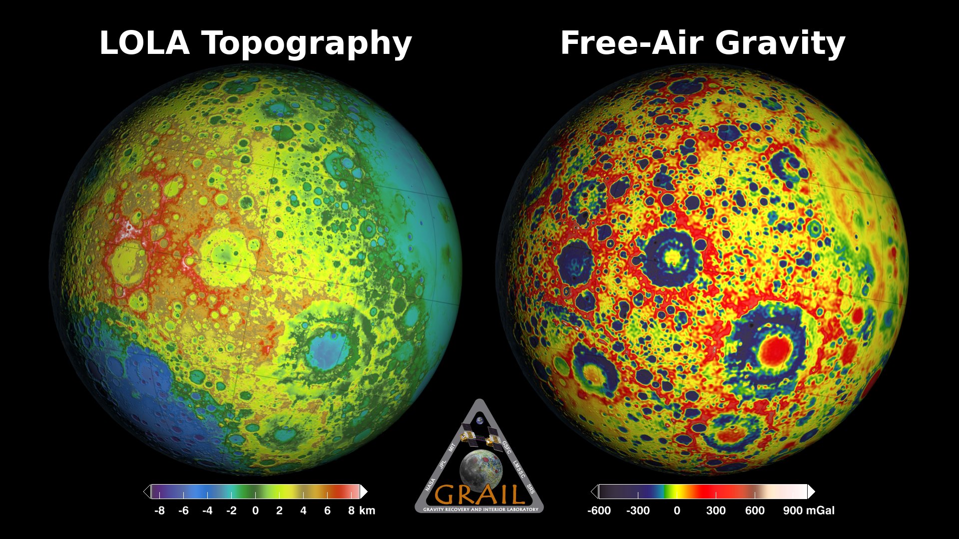
This print-resolution still image was created for the cover of the May 28, 2014 issue of Geophysical Research Letters. It features a free-air gravity map of the Moon's southern latitudes developed by S. Goossens et al. from data returned by the Gravity Recovery and Interior Laboratory (GRAIL) mission.
If the Moon were a perfectly smooth sphere of uniform density, the gravity map would be a single, featureless color, indicating that the force of gravity at a given elevation was the same everywhere. But like other rocky bodies in the solar system, including Earth, the Moon has both a bumpy surface and a lumpy interior. Spacecraft in orbit around the Moon experience slight variations in gravity caused by both of these irregularities.
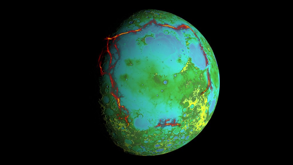
The free-air gravity map shows deviations from the mean gravity that a cueball Moon would have. The deviations are measured in milliGals, a unit of acceleration. On the map, purple is at the low end of the range, at around -400 mGals, and red is at the high end near +400 mGals. Yellow denotes the mean.
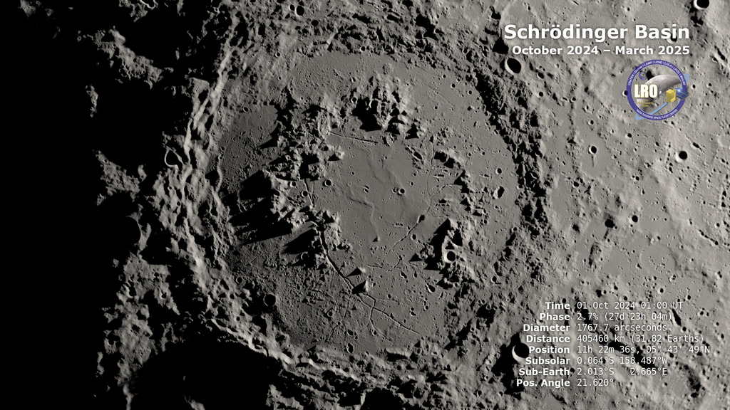
The map shown here extends from the south pole of the Moon up to 50°S and reveals the gravity for that region in even finer detail than the global gravity maps published previously. The image illustrates the very good correlation between the gravity map and topographic features such as peaks and craters, as well as the mass concentration lying beneath the large Schrödinger basin in the center of the frame. The terrain in the image is based on Lunar Reconnaissance Orbiter (LRO) altimeter and camera data.
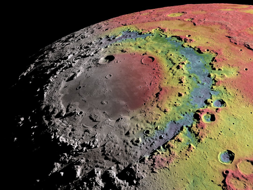
 and camera (LROC) data. The view is south-up, with the south pole near the horizon in the upper left and the crescent Earth in the distance. The terminator crosses the eastern rim of the Schrödinger basin. Gravity is painted onto the areas that are in or near the night side. Red corresponds to mass excesses and blue to mass deficits.")
A high-resolution free-air gravity map based on GRAIL data, overlaid on terrain based on LRO altimeter (LOLA) and camera (LROC) data. The view is south-up, with the south pole near the horizon in the upper left and the crescent Earth in the distance. The terminator crosses the eastern rim of the Schrödinger basin. Gravity is painted onto the areas that are in or near the night side. Red corresponds to mass excesses and blue to mass deficits.
Credits
Please give credit for this item to:
NASA's Scientific Visualization Studio
-
Animator
- Ernie Wright (USRA)
-
Scientists
- Sander Goossens
- Erwan M. Mazarico (Massachusetts Institute of Technology)
-
Project support
- Laurence Schuler (ADNET Systems, Inc.)
- Ian Jones (ADNET Systems, Inc.)
Release date
This page was originally published on Tuesday, June 17, 2014.
This page was last updated on Monday, July 15, 2024 at 12:03 AM EDT.
Missions
This visualization is related to the following missions:Series
This visualization can be found in the following series:Papers used in this visualization
Datasets used in this visualization
-
DEM (Digital Elevation Map) [LRO: LOLA]
ID: 653 -
GRAIL Free-Air Gravity (Free-Air Gravity) [GRAIL: Lunar Gravity Ranging System]
ID: 766 -
WAC 643nm High Sun Global Mosaic [LRO: LROC]
ID: 803
Note: While we identify the data sets used in these visualizations, we do not store any further details, nor the data sets themselves on our site.
Related
- ID: 5029
 Visualization
 - ID: 4499
 Visualization
 - ID: 4218
 Visualization
 - ID: 4023
 Visualization
 - ID: 4014
 Visualization