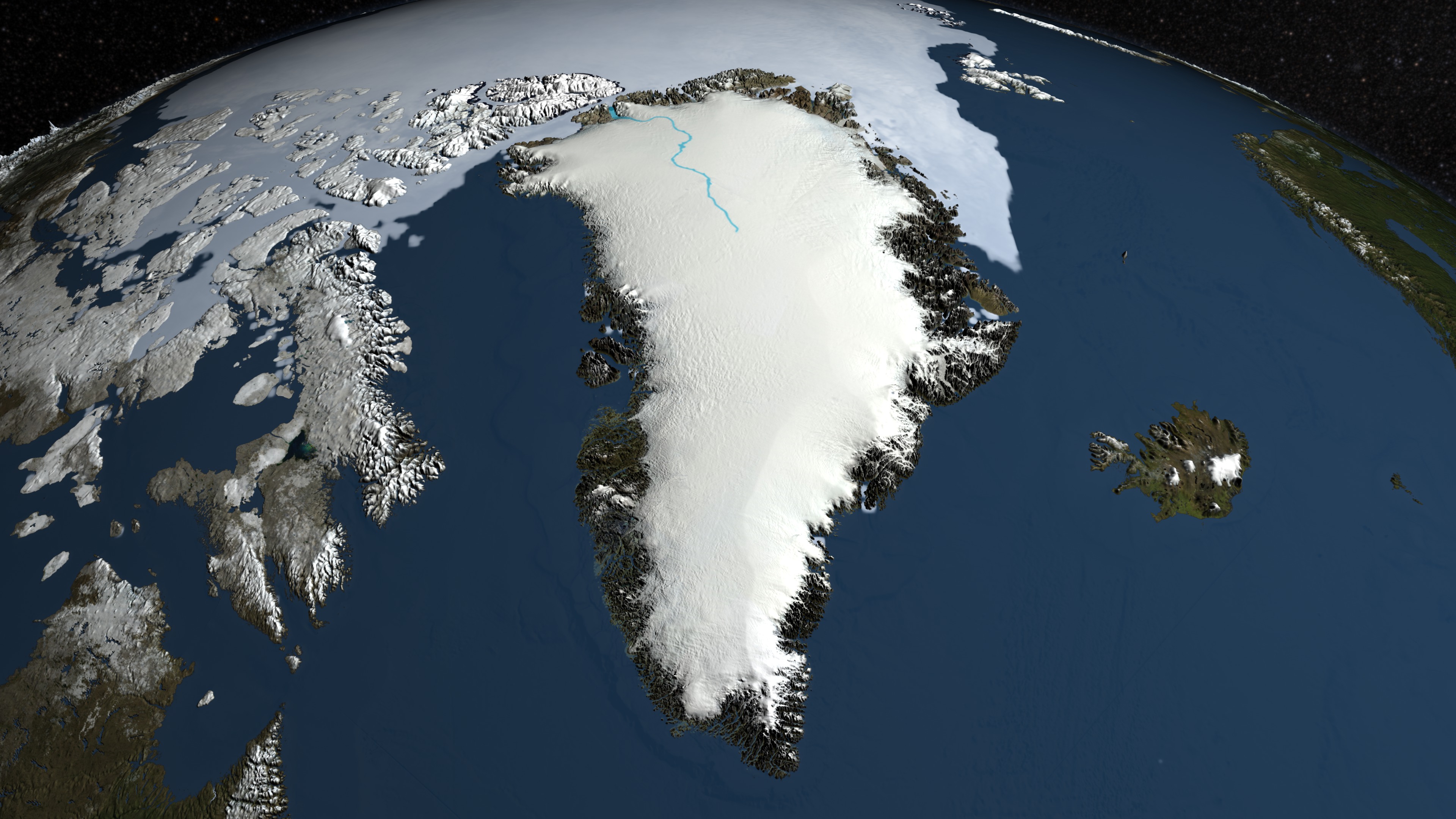
Greenland's Mega-Canyon beneath the Ice Sheet
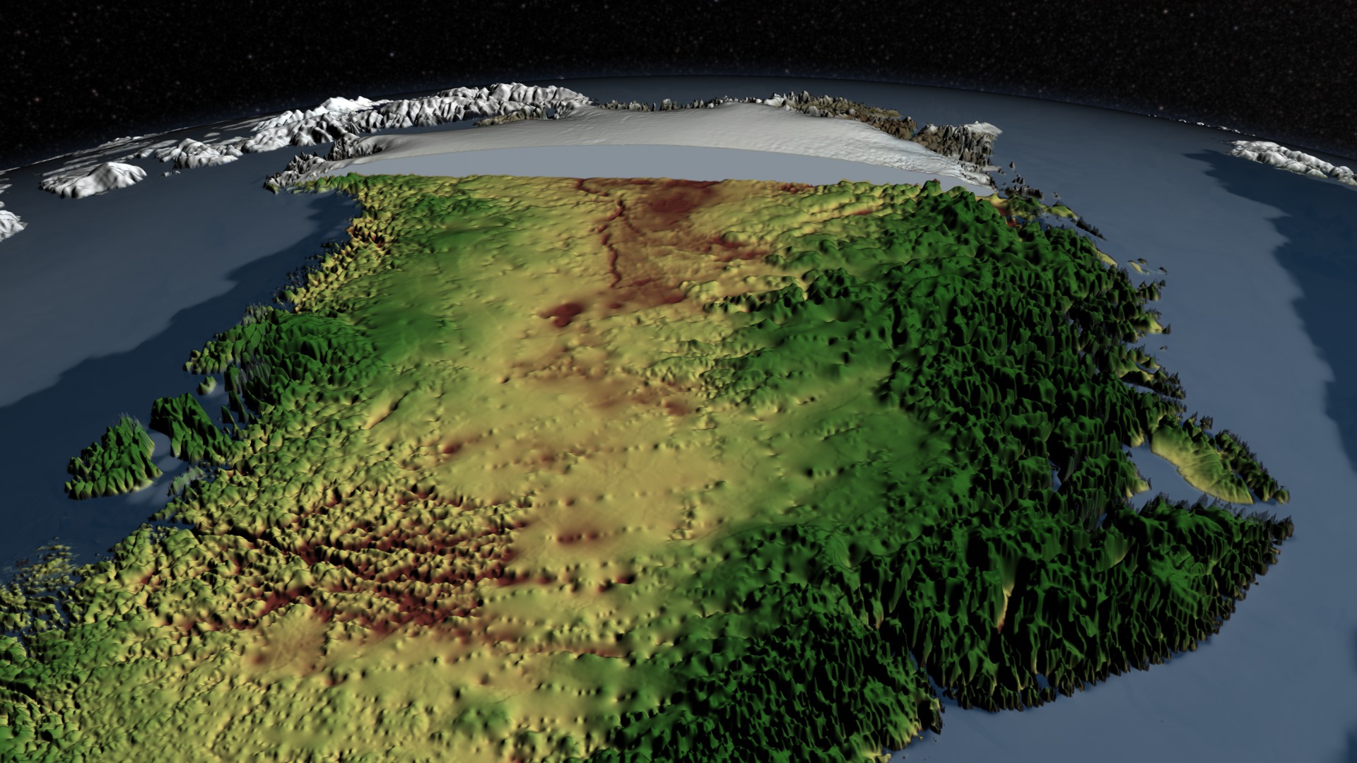
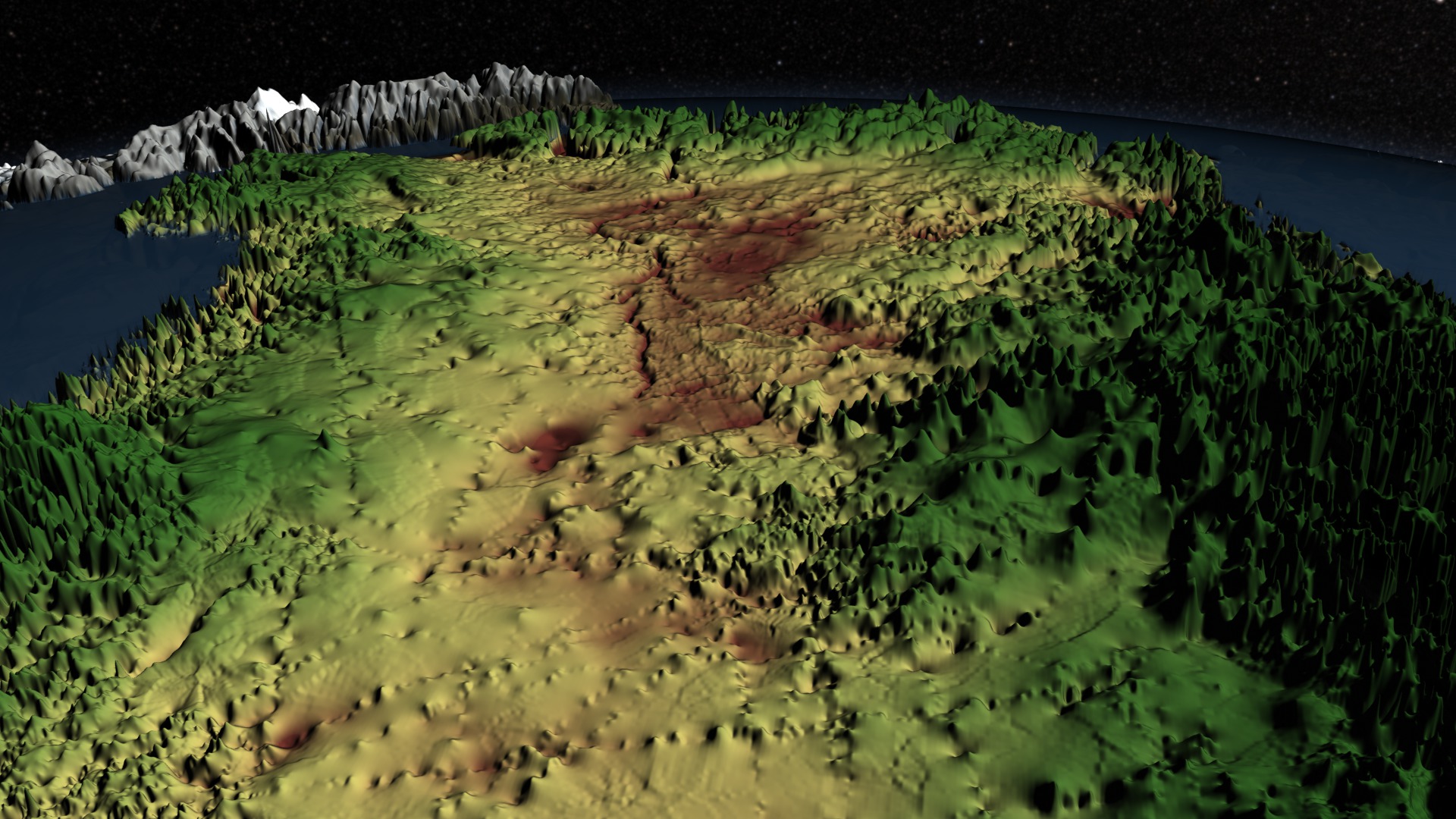
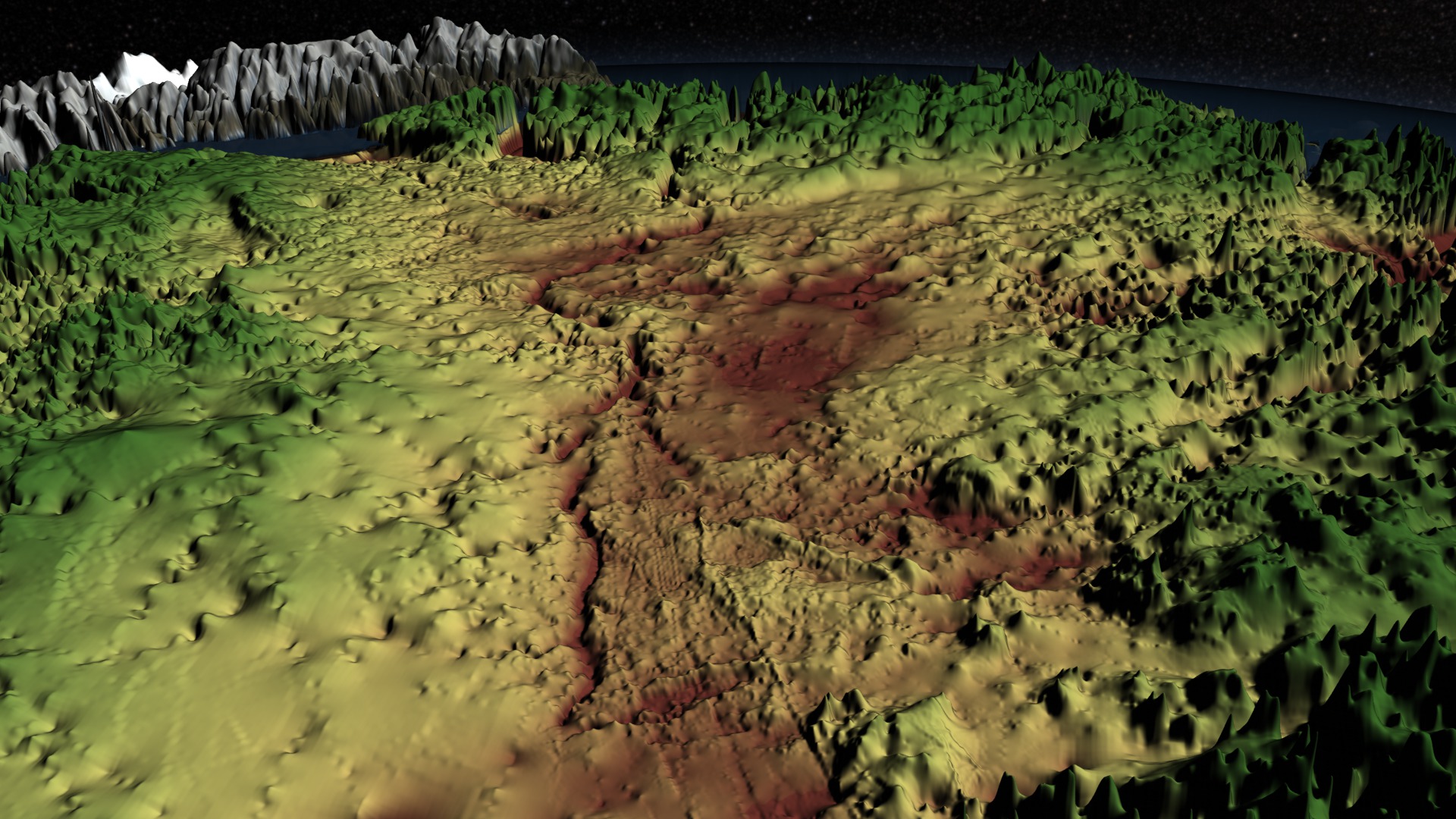
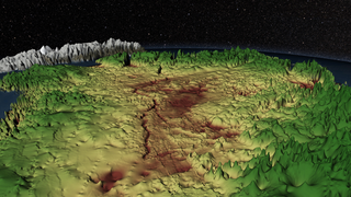
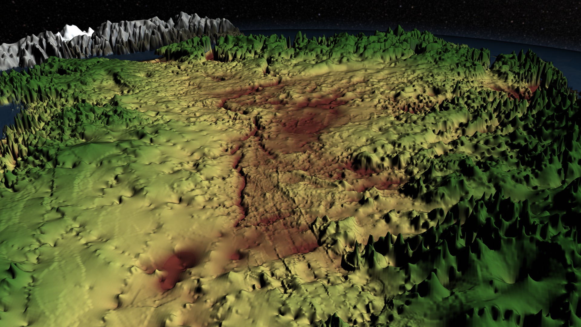
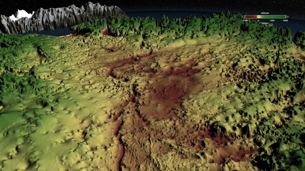
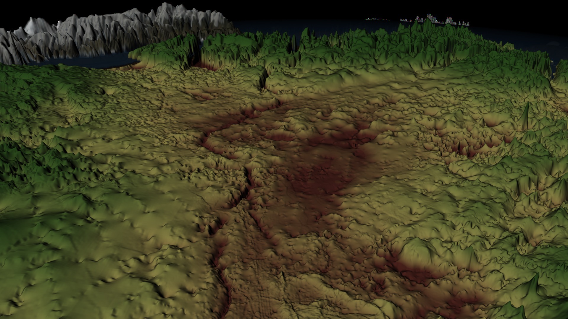
Starting with a view of the surface of Greenland, the animation zooms closer to the surface as the ice sheet is stripped away to reveal the false-color topography of the bedrock that lies beneath. Regions above sea level are shown in shades of green while areas below zero are colored by shades of brown. Yellow indicates the area near sea level. The topography is exaggerated from 12 to 40 times in order to accentuate the topographic relief. Visible in the topography from about the midpoint of Greenland to its Northwest coast is the 750-km-long subglacial canyon described by the authors.

Related
Visualization Credits
Greg Shirah (NASA/GSFC): Animator
Jefferson Beck (USRA): Producer
J. L. Bamber (School of Geographical Sciences, University of Bristol, UK): Scientist
Michael Studinger (NASA/GSFC): Scientist
Laurence Schuler (ADNET Systems, Inc.): Project Support
Ian Jones (ADNET Systems, Inc.): Project Support
NASA's Goddard Space Flight Center Scientific Visualization Studio
The Blue Marble Next Generation data is courtesy of Reto Stockli (NASA/GSFC).
Bamber, J.L., Siegert, M.J., Griggs, J.A., Marshall, S., Spada, G. Paleofluvial canyon drains subglacial water from northern Greenland, Science, 2013.
Bamber, J. L., Griggs, J. A., Hurkmans, R. T. W. L., Dowdeswell, J. A., Gogineni, S. P., Howat, I., Mouginot, J., Paden, J., Palmer, S., Rignot, E., and Steinhage, D.: A new bed elevation dataset for Greenland, The Cryosphere, 7, 499-510, 10.5194/tc-7-499-2013, 2013. (Available here.)
Short URL to share this page:
https://svs.gsfc.nasa.gov/4097
Missions:
Operation IceBridge
Terra
Data Used:
Terra and Aqua/MODIS/Blue Marble: Next Generation also referred to as: BMNG
2004The Blue Marble data is courtesy of Reto Stockli (NASA/GSFC).
Greenland Mapping Project (GIMP) Digital Elevation Model also referred to as: GIMP Greenland DEM
Data Compilation - Courtesy of Ian Howat, OSU - 2003 - 2009Greenland bed elevation dataset by Bamber, et al., 2013
Data Compilation - Bristol Glaciology Centre, University of Bristol - 1970 - 2012Keywords:
SVS >> HDTV
DLESE >> Physical geography
GCMD >> Earth Science >> Land Surface >> Topography
GCMD >> Earth Science >> Cryosphere >> Glaciers/Ice Sheets >> Ice Sheets
GCMD >> Earth Science >> Hydrosphere >> Glaciers/Ice Sheets >> Ice Sheets
GCMD >> Earth Science >> Land Surface >> Topography >> Topographic Effects
GCMD >> Earth Science >> Land Surface >> Topography >> Topographical Relief
NASA Science >> Earth
GCMD keywords can be found on the Internet with the following citation: Olsen, L.M., G. Major, K. Shein, J. Scialdone, S. Ritz, T. Stevens, M. Morahan, A. Aleman, R. Vogel, S. Leicester, H. Weir, M. Meaux, S. Grebas, C.Solomon, M. Holland, T. Northcutt, R. A. Restrepo, R. Bilodeau, 2013. NASA/Global Change Master Directory (GCMD) Earth Science Keywords. Version 8.0.0.0.0


