Earth
ID: 3632
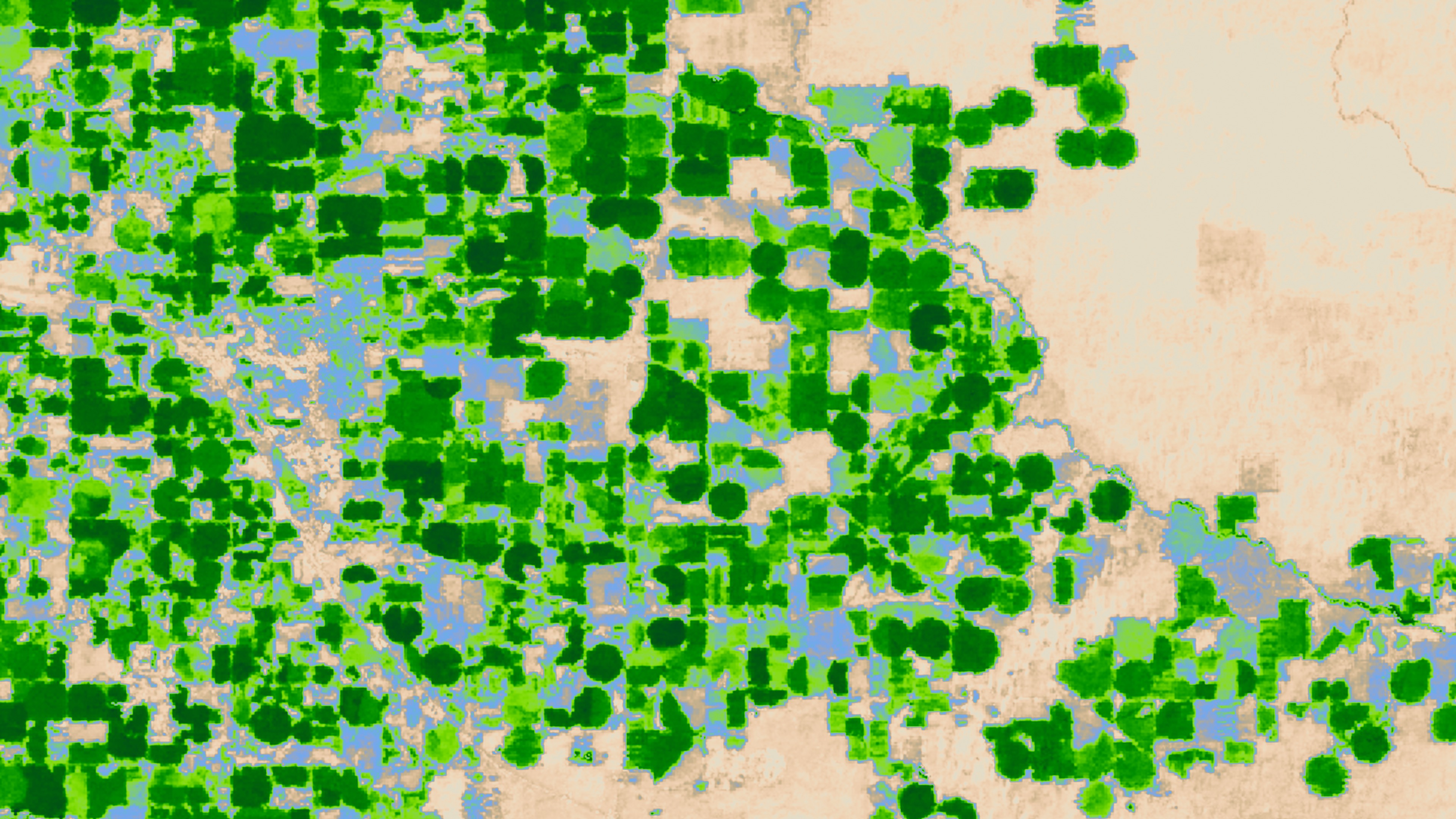
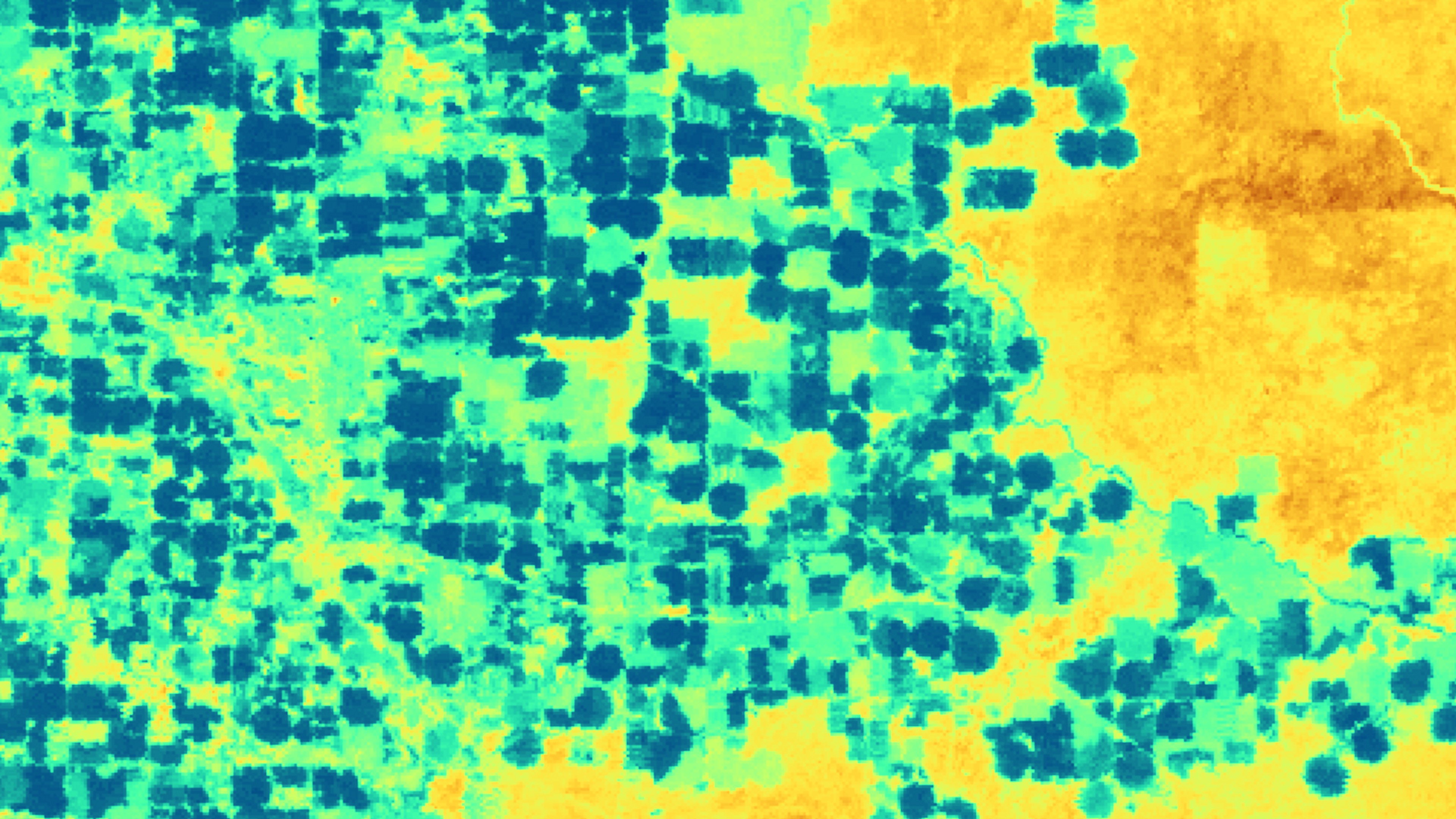
Instruments on the Landsat satellites capture images in the visible spectrum, but they also take images in wavelengths invisible to the naked eye. Landsat's thermal imager captures land surface temperature data. As farmers irrigate fields, water evaporates from the soil and transpires from plants' leaves. The combined process is called evapotranspiration. Evapotranspiring water absorbs energy, so farm fields consuming more water appear cooler in the thermal band. Landsat-based evapotranspiration measurements provide an objective way for water managers to assess on a field-by-field basis how much water agricultural growers are using. The measurements have even been used to help settle water rights conflicts in court.
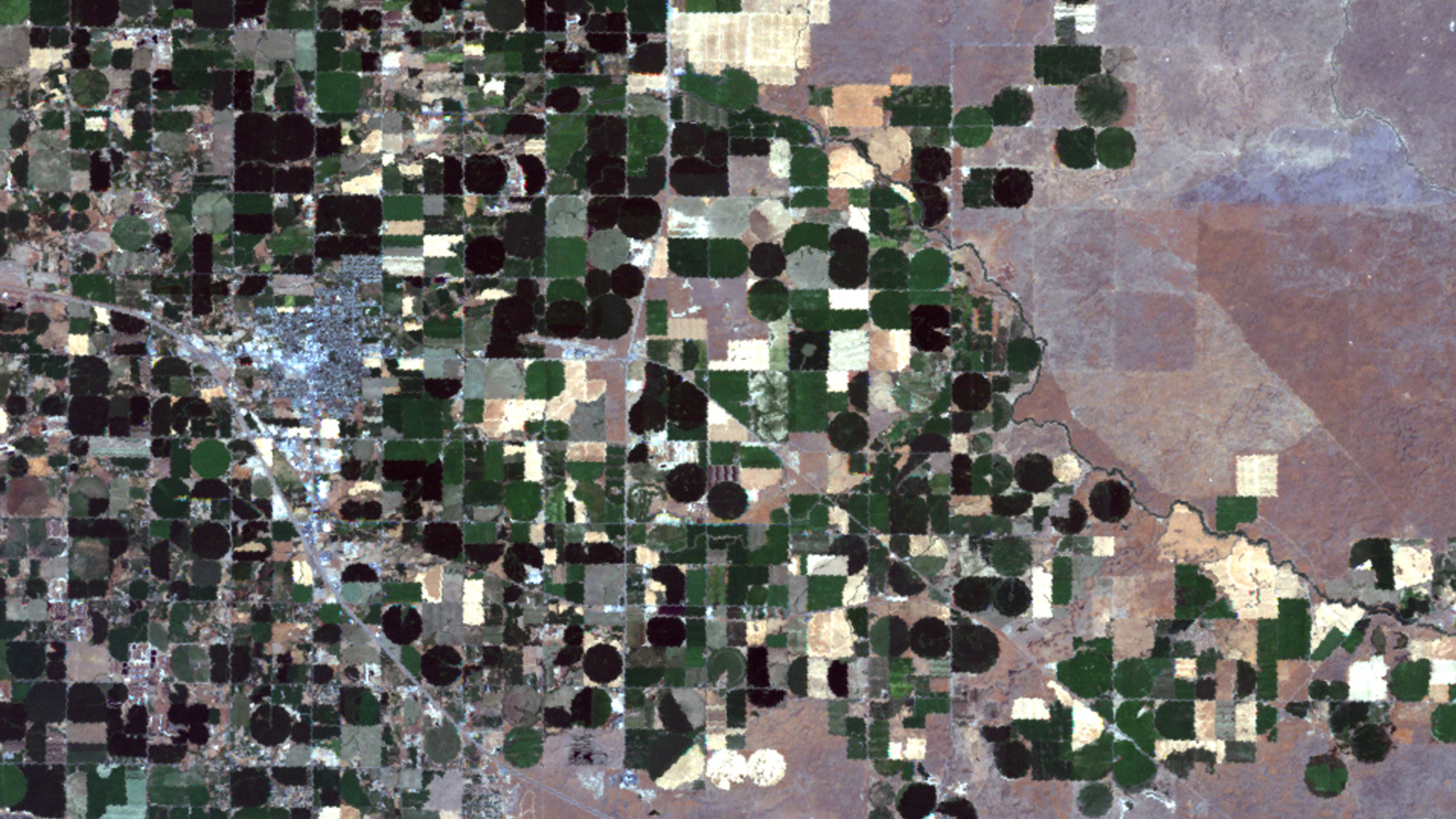

Evapotranspiration from Landsat
Visualization Credits
Adam Martin (UMBC): Lead Animator
Lori Perkins (NASA/GSFC): Animator
Stefanie Misztal (UMBC): Video Editor
Jennifer A. Shoemaker (UMBC): Producer
Darrel Williams (NASA/GSFC): Scientist
Richard Trezza (University of Idaho): Scientist
Richard Allen (University of Idaho): Scientist
Jennifer A. Shoemaker (UMBC): Writer
Lori Perkins (NASA/GSFC): Animator
Stefanie Misztal (UMBC): Video Editor
Jennifer A. Shoemaker (UMBC): Producer
Darrel Williams (NASA/GSFC): Scientist
Richard Trezza (University of Idaho): Scientist
Richard Allen (University of Idaho): Scientist
Jennifer A. Shoemaker (UMBC): Writer
Please give credit for this item to:
NASA/Goddard Space Flight Center Scientific Visualization Studio
NASA/Goddard Space Flight Center Scientific Visualization Studio
Short URL to share this page:
https://svs.gsfc.nasa.gov/3632
Mission:
Landsat
Data Used:
Note: While we identify the data sets used in these visualizations, we do not store any further details nor the data sets themselves on our site.
This item is part of this series:
Agriculture Animations - Land Use Change
Keywords:
DLESE >> Environmental science
SVS >> HDTV
GCMD >> Earth Science >> Atmosphere >> Atmospheric Water Vapor >> Evaporation
GCMD >> Earth Science >> Atmosphere >> Atmospheric Water Vapor >> Evapotranspiration
GCMD >> Earth Science >> Hydrosphere >> Ground Water >> Water Table
GCMD >> Location >> Idaho
SVS >> Hyperwall
SVS >> For Educators
SVS >> Farming
NASA Science >> Earth
GCMD keywords can be found on the Internet with the following citation: Olsen, L.M., G. Major, K. Shein, J. Scialdone, S. Ritz, T. Stevens, M. Morahan, A. Aleman, R. Vogel, S. Leicester, H. Weir, M. Meaux, S. Grebas, C.Solomon, M. Holland, T. Northcutt, R. A. Restrepo, R. Bilodeau, 2013. NASA/Global Change Master Directory (GCMD) Earth Science Keywords. Version 8.0.0.0.0
https://svs.gsfc.nasa.gov/3632
Mission:
Landsat
Data Used:
Landsat-7/ETM+
08/14/2000This item is part of this series:
Agriculture Animations - Land Use Change
Keywords:
DLESE >> Environmental science
SVS >> HDTV
GCMD >> Earth Science >> Atmosphere >> Atmospheric Water Vapor >> Evaporation
GCMD >> Earth Science >> Atmosphere >> Atmospheric Water Vapor >> Evapotranspiration
GCMD >> Earth Science >> Hydrosphere >> Ground Water >> Water Table
GCMD >> Location >> Idaho
SVS >> Hyperwall
SVS >> For Educators
SVS >> Farming
NASA Science >> Earth
GCMD keywords can be found on the Internet with the following citation: Olsen, L.M., G. Major, K. Shein, J. Scialdone, S. Ritz, T. Stevens, M. Morahan, A. Aleman, R. Vogel, S. Leicester, H. Weir, M. Meaux, S. Grebas, C.Solomon, M. Holland, T. Northcutt, R. A. Restrepo, R. Bilodeau, 2013. NASA/Global Change Master Directory (GCMD) Earth Science Keywords. Version 8.0.0.0.0


