Earth
ID: 31196
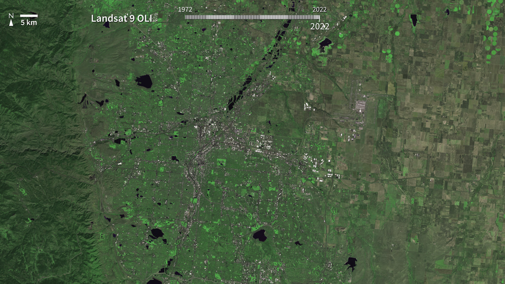
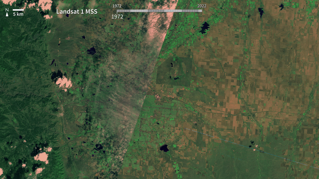
Since 1972, Landsat satellites have observed our planet’s forests, deserts, cities, farms, and badlands. The Mile High City rose up on the hopes of gold miners, who founded the city in 1858 after the discovery of gold in the waters at the confluence of the South Platte River and Cherry Creek. Denver, Colorado, quickly became a hub for the mining towns to the west and the agricultural interests on the plains to the east. Unhindered by any major body of water or topographic feature to the north, south, or east, the city has expanded in all directions. These red-NIR-green combination false color images show the city of Denver between 1972 or 1972 and 2022, using sensors aboard Landsat satellites that have been collecting data in different ranges of frequencies along the electromagnetic spectrum for nearly 50 years.
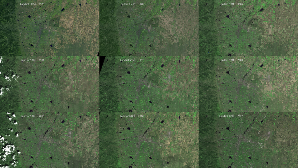
50 years of Landsat: Denver
Related

Credits
Marit Jentoft-Nilsen: Lead Animator
Please give credit for this item to:
NASA's Goddard Space Flight Center
NASA's Goddard Space Flight Center
Short URL to share this page:
https://svs.gsfc.nasa.gov/31196
Mission:
Landsat
Keywords:
SVS >> Urban Growth
GCMD >> Earth Science >> Land Surface >> Land Use/Land Cover >> Land Cover
SVS >> Hyperwall
NASA Science >> Earth
GCMD >> Earth Science >> Human Dimensions >> Habitat Conversion/fragmentation >> Urbanization/urban Sprawl
GCMD keywords can be found on the Internet with the following citation: Olsen, L.M., G. Major, K. Shein, J. Scialdone, S. Ritz, T. Stevens, M. Morahan, A. Aleman, R. Vogel, S. Leicester, H. Weir, M. Meaux, S. Grebas, C.Solomon, M. Holland, T. Northcutt, R. A. Restrepo, R. Bilodeau, 2013. NASA/Global Change Master Directory (GCMD) Earth Science Keywords. Version 8.0.0.0.0


