Earth
ID: 31106
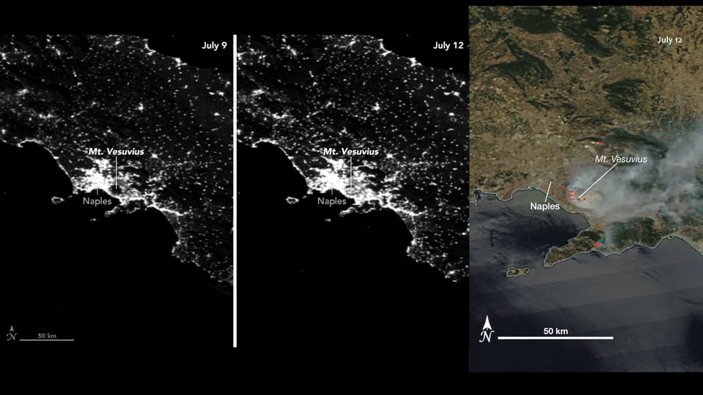
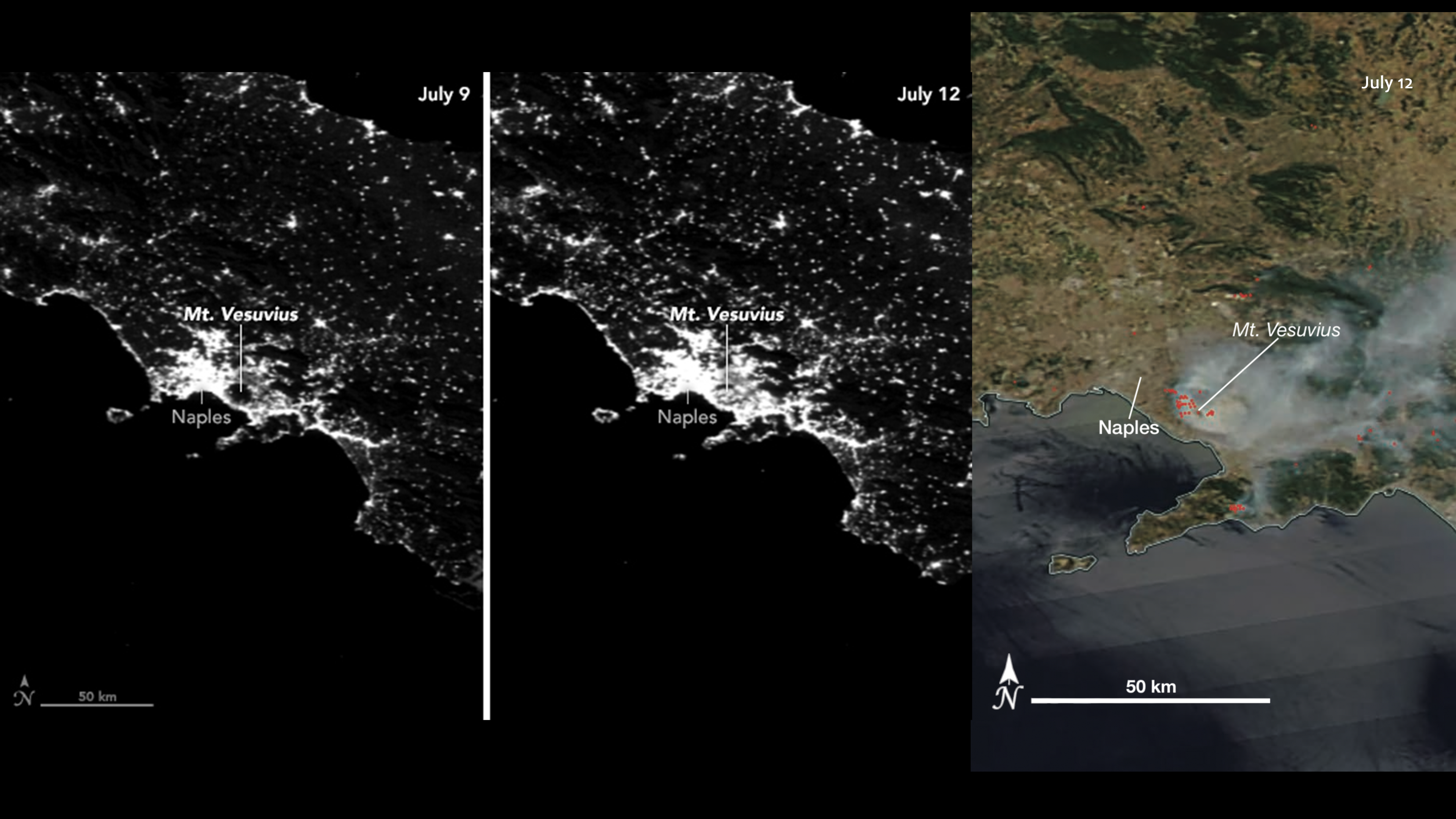
The forest preserve on Mount Vesuvius normally keeps the Italian mountain shrouded in darkness when viewed in nighttime photographs by astronauts or in satellite images of Naples. However, that was not the case on July 12, 2017, when the VIIRS DNB on Suomi NPP captured an image of wildfires lighting up the slopes of the volcano (middle). For comparison, the July 9, 2017, image was taken before the fires began (left). The July fires burned much of the woodlands in Vesuvius National Park, which was established in 1995. The park protects more than 600 types of plants, 100 species of birds, and many small mammals and reptiles. Mount Vesuvius is best known for a catastrophic eruption in 79 A.D. that destroyed the cities of Pompeii and Herculaneum. Its last major eruption occurred in 1944. For comparison, the MODIS instrument captured the daylight image (right) of the fires (red dots) on July 12. Note how the extent of Naples and the area around the volcano are less clearly defined.
Fires Light Up Mount Vesuvius
For More Information
Credits
Amy Moran (Global Science and Technology, Inc.): Lead Technical Support
Joshua Stevens (SSAI): Lead Data Visualizer
Joshua Stevens (SSAI): Lead Data Visualizer
Please give credit for this item to:
NASA, Earth at Night book
NASA, Earth at Night book
Short URL to share this page:
https://svs.gsfc.nasa.gov/31106
Keywords:
SVS >> Volcano
SVS >> Hyperwall
SVS >> VIIRS
SVS >> MODIS
NASA Science >> Earth
GCMD >> Earth Science >> Human Dimensions >> Natural Hazards >> Wildfires
GCMD keywords can be found on the Internet with the following citation: Olsen, L.M., G. Major, K. Shein, J. Scialdone, S. Ritz, T. Stevens, M. Morahan, A. Aleman, R. Vogel, S. Leicester, H. Weir, M. Meaux, S. Grebas, C.Solomon, M. Holland, T. Northcutt, R. A. Restrepo, R. Bilodeau, 2013. NASA/Global Change Master Directory (GCMD) Earth Science Keywords. Version 8.0.0.0.0


