Pine Island Glacier Retreat, Antarctica
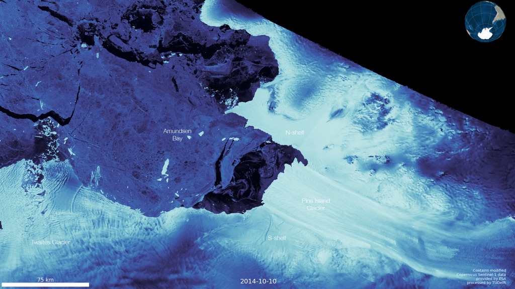
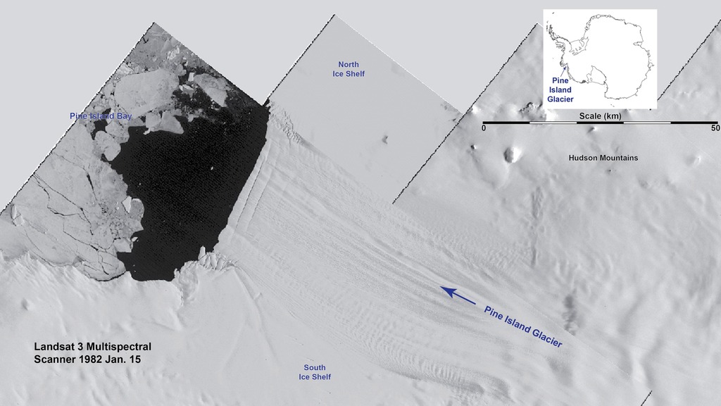
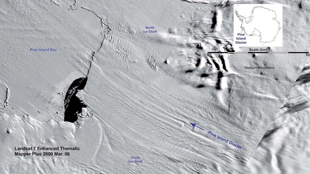
These visualizations show the advance and retreat of the front of this ~35-kilometer (~22-mile) wide outlet glacier. The flow of inland ice causes the glacier’s front to advance and multiple calving events cause the front to retreat. The glacier’s ice front has retreated ~25 kilometers (~15 miles) since 2000. Combined, the 2015 and 2017 calving events have led to the glacier’s ice front being fully disconnected from the North Ice Shelf. The changes to this large outlet from West Antarctica could signal additional sea level contributions from this glacier and the even larger outlet to the west, Thwaites Glacier.
For More Information
Credits
Christopher Shuman (UMBC JCET): Lead Scientist
Stef Lhermitte (Delft University of Technology, Netherlands): Lead Scientist
Christopher A. Shuman, University of Maryland, Baltimore County, at NASA Goddard Space Flight Center’s Cryospheric Sciences Laboratory, Greenbelt, MD USA
Stef Lhermitte, Delft University of Technology, Netherlands
Contains modified Copernicus Sentinel data (2017), processed by ESA
https://svs.gsfc.nasa.gov/30914
Mission:
Landsat
Data Used:
Suomi NPP/VIIRS also referred to as: VIIRS
Landsat-8/TIRS
Observed DataKeywords:
SVS >> Antarctic
SVS >> Antarctic Ice
SVS >> HDTV
SVS >> Landsat
SVS >> Pine Island Glacier
GCMD >> Earth Science >> Hydrosphere >> Glaciers/Ice Sheets >> Glacier Motion/Ice Sheet Motion
SVS >> Hyperwall
SVS >> Glaciers
NASA Science >> Earth
GCMD keywords can be found on the Internet with the following citation: Olsen, L.M., G. Major, K. Shein, J. Scialdone, S. Ritz, T. Stevens, M. Morahan, A. Aleman, R. Vogel, S. Leicester, H. Weir, M. Meaux, S. Grebas, C.Solomon, M. Holland, T. Northcutt, R. A. Restrepo, R. Bilodeau, 2013. NASA/Global Change Master Directory (GCMD) Earth Science Keywords. Version 8.0.0.0.0


