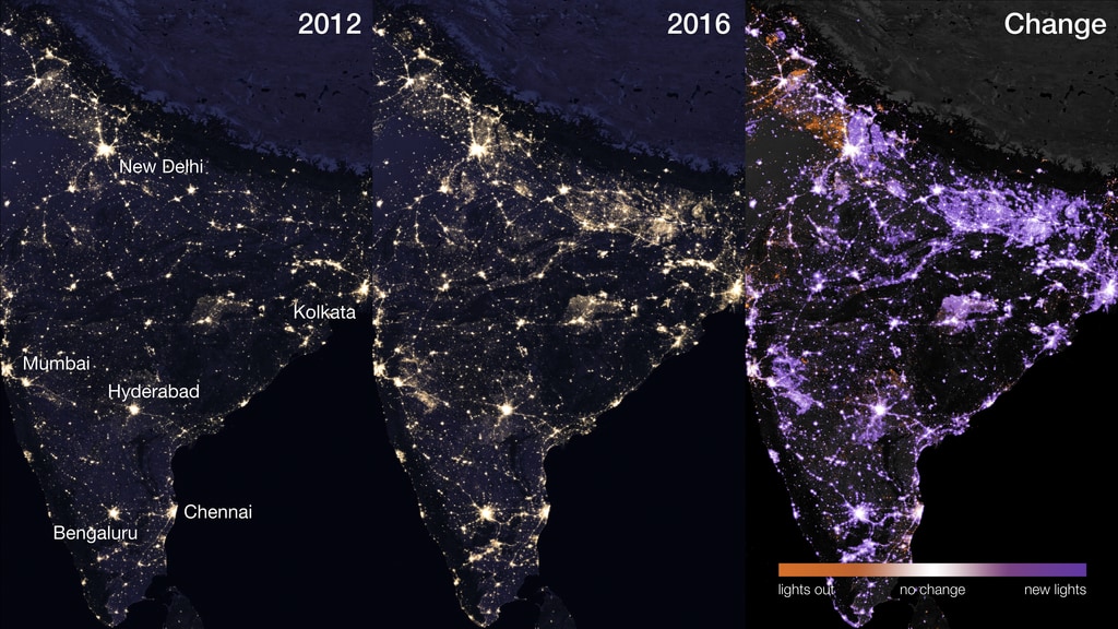
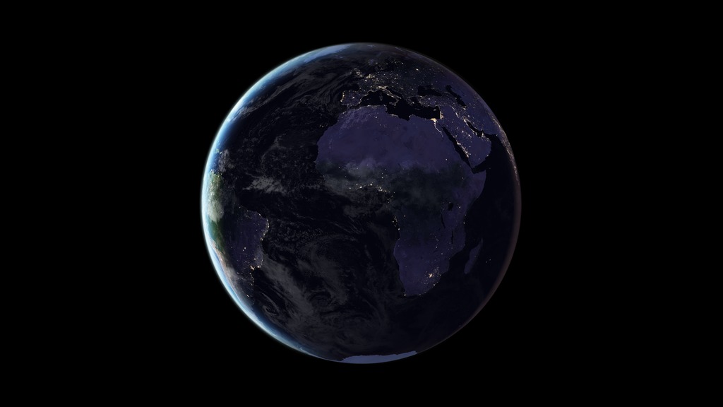
Black Marble 2012 vs. 2016
Black Marble comparing 2012 lights vs. 2016 lights
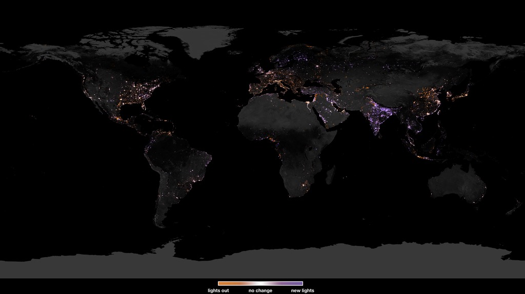
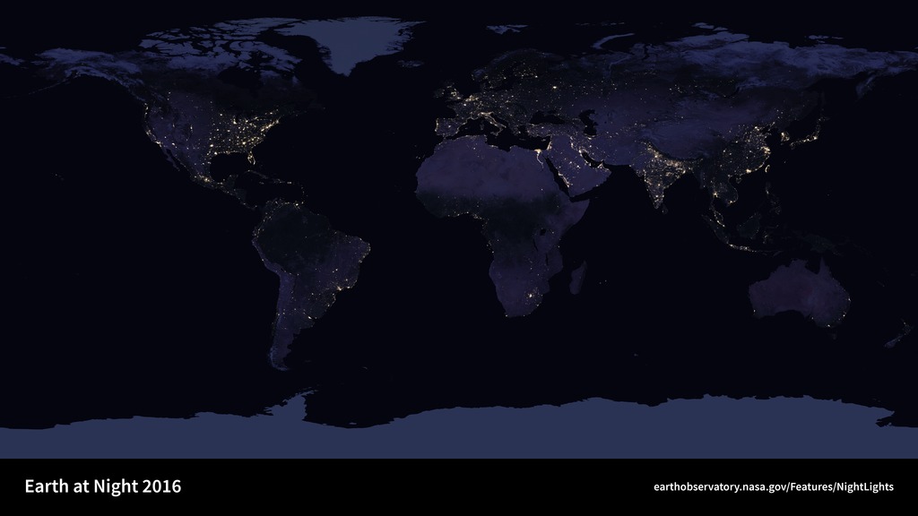
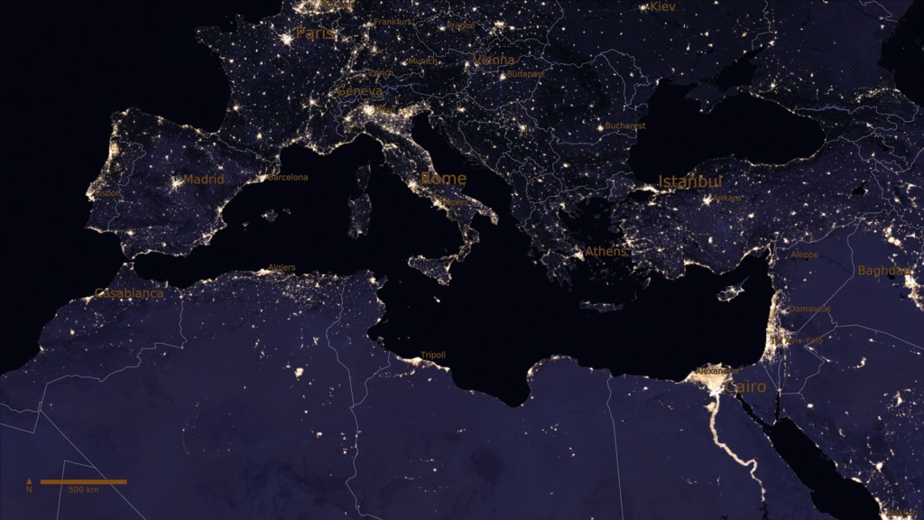
Satellite images of Earth at night—often referred to as "night lights"—have been a gee-whiz curiosity for the public and a tool for fundamental research for nearly 25 years. They have provided a broad, beautiful picture, showing how humans have shaped the planet and lit up the darkness. Produced every decade or so, such maps have spawned hundreds of pop-culture uses and dozens of economic, social science, and environmental research projects.
These images of Earth at night in 2012 and 2016 were created with data from the Suomi National Polar-orbiting Partnership (NPP) satellite launched in October 2011 by NASA, the National Oceanic and Atmospheric Administration, and the U.S. Department of Defense. Each pixel shows roughly 0.46 miles (742 meters) across.
Scientists use the Suomi NPP night-lights dataset in many ways. Some applications include: forecasting a city’s energy use and carbon emissions; eradicating energy poverty and fostering sustainable energy development; providing immediate information when disasters strike; and monitoring the effects of conflict and population displacement. Scientists at NASA are working to automate nighttime VIIRS data processing so that data users are able to view nighttime imagery within hours of acquisition, which could lead to other potential uses by research, meteorological, and civic groups.
Credits
Please give credit for this item to:
NASA's Goddard Space Flight Center
-
Animator
- Amy Moran (Global Science and Technology, Inc.)
-
Scientist
- Miguel Román (NASA/GSFC)
Release date
This page was originally published on Wednesday, June 28, 2017.
This page was last updated on Monday, July 15, 2024 at 12:21 AM EDT.
Datasets used in this visualization
-
VIIRS [Suomi NPP: VIIRS]
ID: 722
Note: While we identify the data sets used in these visualizations, we do not store any further details, nor the data sets themselves on our site.
Related
- ID: 31099
 Hyperwall Visual
 - ID: 30919
 Hyperwall Visual
 - ID: 30876
 Hyperwall Visual
 - ID: 30877
 Hyperwall Visual
 - ID: 30878
 Hyperwall Visual
 - ID: 30028
 Hyperwall Visual