ID: 30183
The astronauts who snapped photos of Earth during the Mercury and Gemini missions produced more than just pretty pictures. They planted seeds at the USGS and NASA. In the mid-1960s, the director of USGS proposed a satellite program to observe our planet from above, and later described Landsat as “a direct result of the demonstrated utility of the Mercury and Gemini orbital photography to Earth resource studies.”
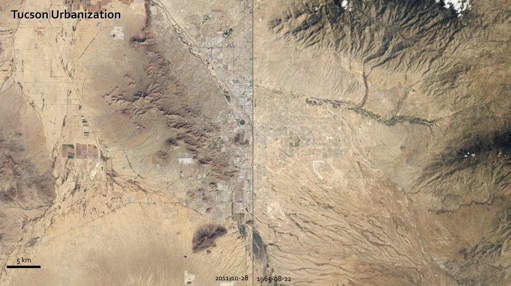
On a flight in late August 1965, Gemini V astronauts Gordon Cooper and Pete Conrad took photos of the Earth, including a shot showing Tucson, Arizona. A lot changed in the 46 years between that photo and the satellite image acquired in 2011 by the Thematic Mapper on Landsat 5.
A comparison of the images shows more city and less green. The expansion of urbanized areas is readily identifiable by the grid pattern of city streets. Between 1965 and 2011, Tucson’s population grew rapidly. In 1970, the population was 262,933; in 2010, it was 520,116.
Urban Growth in Tucson, Arizona
For More Information
Credits
Marit Jentoft-Nilsen (Global Science and Technology, Inc.): Animator
Robert Simmon (Sigma Space Corporation): Animator
Michon Scott (National Snow and Ice Data Center): Writer
Robert Simmon (Sigma Space Corporation): Animator
Michon Scott (National Snow and Ice Data Center): Writer
Please give credit for this item to:
NASA/Goddard Space Flight Center
NASA/Goddard Space Flight Center
Short URL to share this page:
https://svs.gsfc.nasa.gov/30183
Missions:
Gemini
Landsat
Keywords:
SVS >> HDTV
SVS >> Landsat
SVS >> Hyperwall
SVS >> Presentation
SVS >> Gemini
https://svs.gsfc.nasa.gov/30183
Missions:
Gemini
Landsat
Keywords:
SVS >> HDTV
SVS >> Landsat
SVS >> Hyperwall
SVS >> Presentation
SVS >> Gemini


