Earth
ID: 30158
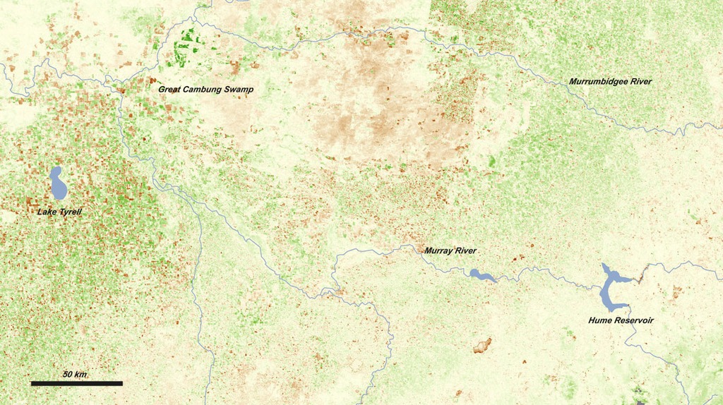
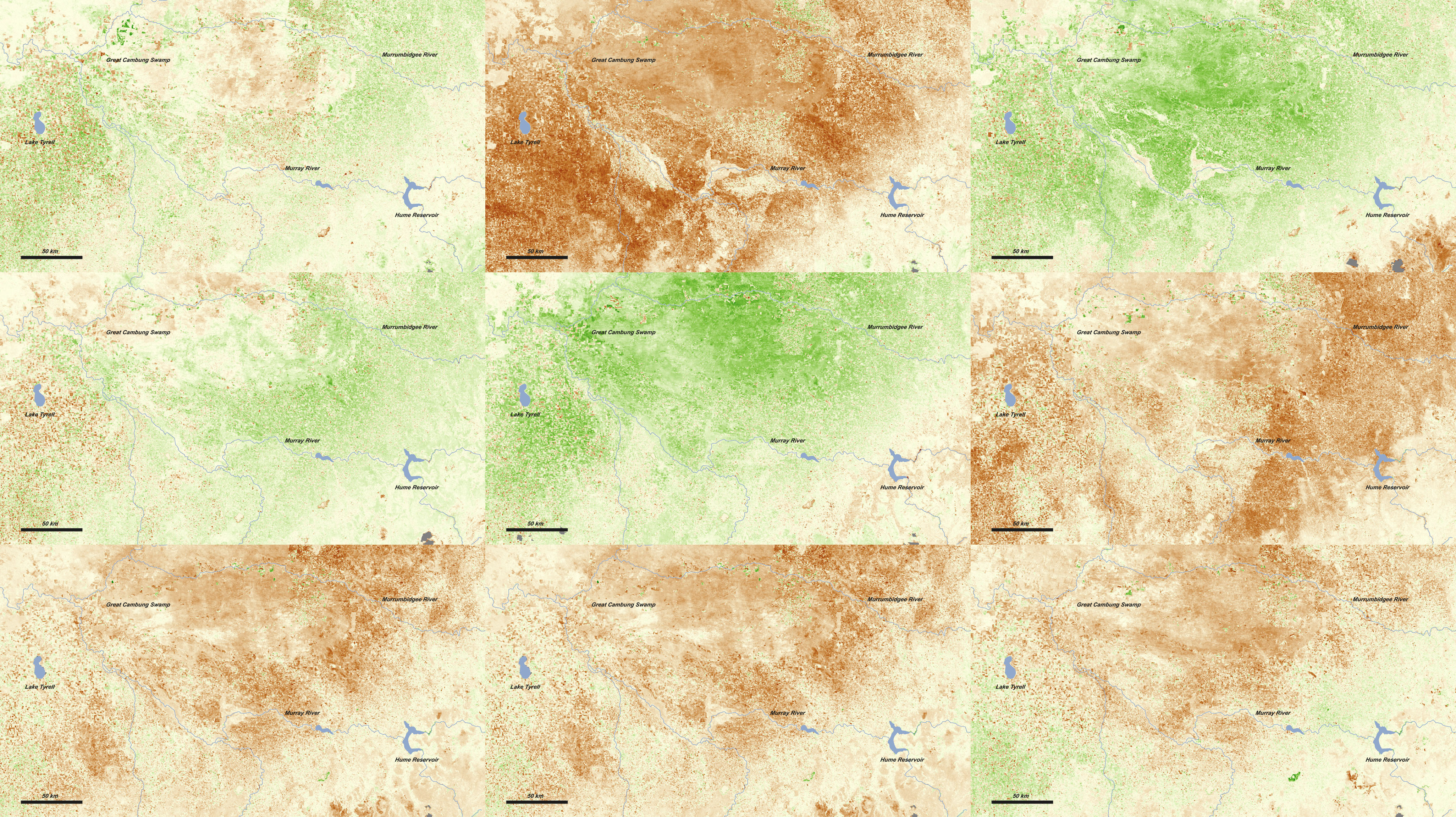
Drought is a frequent visitor in Australia. The Australian Bureau of Meteorology describes the typical rainfall over much of the continent as “not only low, but highly erratic.” These satellite-based vegetation images document what farmers and ranchers have had to contend with over the past decade. The images are centered on the agricultural areas near the Murray River—Australia’s largest river—between Hume Reservoir and Lake Tyrrell. The series shows vegetation growing conditions for a 16-day period in the middle of September each year from 2000 through 2010 compared to the average mid-September conditions over the decade. Places where the amount and/or health of vegetation was above the decadal average are green, average areas are off-white, and places where vegetation growth was below average are brown.

Drought Cycles in Australia
For More Information
Credits
Please give credit for this item to:
NASA/Goddard Space Flight Center
NASA/Goddard Space Flight Center
Short URL to share this page:
https://svs.gsfc.nasa.gov/30158
Mission:
Terra
Data Used:
Note: While we identify the data sets used in these visualizations, we do not store any further details nor the data sets themselves on our site.
This item is part of this series:
World of Change
Keywords:
SVS >> Drought
SVS >> HDTV
DLESE >> Natural hazards
SVS >> Hyperwall
NASA Science >> Earth
SVS >> Presentation
https://svs.gsfc.nasa.gov/30158
Mission:
Terra
Data Used:
Terra/MODIS
2000 - 2010This item is part of this series:
World of Change
Keywords:
SVS >> Drought
SVS >> HDTV
DLESE >> Natural hazards
SVS >> Hyperwall
NASA Science >> Earth
SVS >> Presentation


