Earth
ID: 30047
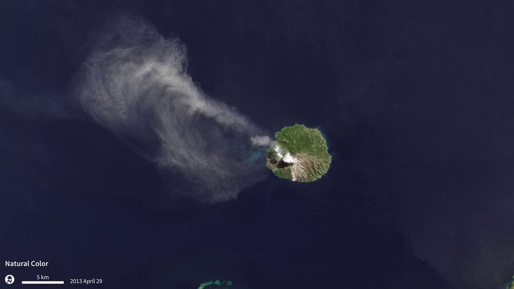
As the Landsat Data Continuity Mission—now renamed Landsat-8—flew over Indonesia’s Flores Sea on April 29, 2013, the satellite’s Operational Land Imager (OLI) and Thermal Infrared Sensor (TIRS) captured these images of the Paluweh volcano spewing ash. The OLI captured the natural-color image that shows the white cloud of ash drifting northwest over the darker forests and water, while TIRS detected thermal infrared radiation, or heat, from the scene. The TIRS image reveals a hot spot (bright white) where lava was oozing out near the top of the volcano, surrounded by cooler ash clouds (dark gray). The image pair illustrates the value of having both OLI and TIRS on Landsat-8 and highlights TIRS ability to detect very small changes in temperature over small distances—down to about a tenth of a degree Celsius.
Thermal Sensor Lights Up from Volcanic Heat
For More Information
Credits
Marit Jentoft-Nilsen (Global Science and Technology, Inc.): Animator
Mark Malanoski (GST): Project Support
Mark Malanoski (GST): Project Support
Please give credit for this item to:
NASA's Goddard Space Flight Center
NASA's Goddard Space Flight Center
Short URL to share this page:
https://svs.gsfc.nasa.gov/30047
Mission:
Landsat
Data Used:
Note: While we identify the data sets used in these visualizations, we do not store any further details nor the data sets themselves on our site.
Keywords:
SVS >> HDTV
SVS >> Hyperwall
NASA Science >> Earth
SVS >> Presentation
https://svs.gsfc.nasa.gov/30047
Mission:
Landsat
Data Used:
Landsat-8/OLI/Band Combination 2,3,4 also referred to as: True Color
Observed DataLandsat-8/TIRS
Observed DataKeywords:
SVS >> HDTV
SVS >> Hyperwall
NASA Science >> Earth
SVS >> Presentation


