Planets and Moons
ID: 2971
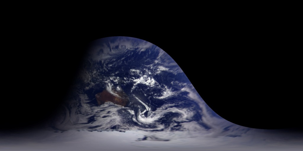
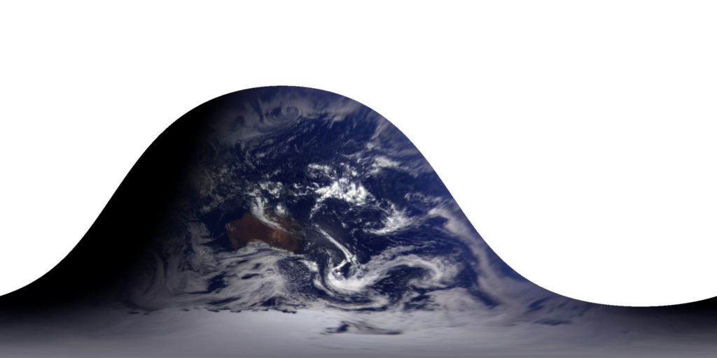
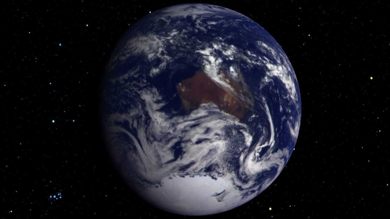
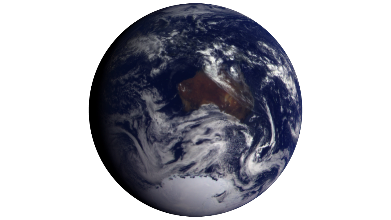
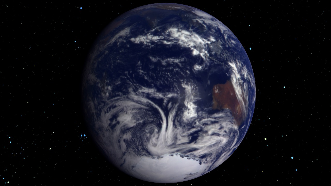
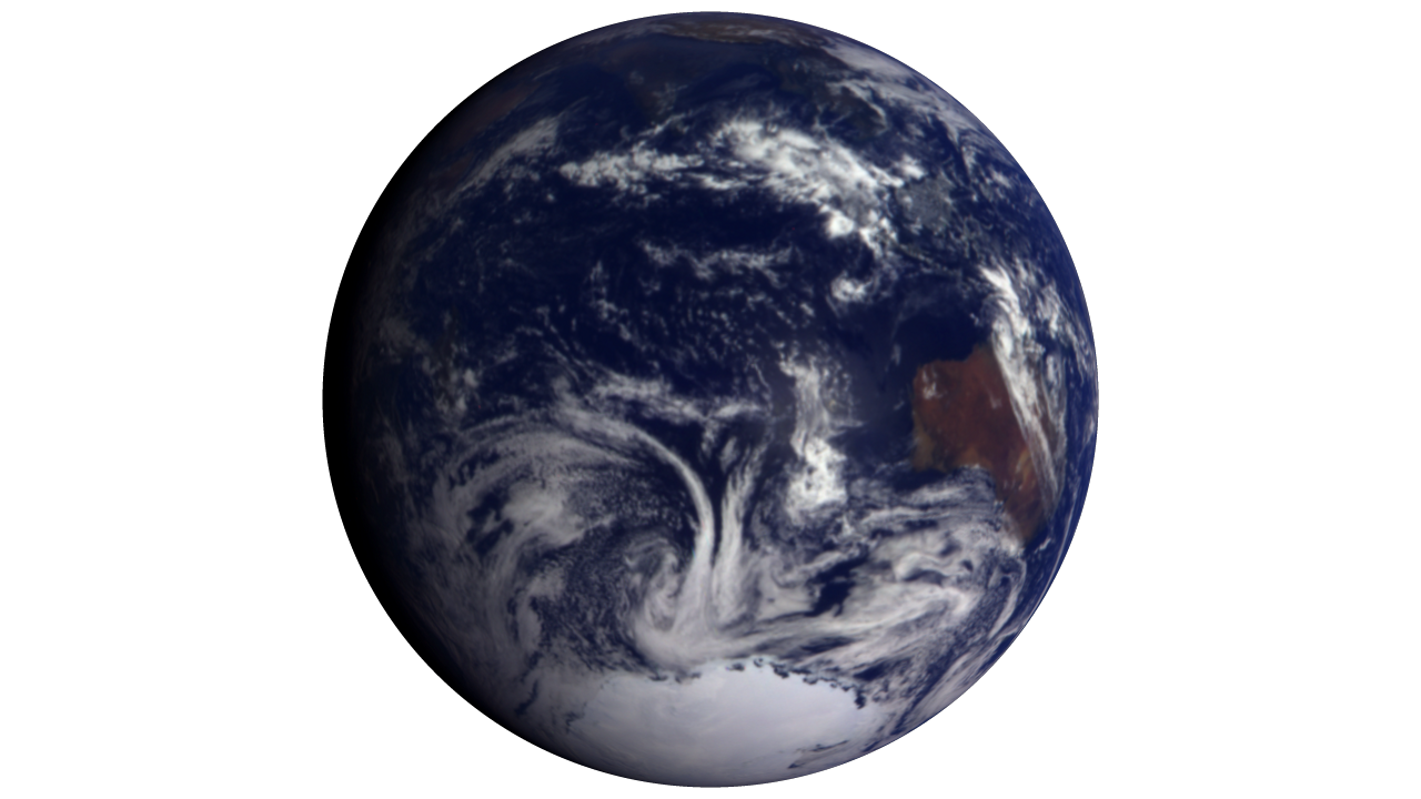
The Galileo spacecraft was launched from the Space Shuttle Atlantis on October 18, 1989 on a six-year trip to Jupiter. On the way, the trajectory of the spacecraft took it past Venus once and Earth twice. Galileo took the Earth images in this animation just after the first flyby of the Earth, on December 11 and 12, 1990. This six-hour sequence of images taken two minutes apart clearly shows how the Earth looks from space and how fast (or slow) the cloud features change when looked at from a distance. The path of the sun can be seen crossing Australia by its reflection in the nearby ocean, and the terminator region between night and day can be seen moving across the Indian Ocean. In the original images, the Earth's rotation is so dominant that cloud movement is hard to see, but these images have been mapped to the Earth is such a way that a viewer can watch just the clouds move in the ocean around Antarctica or across the Australian land mass. In this animation, New Zealand can ony be seen as a stationary disturbance under a moving cloud bank. The black area with the sharp boundary to the north and east of Australia is the side of the Earth that could not be seen from Galileo's position.
Galileo Earth Views (WMS)
For More Information
Visualization Credits
Horace Mitchell (NASA/GSFC): Lead Animator
Greg Shirah (NASA/GSFC): Animator
Horace Mitchell (NASA/GSFC): Scientist
Greg Shirah (NASA/GSFC): Animator
Horace Mitchell (NASA/GSFC): Scientist
Please give credit for this item to:
NASA/Goddard Space Flight Center Scientific Visualization Studio
NASA/Goddard Space Flight Center Scientific Visualization Studio
Short URL to share this page:
https://svs.gsfc.nasa.gov/2971
Mission:
Galileo
Data Used:
Note: While we identify the data sets used in these visualizations, we do not store any further details nor the data sets themselves on our site.
This item is part of this series:
WMS
Keywords:
DLESE >> Atmospheric science
SVS >> HDTV
DLESE >> Physical geography
GCMD >> Earth Science >> Spectral/Engineering >> Visible Wavelengths >> Visible Imagery
SVS >> For Educators
SVS >> Earth >> Texas >> Houston
SVS >> Spacecraft >> Galileo
NASA Science >> Planets and Moons
GCMD keywords can be found on the Internet with the following citation: Olsen, L.M., G. Major, K. Shein, J. Scialdone, S. Ritz, T. Stevens, M. Morahan, A. Aleman, R. Vogel, S. Leicester, H. Weir, M. Meaux, S. Grebas, C.Solomon, M. Holland, T. Northcutt, R. A. Restrepo, R. Bilodeau, 2013. NASA/Global Change Master Directory (GCMD) Earth Science Keywords. Version 8.0.0.0.0
https://svs.gsfc.nasa.gov/2971
Mission:
Galileo
Data Used:
Galileo/Solid-State Imaging Camera
NASA/JPL - 1990/12/11 - 1990/12/12This item is part of this series:
WMS
Keywords:
DLESE >> Atmospheric science
SVS >> HDTV
DLESE >> Physical geography
GCMD >> Earth Science >> Spectral/Engineering >> Visible Wavelengths >> Visible Imagery
SVS >> For Educators
SVS >> Earth >> Texas >> Houston
SVS >> Spacecraft >> Galileo
NASA Science >> Planets and Moons
GCMD keywords can be found on the Internet with the following citation: Olsen, L.M., G. Major, K. Shein, J. Scialdone, S. Ritz, T. Stevens, M. Morahan, A. Aleman, R. Vogel, S. Leicester, H. Weir, M. Meaux, S. Grebas, C.Solomon, M. Holland, T. Northcutt, R. A. Restrepo, R. Bilodeau, 2013. NASA/Global Change Master Directory (GCMD) Earth Science Keywords. Version 8.0.0.0.0


