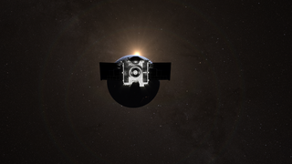
Earth
ID: 20340
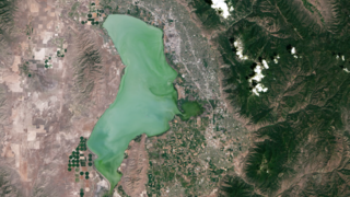
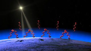
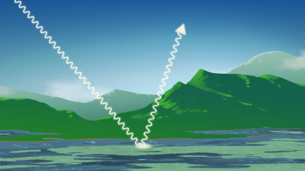
Landsat collects light in visible and infrared wavelengths. Sunlight reflects off Earth’s surface, and scientists identify the land cover based on which wavelengths are reflected strongly or weakly.
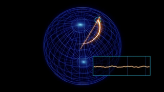
But sunlight is also reflected by particles in the atmosphere, which distorts the data and can lead to what looks like a haze in the imagery. Using basic principles of physics, and knowing the meteorological conditions, scientists can determine the effects of the scattering and absorption as light passes through the atmosphere. This atmospheric correction is essential to determining exactly how much of each wavelength reflected of the features of the surface, and having quantifiable data.
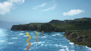
The videos below show different examples of atmospheric scattering which need to be accounted for when doing atmospheric correction of satellite data. In these cases, it is for observations over water. The resulting atmospheric corrections are part of the process for the new Landsat Aquatic Reflectance data product.
Landsat’s highly calibrated data products, free to download and use, are making detailed Earth-observation data more accessible to users and bringing a greater benefit to society.
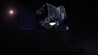
Landsat 9 Atmospheric Correction
But sunlight is also reflected by particles in the atmosphere, which distorts the data and can lead to what looks like a haze in the imagery. Using basic principles of physics, and knowing the meteorological conditions, scientists can determine the effects of the scattering and absorption as light passes through the atmosphere. This atmospheric correction is essential to determining exactly how much of each wavelength reflected of the features of the surface, and having quantifiable data.
The videos below show different examples of atmospheric scattering which need to be accounted for when doing atmospheric correction of satellite data. In these cases, it is for observations over water. The resulting atmospheric corrections are part of the process for the new Landsat Aquatic Reflectance data product.
Landsat’s highly calibrated data products, free to download and use, are making detailed Earth-observation data more accessible to users and bringing a greater benefit to society.
Used Elsewhere In
Animation Credits
Adriana Manrique Gutierrez (USRA): Lead Animator
Aaron E. Lepsch (ADNET Systems, Inc.): Technical Support
Matthew R. Radcliff (USRA): Lead Producer
Nima Pahlevan (SSAI): Scientist
Aaron E. Lepsch (ADNET Systems, Inc.): Technical Support
Matthew R. Radcliff (USRA): Lead Producer
Nima Pahlevan (SSAI): Scientist
Please give credit for this item to:
NASA's Goddard Space Flight Center Conceptual Image Lab
NASA's Goddard Space Flight Center Conceptual Image Lab
Short URL to share this page:
https://svs.gsfc.nasa.gov/20340
Missions:
Landsat
Landsat 8
Landsat 9
Keywords:
SVS >> Landsat
GCMD >> Earth Science >> Atmosphere >> Atmospheric Radiation >> Scattering
NASA Science >> Earth
GCMD keywords can be found on the Internet with the following citation: Olsen, L.M., G. Major, K. Shein, J. Scialdone, S. Ritz, T. Stevens, M. Morahan, A. Aleman, R. Vogel, S. Leicester, H. Weir, M. Meaux, S. Grebas, C.Solomon, M. Holland, T. Northcutt, R. A. Restrepo, R. Bilodeau, 2013. NASA/Global Change Master Directory (GCMD) Earth Science Keywords. Version 8.0.0.0.0