Earth
ID: 20199
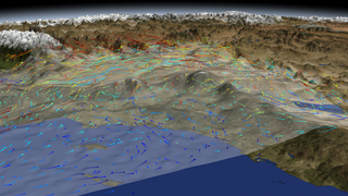
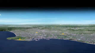
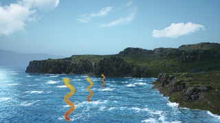
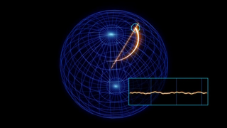
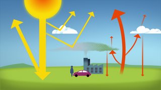
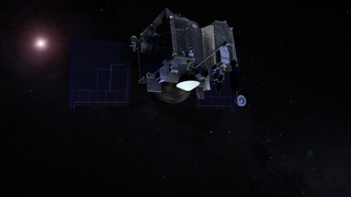
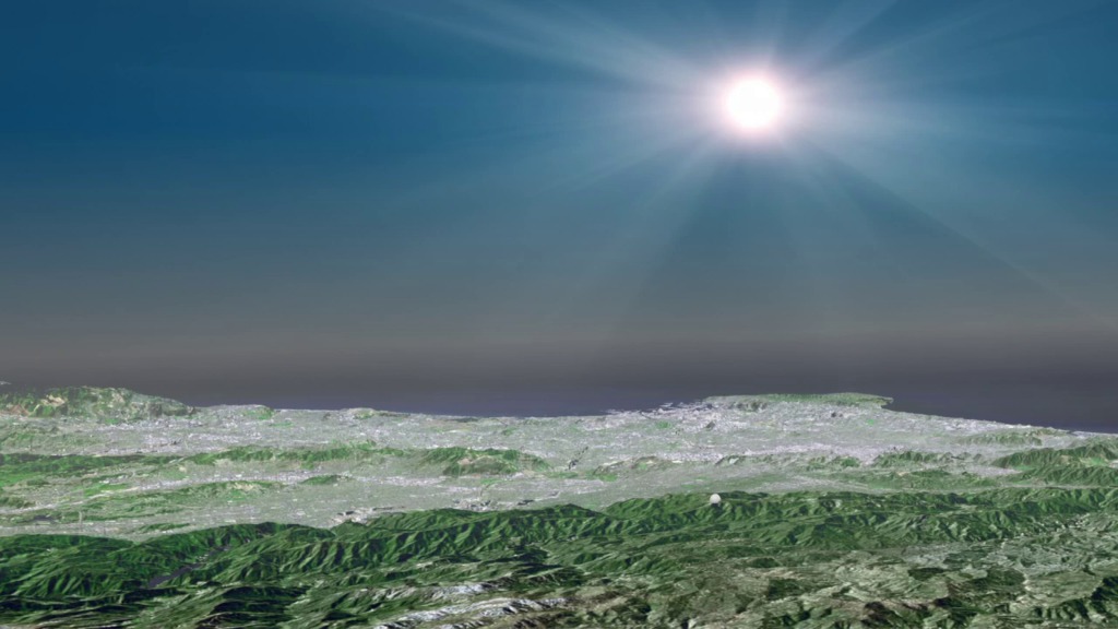
The Megacities Carbon Project is developing and testing methods for monitoring the greenhouse gas emissions of cities, the largest human contributors to climate change. One of the sites in the Megacities monitoring network for Los Angeles is the California Laboratory for Atmospheric Remote Sensing (CLARS) located on Mt Wilson. From an altitude of nearly 6000 ft, CLARS makes frequent scans during daylight hours across the LA basin. In this animation, the CLARS telescope mirror points sequentially to different pre-programmed points to sample sunlight scattering off the Earth's surface. The CLARS spectrometer splits the light from each reflection point into a spectrum (like colors in a rainbow) to reveal the unique "fingerprints" of carbon dioxide, methane and other gases in the atmosphere. The lines in the spectrum are due to absorption from the various gases - analysis of which is used to reveal the concentration of a given gas in a column of air for a given location.
The California Laboratory for Atmospheric Remote Sensing
CLARS serves as a prototype for a future geostationary satellite instrument that may someday serve as a "carbon weather satellite" - providing frequent wall-to-wall mapping of greenhouse gases across entire cities and broader regions.
CLARS was developed by JPL with support from the NASA Earth Science Technology Office. CLARS operations are funded jointly by NASA and NIST.
Related

For More Information
Animation Credits
Walt Feimer (HTSI): Animator
Kayvon Sharghi (USRA): Producer
Riley Duren (NASA/JPL CalTech): Scientist
Kayvon Sharghi (USRA): Producer
Riley Duren (NASA/JPL CalTech): Scientist
Please give credit for this item to:
NASA's Goddard Space Flight Center Conceptual Image Lab
NASA's Goddard Space Flight Center Conceptual Image Lab
Short URL to share this page:
https://svs.gsfc.nasa.gov/20199
Keywords:
SVS >> HDTV
NASA Science >> Earth
https://svs.gsfc.nasa.gov/20199
Keywords:
SVS >> HDTV
NASA Science >> Earth