Earth
ID: 20018
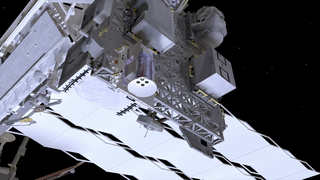
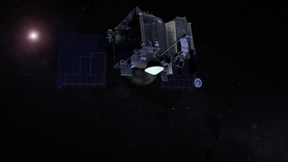
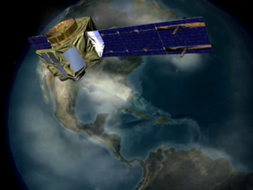
Beyond the Pale—Hyperion Imaging Spectrometer - It's not so much that the Hyperion instrument will be able to see the Earth more 'close up' or have a higher spatial resolution than previous instruments. Yet Hyperion's goals are nothing less than ambitious. The instrument is designed to gather highly complex data from a given region on the Earth by viewing the surface in terms of 220 distinct colors or 'bands' of light. Think of looking at a photograph in black and white and then comparing the exact same frame in color. Even though there is no greater resolution to the image, no change in perspective, lighting, or magnification, the amount of data presented to the viewer has greatly increased. Project managers designed Hyperion to fill in that kind of data in observed regions on the ground. The uses for an instrument than can make such fine spectral distinctions include studies of land use, changes in land cover, mineral resource assessment, research into coastal processes, changes in the atmosphere and more.
E01 - Hyperion Imaging Spectrometer
Animation Credits
Please give credit for this item to:
NASA/Goddard Space Flight Center Conceptual Image Lab
NASA/Goddard Space Flight Center Conceptual Image Lab
Short URL to share this page:
https://svs.gsfc.nasa.gov/20018
Goddard TV Tape:
G2000-093
Keywords:
SVS >> Byrne
SVS >> EO-1
SVS >> Gonnelli
SVS >> Hyperion
SVS >> Imaging
SVS >> Instrument
SVS >> Spacial Resolution
GCMD >> Earth Science
NASA Science >> Earth
GCMD keywords can be found on the Internet with the following citation: Olsen, L.M., G. Major, K. Shein, J. Scialdone, S. Ritz, T. Stevens, M. Morahan, A. Aleman, R. Vogel, S. Leicester, H. Weir, M. Meaux, S. Grebas, C.Solomon, M. Holland, T. Northcutt, R. A. Restrepo, R. Bilodeau, 2013. NASA/Global Change Master Directory (GCMD) Earth Science Keywords. Version 8.0.0.0.0
