Earth
ID: 12851
In its five years in space, Landsat 8 has racked up an impressive line of statistics. The satellite made 26,500 orbits around Earth. It captured 1.1 million "scenes" of our home planet. Its images now represent 16 percent of all the observations kept in the 45-year Landsat archive.
Landsat 8's higher resolution and faster data acquisition rates are enabling significant research and opening up new ways in which scientists, businesses, and resource managers can use the data. Water quality mapping, near-real-time ice velocity detection, and improved tracking of crop health and how much water crops use are among the research and real-world applications that Landsat 8 is enabling.
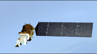
Landsat 8, which before launch was called the Landsat Data Continuity Mission, launched into orbit on Feb. 11, 2013. Once it was renamed Landsat 8 and became operational, the satellite continued a streak of engineering and science success unmatched in spaceflight: the succession of Landsat satellites has now made 45-plus years of continuous observations of Earth's surface, without any gaps. The length of this record is what makes Landsat a "cornerstone" program in the growing field of land imaging. For any new missions that want to compare imagery or data to from previous decades, the unbroken Landsat record offers the one, consistent reference point. This role is furthered by USGS and NASA's commitment to keeping the entire Landsat data archive free and accessible to scientists and the public.
5th Anniversary of Landsat 8's Launch
Landsat 8, which before launch was called the Landsat Data Continuity Mission, launched into orbit on Feb. 11, 2013. Once it was renamed Landsat 8 and became operational, the satellite continued a streak of engineering and science success unmatched in spaceflight: the succession of Landsat satellites has now made 45-plus years of continuous observations of Earth's surface, without any gaps. The length of this record is what makes Landsat a "cornerstone" program in the growing field of land imaging. For any new missions that want to compare imagery or data to from previous decades, the unbroken Landsat record offers the one, consistent reference point. This role is furthered by USGS and NASA's commitment to keeping the entire Landsat data archive free and accessible to scientists and the public.
Related
Credits
Matthew R. Radcliff (USRA): Lead Producer
Patrick Lynch (NASA/GSFC): Writer
James R. Irons (NASA/GSFC): Scientist
Laura Rocchio (SSAI): Writer
Patrick Lynch (NASA/GSFC): Writer
James R. Irons (NASA/GSFC): Scientist
Laura Rocchio (SSAI): Writer
Please give credit for this item to:
NASA's Goddard Space Flight Center
NASA's Goddard Space Flight Center
Short URL to share this page:
https://svs.gsfc.nasa.gov/12851
Missions:
Landsat
LDCM: Landsat Data Continuity Mission
This item is part of these series:
Narrated Movies
Landsat
LDCM
Keywords:
SVS >> HDTV
DLESE >> Human geography
SVS >> Landsat
DLESE >> Physical geography
GCMD >> Earth Science >> Human Dimensions >> Land Use/Land Cover
GCMD >> Earth Science >> Land Surface >> Land Use/Land Cover >> Land Cover
SVS >> Launch
NASA Science >> Earth
GCMD keywords can be found on the Internet with the following citation: Olsen, L.M., G. Major, K. Shein, J. Scialdone, S. Ritz, T. Stevens, M. Morahan, A. Aleman, R. Vogel, S. Leicester, H. Weir, M. Meaux, S. Grebas, C.Solomon, M. Holland, T. Northcutt, R. A. Restrepo, R. Bilodeau, 2013. NASA/Global Change Master Directory (GCMD) Earth Science Keywords. Version 8.0.0.0.0


