Earth
ID: 12471

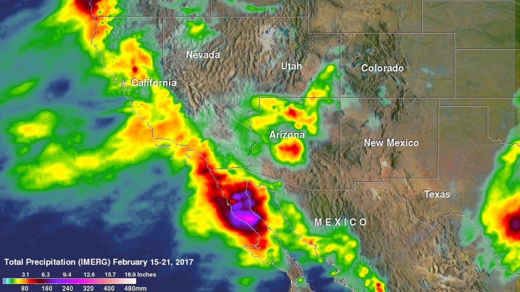
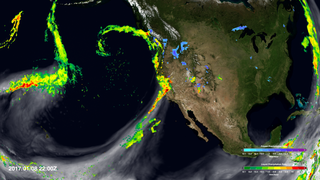
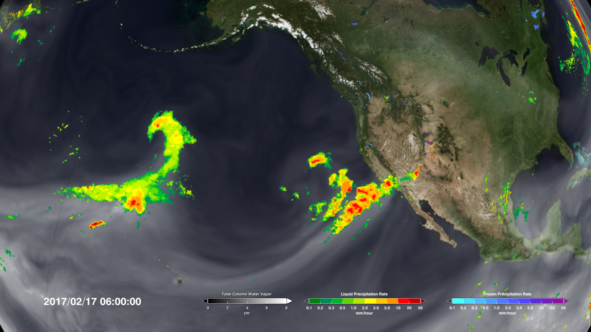
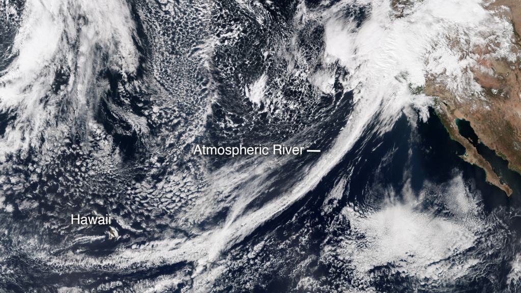
A series of atmospheric rivers delivered record amounts of rainfall to California and the American West this winter, breaking the drought that has gripped the region since 2012. The deluge is fed by long tendrils of water vapor that build up over the ocean – atmospheric rivers – that then turn into rain when they approach and pass over the coast. Rain data shown in green to red from NASA's Global Precipitation Measurement (GPM) mission and water vapor data, in white, from the Goddard Earth Observing System Model (GEOS) show the extreme rainfall that occurred in California during February, 2017, and the atmospheric rivers that transported the rain to the area. Watch the videos to see the rain arrive.

Torrential Atmospheric Rivers
Source Material

For More Information
Story Credits
Lead Visualizer/Animator:
Horace Mitchell (NASA/GSFC)
Lead Scientist:
Duane Waliser (NASA/JPL CalTech)
Lead Writer:
Ellen T. Gray (ADNET Systems, Inc.)
Horace Mitchell (NASA/GSFC)
Lead Scientist:
Duane Waliser (NASA/JPL CalTech)
Lead Writer:
Ellen T. Gray (ADNET Systems, Inc.)
Please give credit for this item to:
NASA/Goddard Space Flight Center Scientific Visualization Studio
VIRRS Suomi NPP natural color image courtesy of NASA/Earth Observatory/Jesse Allen.
Rain Accumulation map courtesy of NASA/Hal Pierce.
NASA/Goddard Space Flight Center Scientific Visualization Studio
VIRRS Suomi NPP natural color image courtesy of NASA/Earth Observatory/Jesse Allen.
Rain Accumulation map courtesy of NASA/Hal Pierce.
Short URL to share this page:
https://svs.gsfc.nasa.gov/12471
Keywords:
SVS >> HDTV
SVS >> App
NASA Science >> Earth
https://svs.gsfc.nasa.gov/12471
Keywords:
SVS >> HDTV
SVS >> App
NASA Science >> Earth


