Earth
ID: 11928

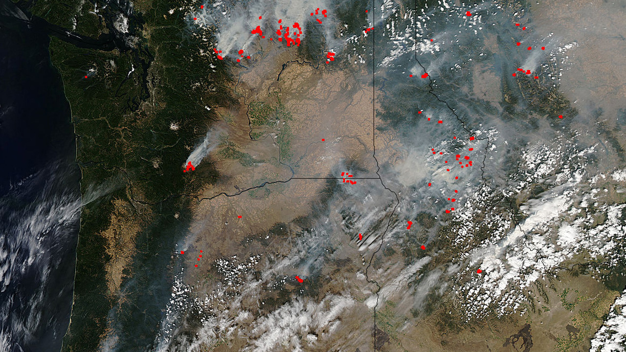
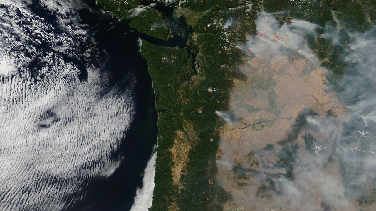
Each year about one third of Earth's land surface is touched by fire. We didn't know this fact until the Moderate Resolution Imaging Spectroradiometer, or MODIS, instrument aboard NASA’s Terra and Aqua satellites together began scanning Earth four times a day to pinpoint every active fire on the planet. In the sixteen years since they began creating this global fire map, they have observed more than 40 million actively burning fires and revolutionized scientists' understanding of where fires occur and how they affect ecosystems, carbon released into the atmosphere that contributes to climate change, and air quality that affects human health. The real-time fire map is one of the most in demand products for fighting wildfires in the United States and across the globe. Explore the images for views of wildfires in the Western U.S. observed by the two satellites in August 2015.

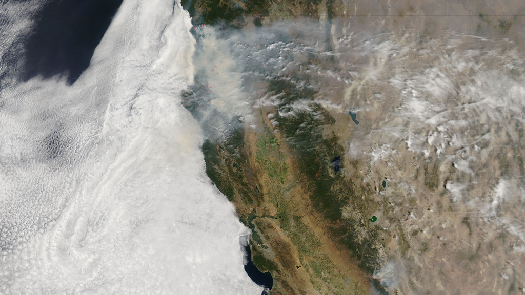
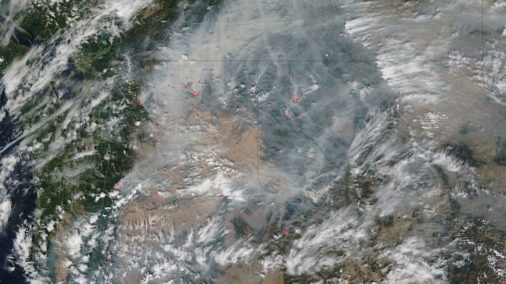
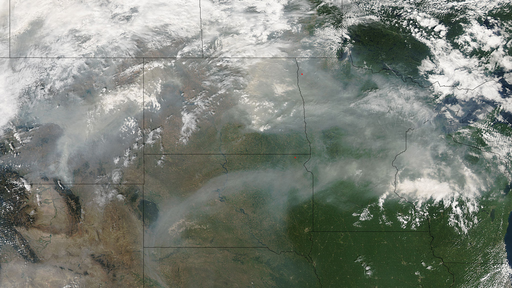
Western Wildfires
Story Credits
Please give credit for this item to:
NASA's Goddard Space Flight Center
Images courtesy of NASA/GSFC/MODIS Rapid Response Team/Jeff Schmaltz
NASA's Goddard Space Flight Center
Images courtesy of NASA/GSFC/MODIS Rapid Response Team/Jeff Schmaltz
Short URL to share this page:
https://svs.gsfc.nasa.gov/11928
Keywords:
SVS >> App
NASA Science >> Earth
https://svs.gsfc.nasa.gov/11928
Keywords:
SVS >> App
NASA Science >> Earth


