Earth
ID: 11275
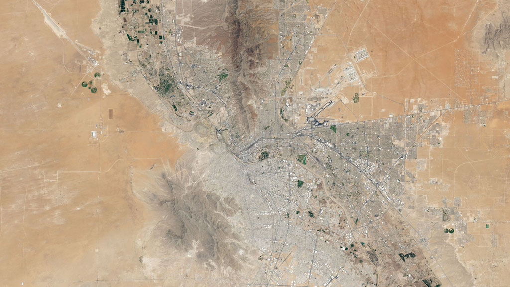
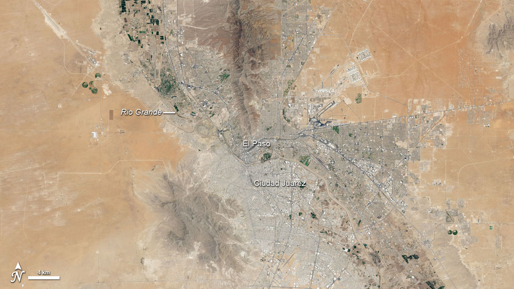
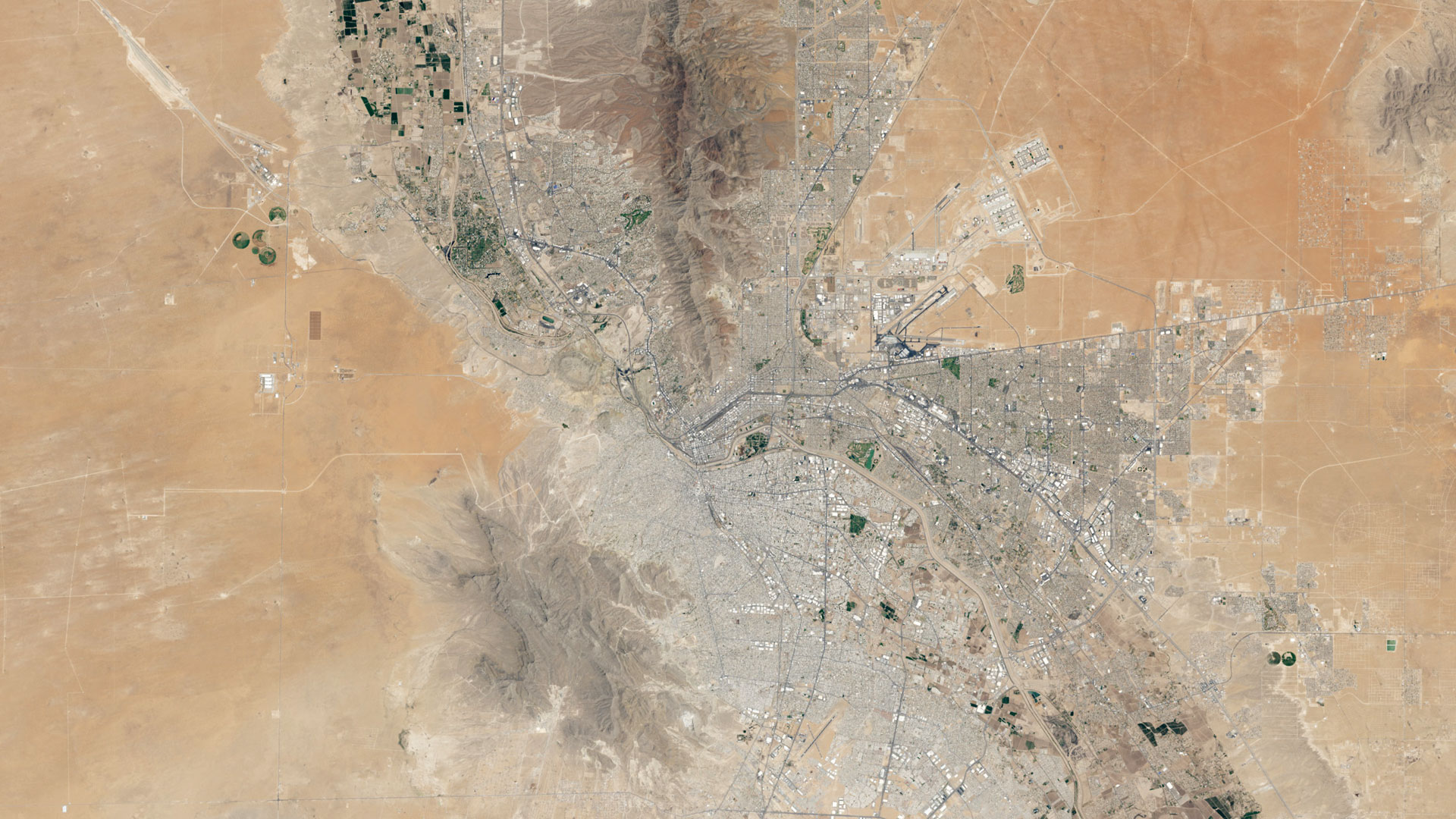
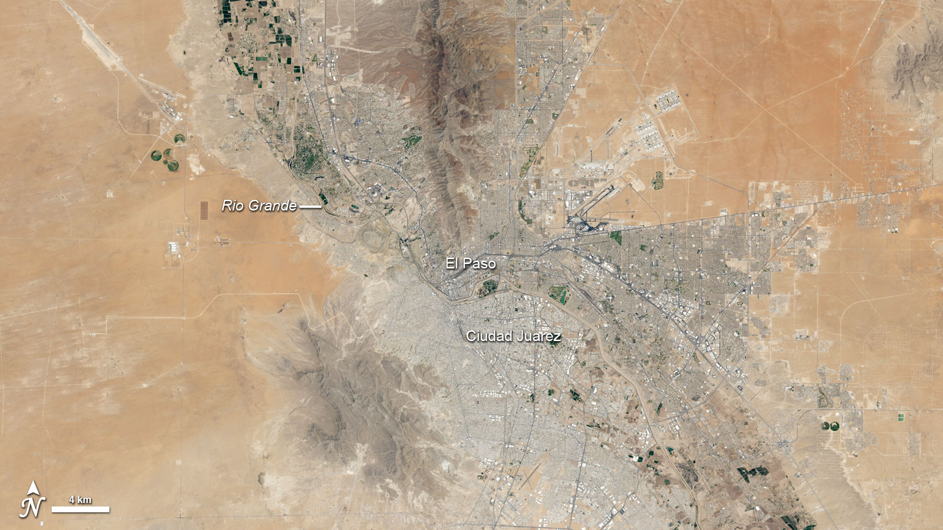
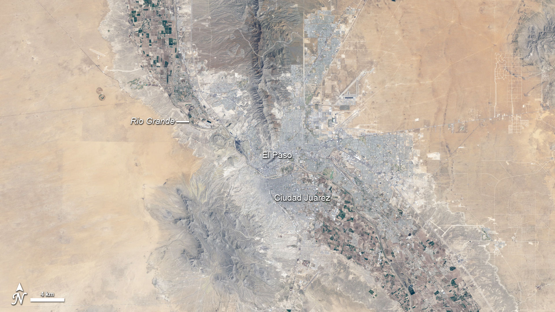
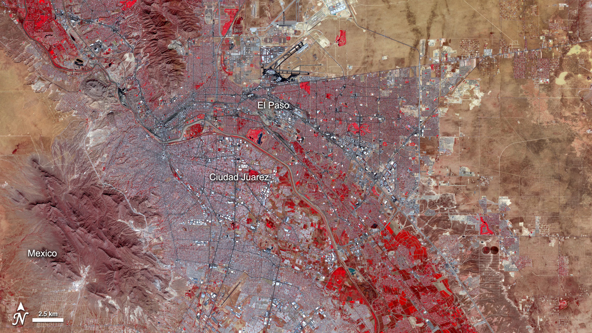
For 41 years, USGS-NASA Landsat satellites have collected images of our planet...millions of them. Such images help everyone from scientists to city planners examine how the landscape changes with time. In one patch of desert, where the Rio Grande makes a border between the United States and Mexico, the Landsat fleet has captured hundreds of photo-like natural-color images. They show fields turning green and brown with the season; new urban and suburban developments expanding around El Paso, Texas, and Ciudad Juárez, Mexico; changing angles of sunlight; and clouds moving over the neighboring mountains. They also reveal subtle changes in the sensors as technology improves with each generation of satellite. Watch the video to see a multi-decadal, time-lapse view of this desert city.


One City, 660 Views
For More Information
Story Credits
Visualizer/Animator:
Robert Simmon (Sigma Space Corporation)
Video Editor:
Robert Simmon (Sigma Space Corporation)
Producers:
Robert Simmon (Sigma Space Corporation)
Mike Carlowicz (Sigma Space Corporation)
Lead Scientist:
James R. Irons (NASA/GSFC)
Lead Writers:
Mike Carlowicz (Sigma Space Corporation)
Kate Ramsayer (Telophase)
Robert Simmon (Sigma Space Corporation)
Video Editor:
Robert Simmon (Sigma Space Corporation)
Producers:
Robert Simmon (Sigma Space Corporation)
Mike Carlowicz (Sigma Space Corporation)
Lead Scientist:
James R. Irons (NASA/GSFC)
Lead Writers:
Mike Carlowicz (Sigma Space Corporation)
Kate Ramsayer (Telophase)
Please give credit for this item to:
NASA's Earth Observatory
Images courtesy of Robert Simmon and Jesse Allen, NASA Earth Observatory
NASA's Earth Observatory
Images courtesy of Robert Simmon and Jesse Allen, NASA Earth Observatory
Short URL to share this page:
https://svs.gsfc.nasa.gov/11275
Keywords:
NASA Science >> Earth
SVS >> App
https://svs.gsfc.nasa.gov/11275
Keywords:
NASA Science >> Earth
SVS >> App


