Earth
ID: 10704
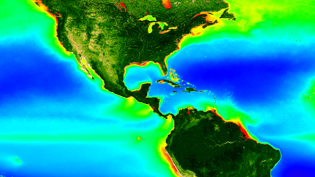
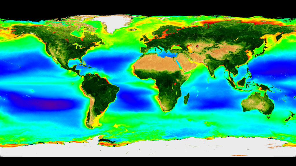
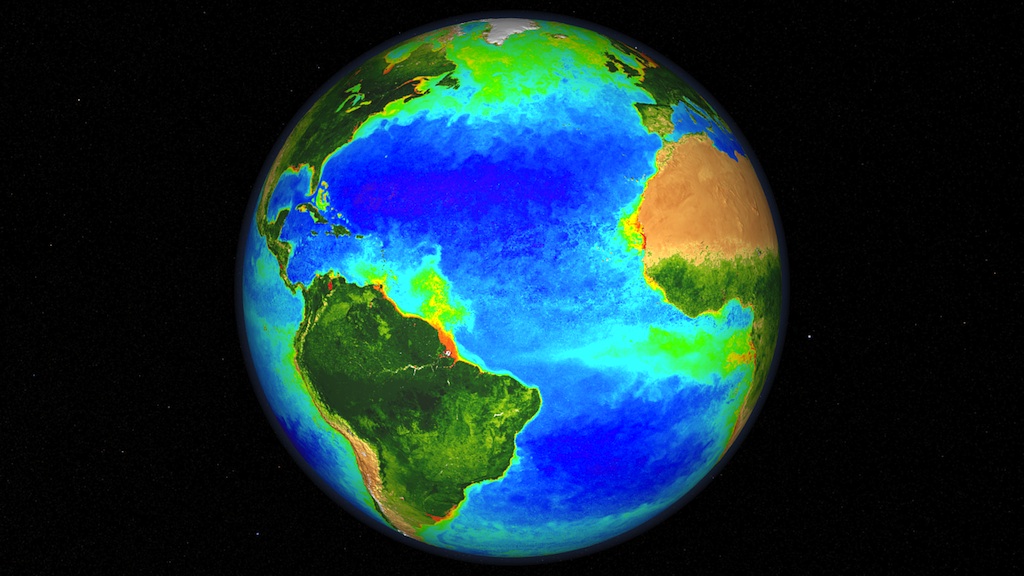
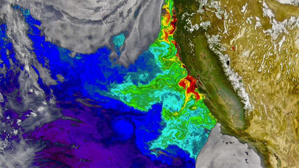
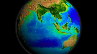
The Sahara. The Gobi. The Mojave. Viewed from space, the dearth of vegetation in deserts paint vast swaths of tan on continents otherwise alive with green. The mesmerizing seasonal ebb and flow of vegetation dancing over the land and sea surface is the most noticeable feature of the first visualization below, which shows a full ten-year span of data from a NASA satellite instrument called the Sea-viewing Wide Field-of-View Sensor (SeaWiFS). More surprising is what SeaWiFS reveals about plant life in the oceans. Vast oceanic "deserts," seen here as dark blue and purple, stretch across large portions of the tropics in all major ocean basins. Here, nutrient-starved, warm waters make it nearly impossible for phytoplankton to survive. More than a decade of SeaWiFS data shows these biological deserts are growing at a rapid rate. Meanwhile, productive areas of the ocean (light green and yellow in the animation) have shrunk by between 1 and 4 percent each year for the last decade. Scientists suspect climate change is the culprit, but they need longer-term satellite records to rule out natural variations.

Marine Deserts On The Move
Related Stories
Story Credits
Visualizer/Animator:
Alex Kekesi (Global Science and Technology, Inc.)
Video Editor:
Brooke Harris (USRA)
Interviewee:
Gene Feldman (NASA/GSFC)
Producer:
Brooke Harris (USRA)
Lead Scientist:
Gene Feldman (NASA/GSFC)
Videographer:
Rob Andreoli (Advocates in Manpower Management, Inc.)
Lead Writer:
Adam P Voiland (Wyle Information Systems)
Please give credit for this item to:
NASA/Goddard Space Flight Center, The SeaWiFS Project and GeoEye. NOTE: All SeaWiFS images and data presented on this web site are for research and educational use only. All commercial use of SeaWiFS data must be coordinated with GeoEye (NOTE: In January 2013, DigitalGlobe and GeoEye combined to become DigitalGlobe).
NASA/Goddard Space Flight Center, The SeaWiFS Project and GeoEye. NOTE: All SeaWiFS images and data presented on this web site are for research and educational use only. All commercial use of SeaWiFS data must be coordinated with GeoEye (NOTE: In January 2013, DigitalGlobe and GeoEye combined to become DigitalGlobe).
Short URL to share this page:
https://svs.gsfc.nasa.gov/10704
Keywords:
SVS >> App
NASA Science >> Earth
https://svs.gsfc.nasa.gov/10704
Keywords:
SVS >> App
NASA Science >> Earth


