Cryospheric Images
Satellites and Instrumentation
- ID: 11389 Produced Video
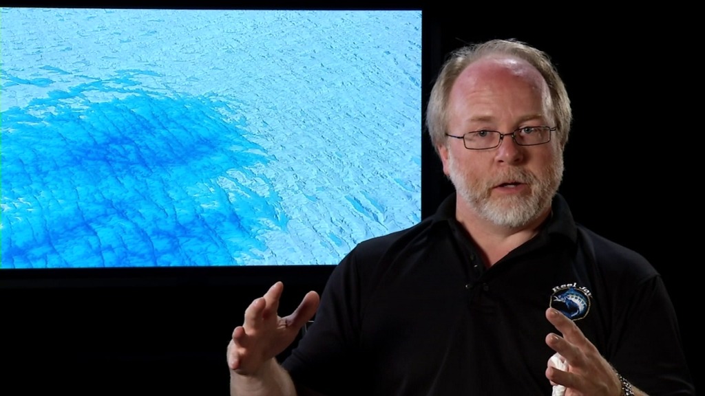
A Laser Scientist Answers 5 Questions about LVIS
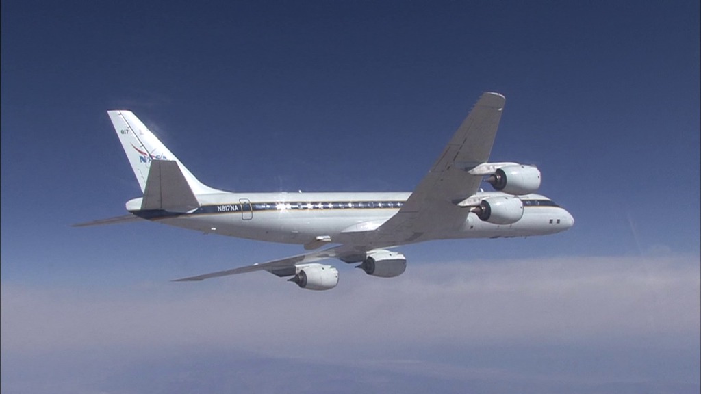
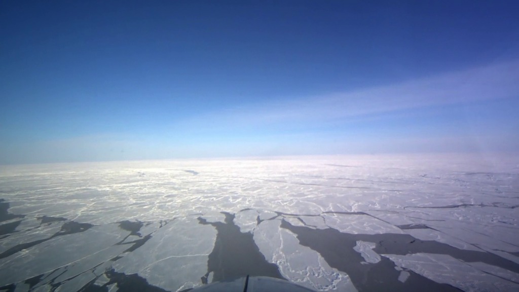
Go to this pageWith winter closing in, a new NASA airborne campaign got under way October 31, 2013 in Greenland. For the first time, the Laser Vegetation Imaging Sensor, or LVIS, is flying aboard NASA's new C-130 aircraft to measure the island's ice following a summer's melt. This data will complement measurements the LVIS instrument has taken in previous springtime campaigns as a part of Operation IceBridge, a six-year multi-instrument survey over both Arctic and Antarctic ice. ||
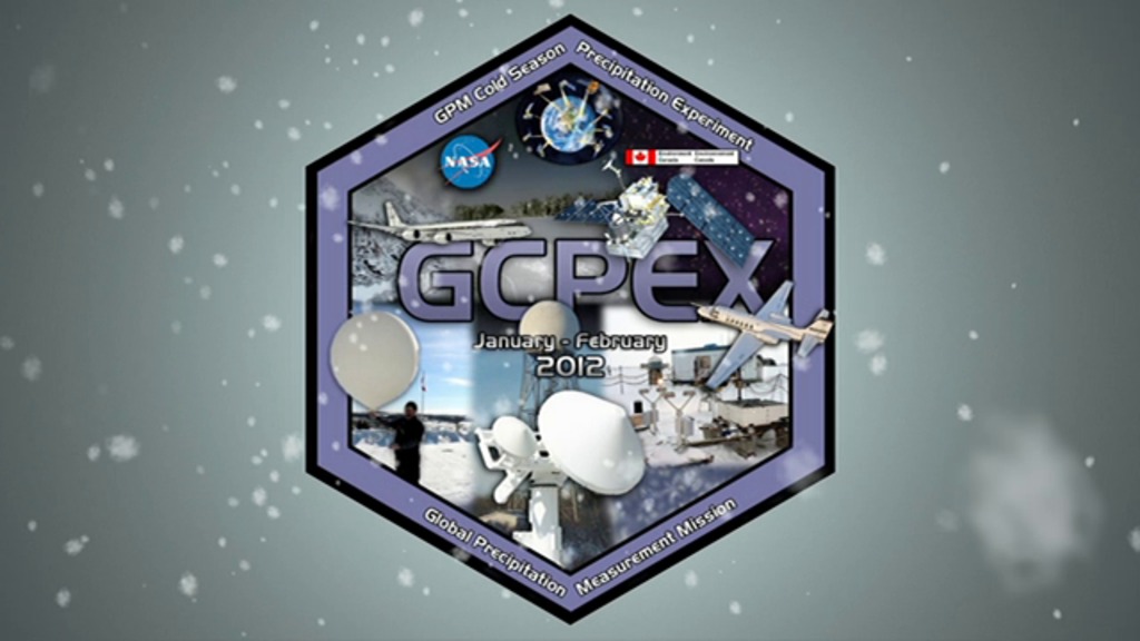
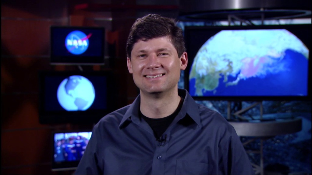
- ID: 10938 Produced Video
NASA Wraps Up Cold Season Campaign for GPM
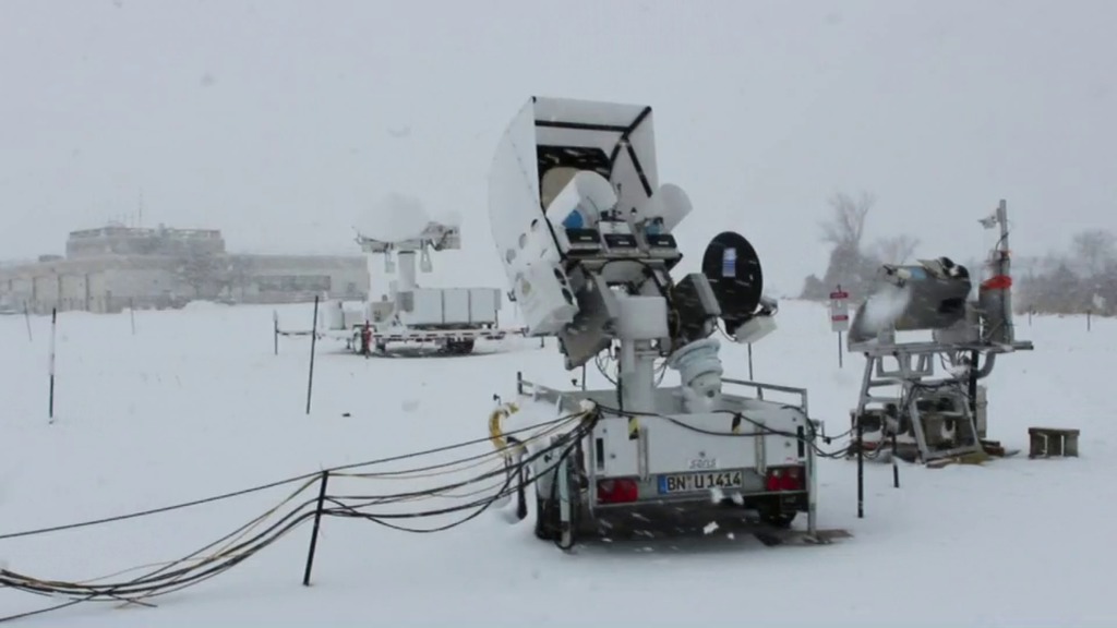
Go to this pageFor six weeks in Ontario, Canada, scientists and engineers lead a field campaign to study the science and mechanics of falling snow. The datasets retrieved will be used to generate algorithms which translate what the GPM Core satellite "sees" into precipitation rates, including that of falling snow. Ground validation science manager Walt Petersen gives a summary of the GCPEx field campaign. Field campaigns are critical in improving satellite observations and precipitation measurements. ||
- ID: 10890 Produced Video
NASA Airborne Cold Weather Experiment Measures Falling Snow
Go to this pageNASA is flying an airborne science laboratory through Canadian snowstorms for six weeks in support of a difficult task of the upcoming Global Precipitation Measurement (GPM) mission: measuring snowfall from space. GPM is an international satellite mission scheduled for launch in 2014 that will provide next-generation observations of worldwide rain and snow every three hours. It is the first precipitation mission designed to detect falling snow from space. ||
Arctic Sea Ice
- ID: 11343 Produced Video
Arctic sea ice live shots 2013
Go to this pageOn Friday August 23, 2013, scientists at NASA's Goddard Space Flight Center talked to television stations from around the country about the Arctic and the changes taking place to sea ice in this region. See below for interviews in English with Tom Wagner and Walt Meier, an interview in Spanish with Carlos del Castillo, and footage and data visualizations of sea ice.For more information please click here. ||
- ID: 10493 Produced Video
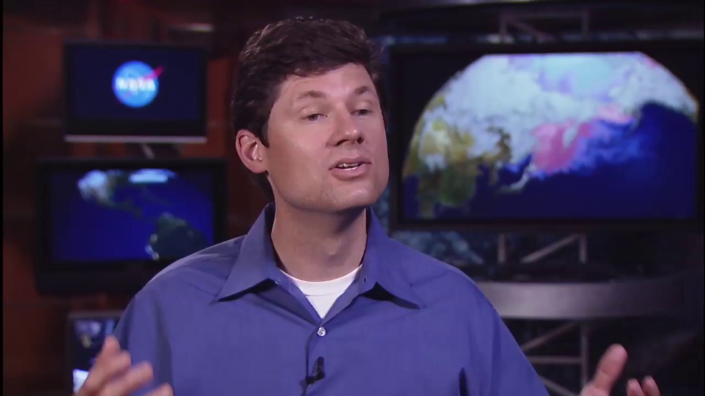
Arctic Sea Ice 101
Go to this pageA fast-paced interview with NASA climate scientist Tom Wagner, where he provides a look at the state of Arctic sea ice in 2009 and discusses NASA's role in monitoring the cryosphere.For complete transcript, click here. || Tom_Wagner-Ag_ep2_Partners_Youtube.00002_print.jpg (1024x576) [68.3 KB] || Tom_Wagner-Ag_ep2_Partners_Youtube_web.png (320x180) [197.0 KB] || Tom_Wagner-Ag_ep2_Partners_Youtube_thm.png (80x40) [16.9 KB] || Wagner_ArcticIce2009_appletv.webmhd.webm (960x540) [63.7 MB] || Tom_Wagner-Ag_ep2_Partners_Youtube.mov (1280x720) [61.4 MB] || Wagner_ArcticIce2009_appletv.m4v (960x540) [156.0 MB] || Wagner_ArcticIce2009_h264.mov (1280x720) [133.7 MB] || Wagner_ArcticIce2009_ipod.m4v (640x360) [52.3 MB] ||
Antarctic Ice Sheet
- ID: 4168 Visualization
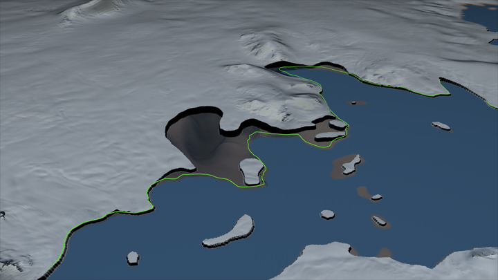
West Antarctic Collapse
Go to this pageA new study by researchers at NASA and the University of California, Irvine, finds a rapidly melting section of the West Antarctic Ice Sheet appears to be in an irreversible state of decline, with nothing to stop the glaciers in this area from melting into the sea according to glaciologist and lead author Eric Rignot, of UC Irvine and NASA's Jet Propulsion Laboratory in Pasadena, California.Three major lines of evidence point to the glaciers' eventual demise: the changes in their flow speeds, how much of each glacier floats on seawater, and the slope and depth of the terrain they are flowing over. In a paper in April, Rignot's research group discussed the steadily increasing flow speeds of these glaciers over the past 40 years. This new study examines the other two lines of evidence.As glaciers flow out from land to the ocean, large expanses of ice behind their leading edges float on the seawater. The point on a glacier where it first loses contact with land is called the grounding line. Nearly all glacier melt occurs on the underside of the glacier beyond the grounding line, on the section floating on seawater. The Antarctic glaciers studied have thinned so much they are now floating above places where they used to sit solidly on land, which means their grounding lines are retreating inland.—><!——><!—Above: Move bar to compare the grounding line of the Smith Glacier from 1996 (left) to the location in 2011 (right) which has retreated inland 35 km during this time. The green line indicates the location of the 1996 grounding line. Download HTML to embed this in your web page.The bedrock topography is another key to the fate of the ice in this basin. All the glacier beds slope deeper below sea level as they extend farther inland. As the glaciers retreat, they cannot escape the reach of the ocean, and the warm water will keep melting them even more rapidly.Below are two edited versions of narrated stories released by JPL to explain this research. In addition are the two versions of the unedited animations provided to JPL to support the release. The unedited animations show the region of study by the JPL researchers, identifying by name the glaciers that terminate in the Amundsen Sea. One of the animations includes data showing the velocity of the glaciers in the region, flow vectors showing the movement of the glaciers colored by their velocity and a difference image showing the change in velocity between 1996 and 2008. The second animation does not include these datasets. Both versions of the animation draw close to the Smith Glacier and show how the grounding line of this glacier has moved inland 35 kilometers between 1996 and 2011. As the surface of the ice sheet is peeled away, showing the height and depth of the bedrock topography. Regions below sea level are shown in shades of brown while areas above sea level are shown in green. Sea level is shown in yellow. ||
- ID: 10412 Produced Video
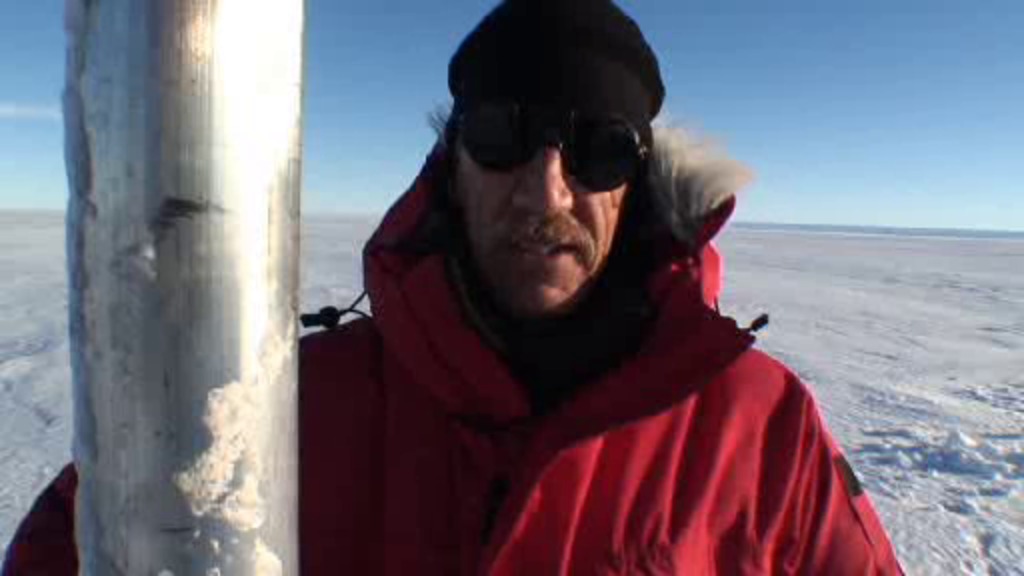
Return to P.I.G.
Go to this pageReturn to PIG provides an update to PIG Ice Shelf: First Contact. Though NASA researcher Bob Bindschadler had hoped to return to Pine Island Glacier Ice Shelf and continue his research during the 2009 season, this video explians how plans hit a snag. Sometimes science takes time, especially when it comes to dealing with the forbidding conditions of Antarctica. ||
- ID: 10202 Produced Video
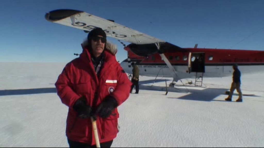
PIG Ice Shelf: First Contact
Go to this pageThis past January NASA scientist Robert Bindschadler led an expedition to a previously untouched part of Antarctica that may be one of the best places to gauge how global warming is affecting the continent. Pine Island Glacier Ice Shelf (PIG for short) is believed to be among the most vulnerable spots ot melting on Earth, but it's also among the most remote. While satellite observations provide a wide-angle view of the action on the glacier, boots on the ground with high tech drills and sensors are needed to provide the close up shots to fill in the blanks. Antarctica footage provided by Polar-Palooza/Passport to Knowledge ||
Snow
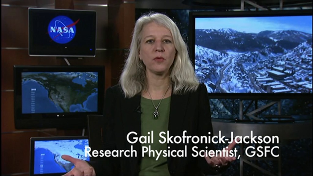
- ID: 11067 Produced Video
GPM: What We Don't Know About Snow
Go to this pageGPM Deputy Project Scientist Gail Skofronick-Jackson discusses GPM's snowfall measurement capabilities and the challenges of measuring snow. ||
- ID: 10912 Produced Video
Uncovering Winter's Mystery Recap
Go to this pageThis is a recap of the satellite media tour "NASA Uncovers Winter's Mystery," featuring Tom Wagner and Gail Skofronick-Jackson. ||
Greenland Ice Sheet
- ID: 11354 Produced Video
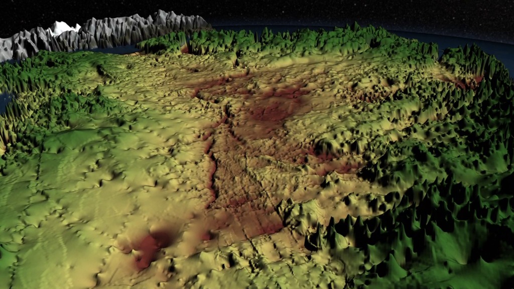
Greenland's Mega Canyon (narrated video)
Go to this pageHidden for all of human history, a 460 mile long canyon has been discovered below Greenland's ice sheet. Using radar data from NASA's Operation IceBridge and other airborne campaigns, scientists led by a team from the University of Bristol found the canyon runs from near the center of the island northward to the fjord of the Petermann Glacier. A large portion of the data was collected by IceBridge from 2009 through 2012. One of the mission's scientific instruments, the Multichannel Coherent Radar Depth Sounder, operated by the Center for the Remote Sensing of Ice Sheets at the University of Kansas, can see through vast layers of ice to measure its thickness and the shape of bedrock below. This is a narrated version of an visualization that can be found, along with more detailed information, at Greenland's Mega-Canyon beneath the Ice Sheet (#4097). ||
Other
- ID: 10889 Produced Video
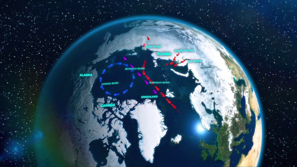
NASA Finds Russian Runoff Freshening Canadian Arctic
Go to this pageA new NASA and University of Washington study allays concerns that melting Arctic sea ice could be increasing the amount of freshwater in the Arctic enough to have an impact on the global "ocean conveyor belt" that redistributes heat around our planet. Read the full press release here: http://www.nasa.gov/topics/earth/features/earth20120104.html ||
- ID: 10419 Produced Video
New Sea Ice Findings Cap Year of Focus on Poles
Go to this pageIn commemoration of the end of the International Polar Year, Tom Wagner, NASA Cryosphere Program Scientist, appeared on television stations around the country on April 6, 2009. This video highlights his answers to questions about the IPY, climate change, and new data on the extent and thickness of sea ice covering the Arctic Ocean.For complete transcript, click here. || Tom_Wagner_Live_EditedH264.00177_print.jpg (1024x576) [83.8 KB] || Tom_Wagner_Live_EditedH264_web.png (320x180) [241.0 KB] || Tom_Wagner_Live_EditedH264_thm.png (80x40) [17.0 KB] || Tom_Wagner_Live_Edited.webmhd.webm (960x540) [57.5 MB] || Tom_Wagner_Live_Edited.m4v (960x540) [178.9 MB] || Tom_Wagner_Live_EditedH264.mov (1280x720) [175.8 MB] || Tom_Wagner_Live_Edited.mov (1280x720) [175.8 MB] || Tom_Wagner_Live_Edited.mp4 (320x240) [11.7 MB] || Tom_Wagner_Live_Edited.wmv (320x236) [25.4 MB] || Tom_Wagner_Live_Edited.mpg (512x288) [46.1 MB] ||