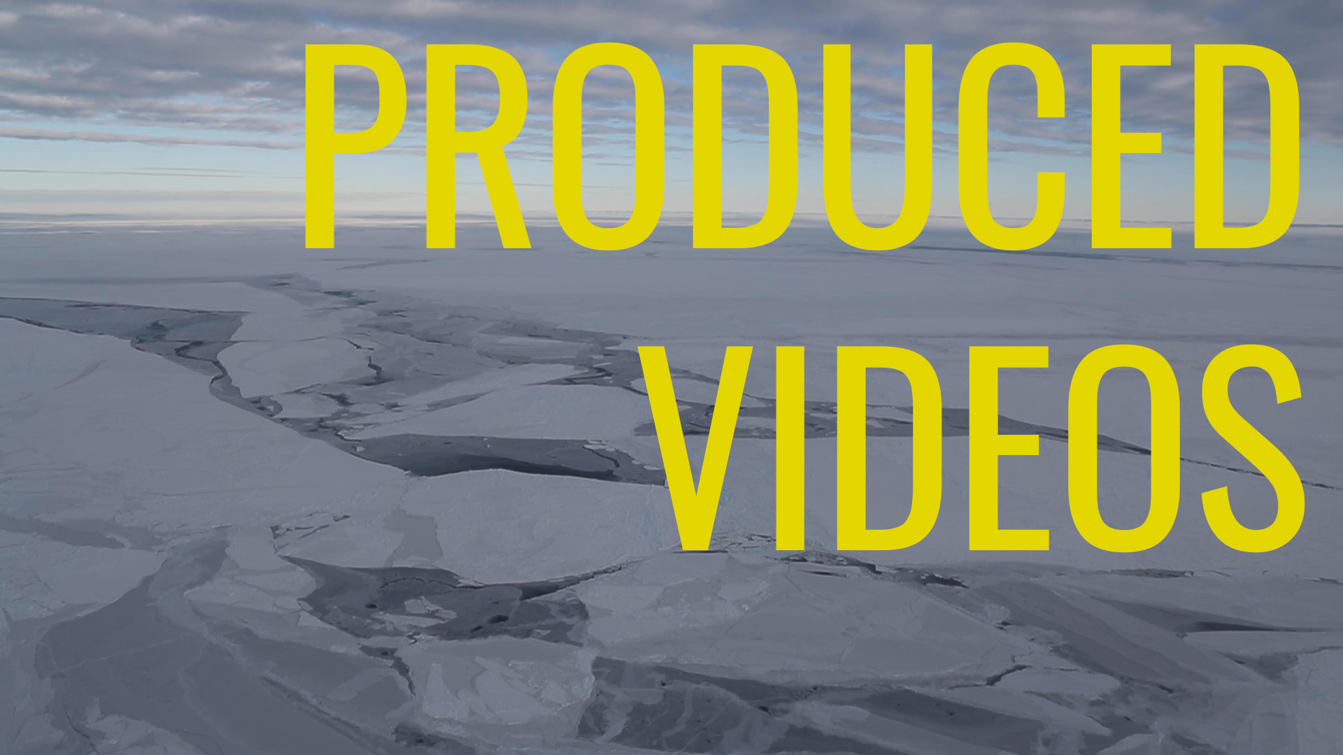
Operation IceBridge
Overview
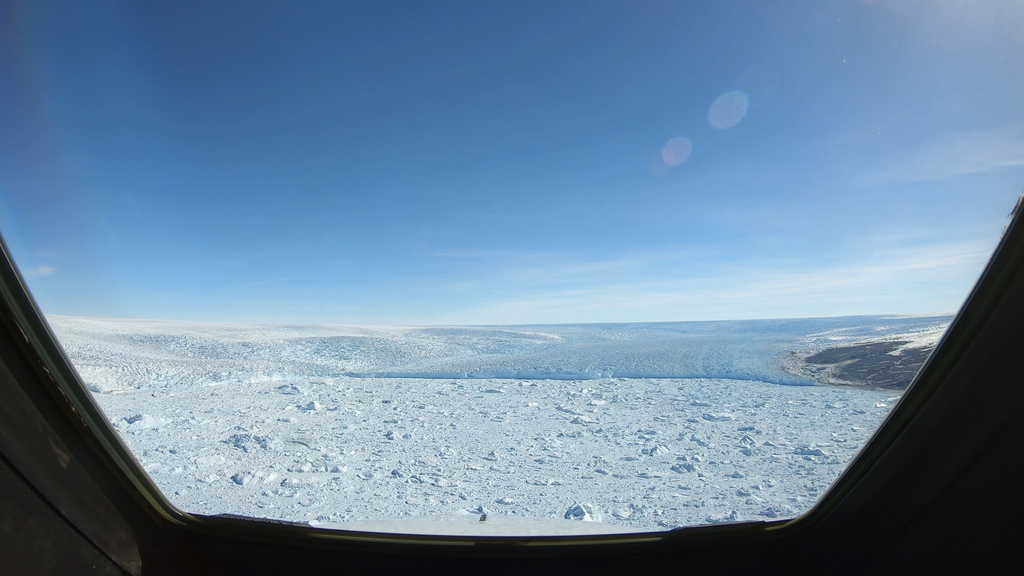
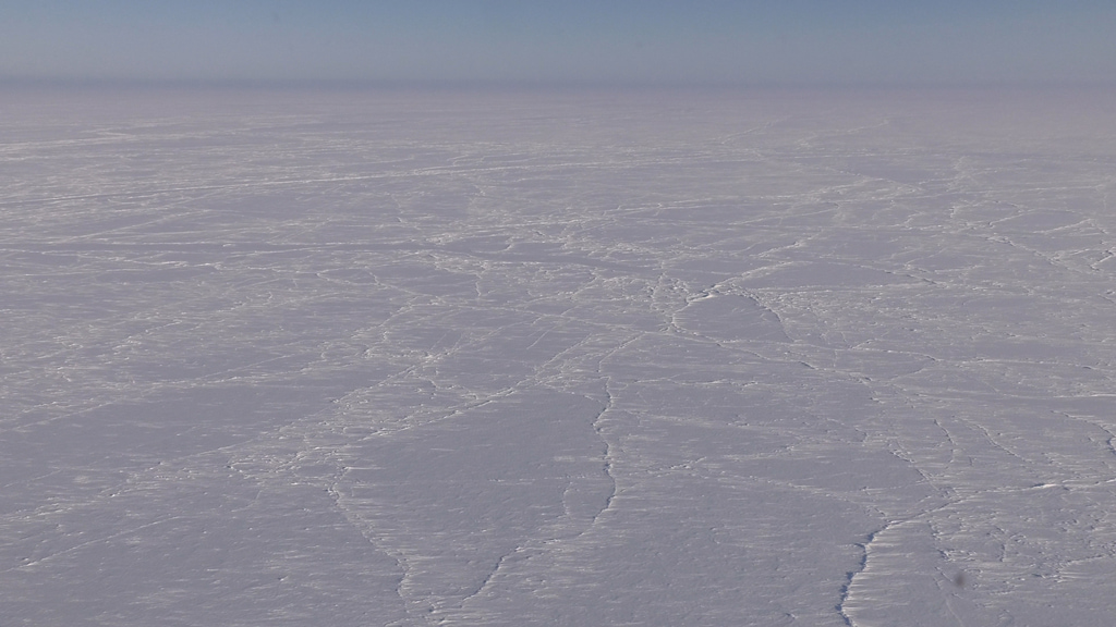
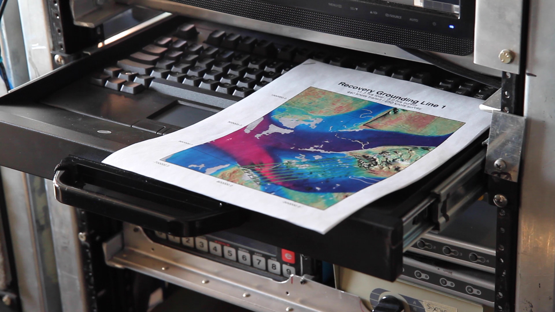
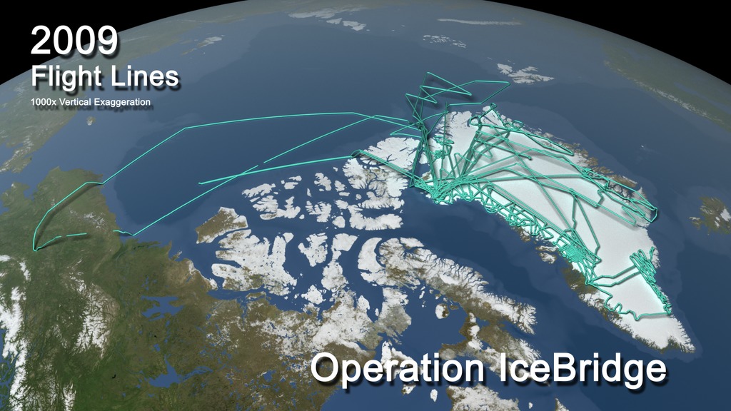
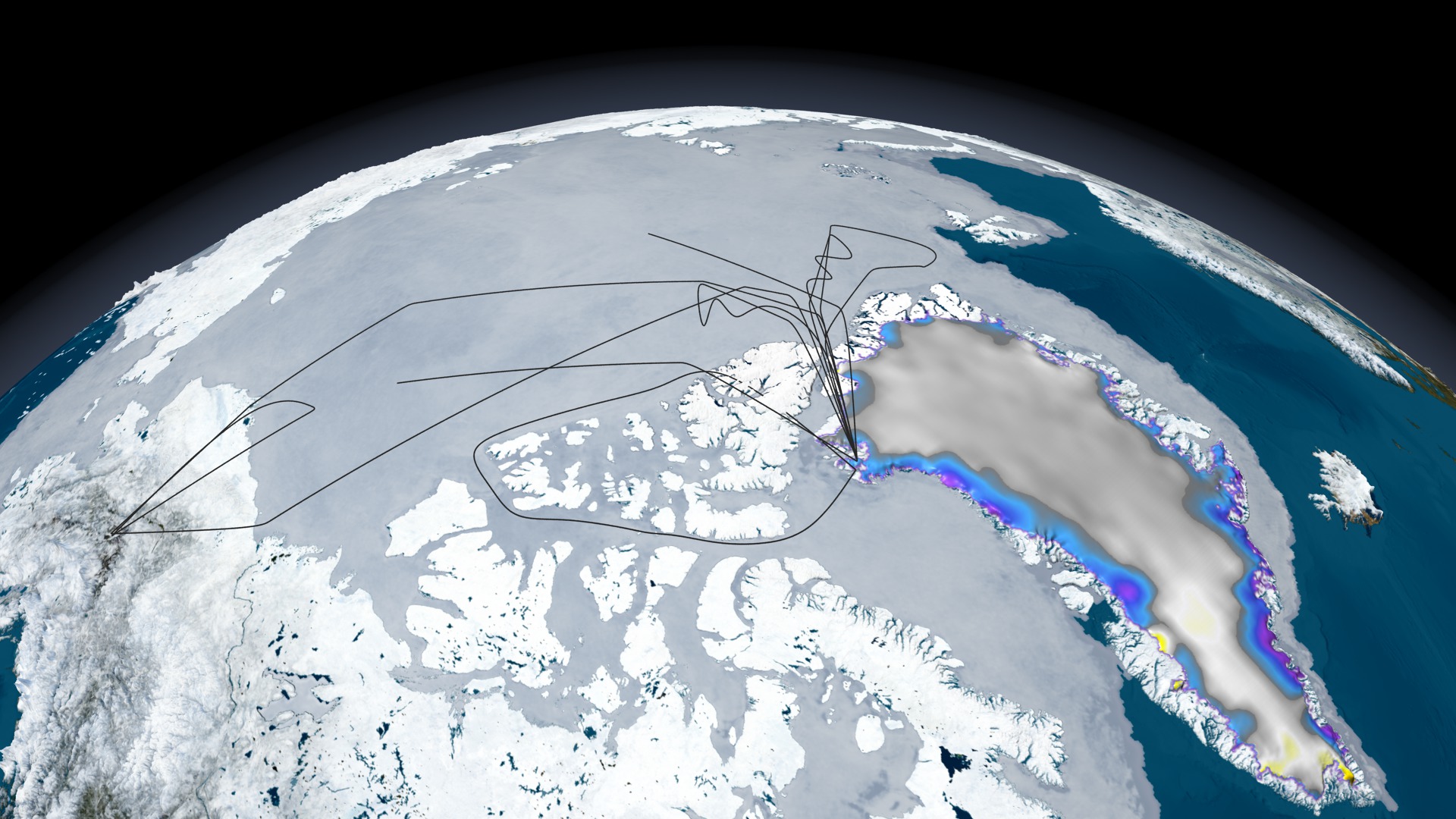
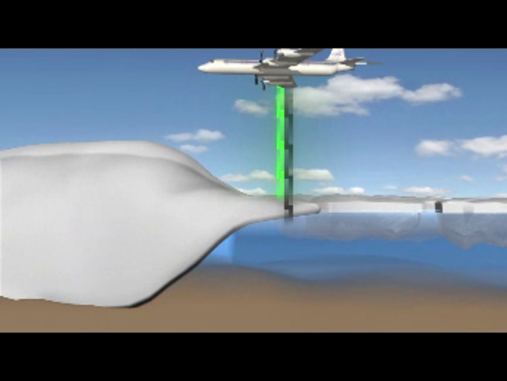
Operation IceBridge was a NASA field campaign that was the largest airborne survey of Earth's polar ice ever flown. Spanning 11 years, IceBridge produced an unprecedented three-dimensional view of Arctic and Antarctic ice sheets, glaciers and sea ice. Dozens of flights every year provided regular, multi-instrument insights into the behavior of Earth’s rapidly changing cryosphere.
Data collected by IceBridge helped scientists bridge the gap in polar observations of ice height between NASA's Ice, Cloud and Land Elevation Satellite (ICESat), which launched in 2003, and ICESat-2, which launched on September 15, 2018. ICESat stopped collecting science data in 2009, making IceBridge critical for ensuring a continuous series of observations. IceBridge surveyed the Arctic and Antarctic areas once a year, typically in the springtime before summer melting began. The first Operation IceBridge flights were conducted in March/May 2009 over Greenland and in October/November 2009 over Antarctica. Other smaller airborne surveys around the world, in particular Alaska, were also part of the IceBridge mission.
Arctic
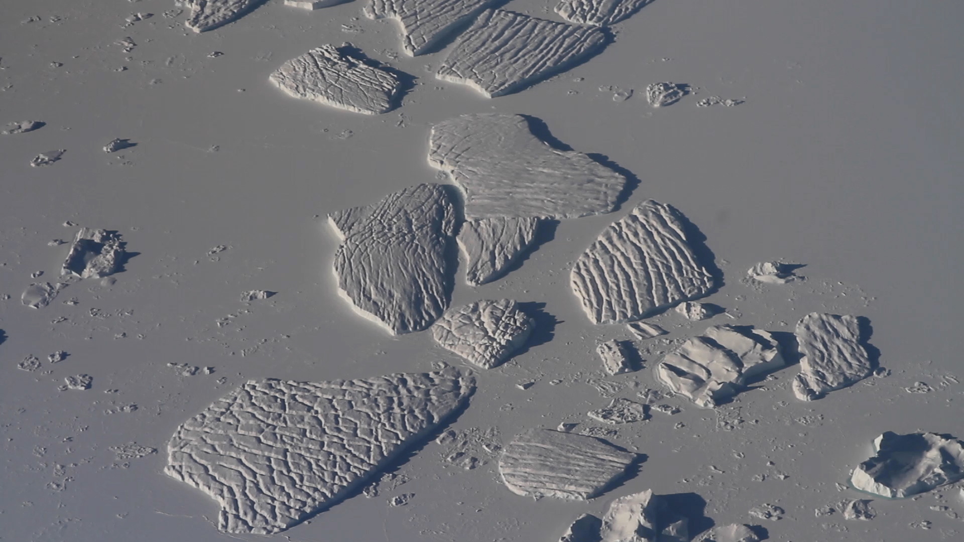
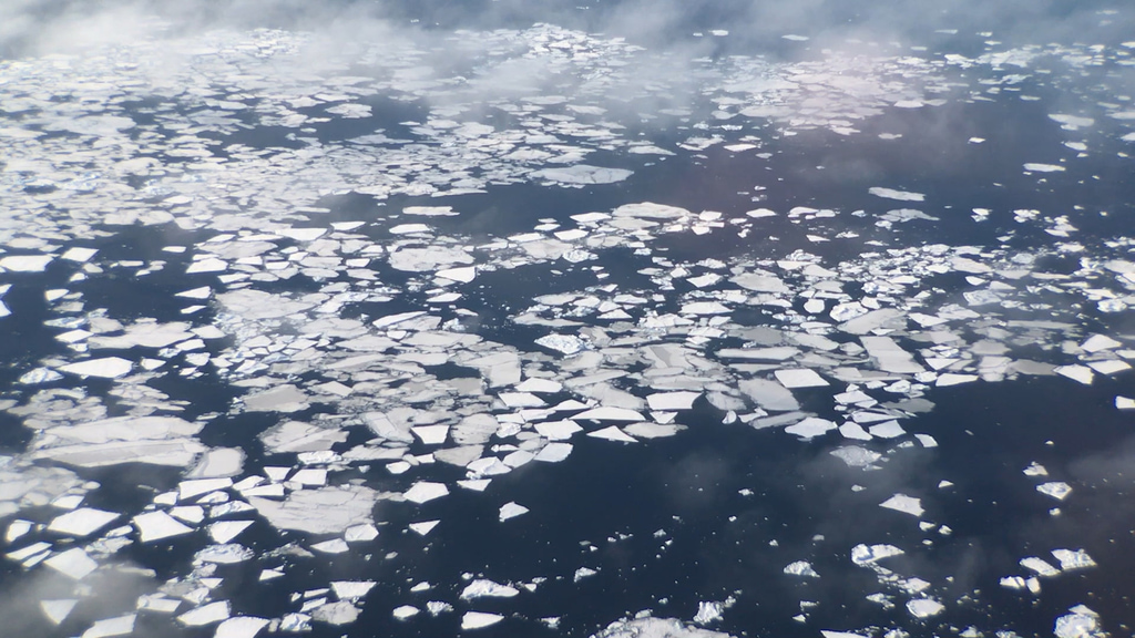
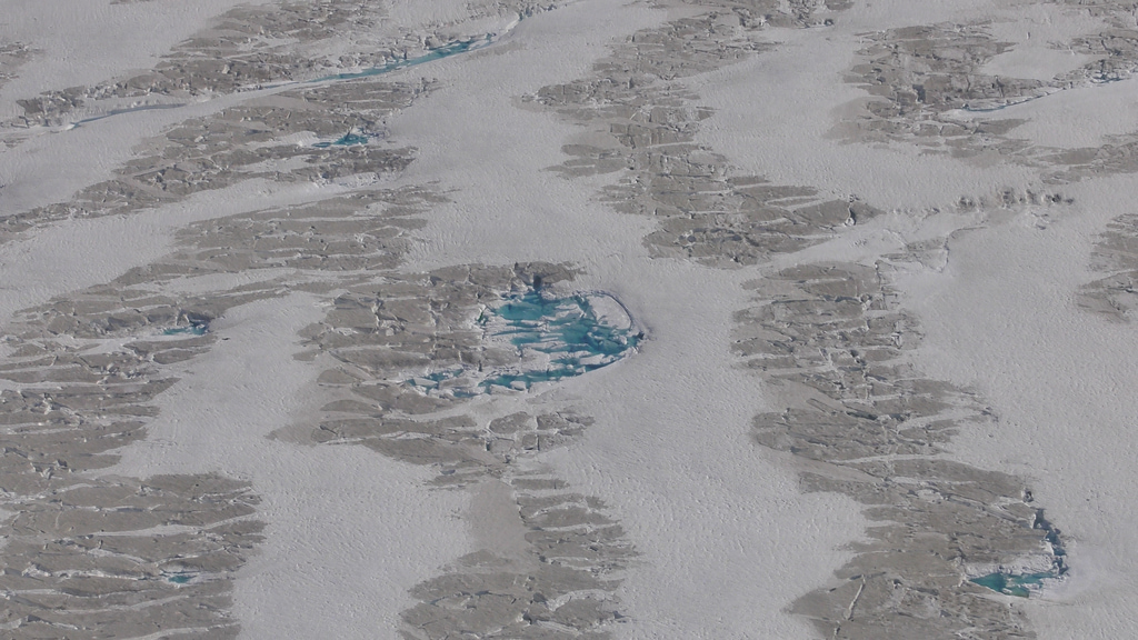
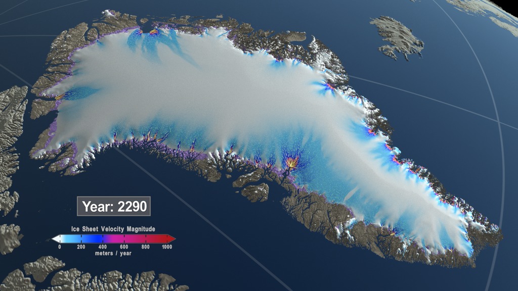
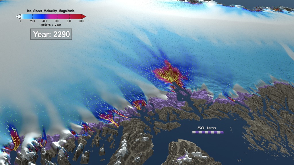
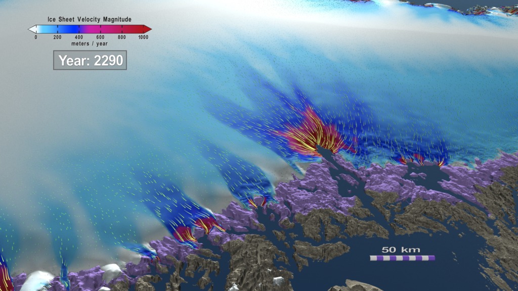
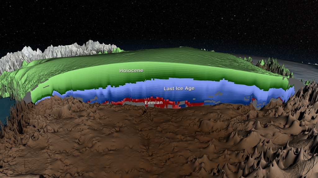
The extensive data IceBridge has gathered over the Greenland ice sheet during its operations have provided an improved picture of the surface, the bed and the internal structures of Greenland’s ice sheet and allowed scientists to create more accurate models of glacier contribution to sea level rise. As for sea ice, IceBridge’s measurements of the thickness of sea ice and its snow cover have assisted in improving forecasts for summertime melt, enhanced the understanding of variations in ice thickness distribution from year to year, and updated the climatology of the snow depth over sea ice.
- ID: 13469
 Produced Video
 - ID: 13471
 Produced Video
 - ID: 13473
 Produced Video
 - ID: 13474
 Produced Video
 - ID: 13475
 Produced Video
 - ID: 13476
 Produced Video
 - ID: 13477
 Produced Video
 - ID: 13478
 Produced Video
 - ID: 13479
 Produced Video
 - ID: 40385
- ID: 40387

- ID: 40395

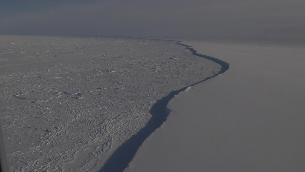
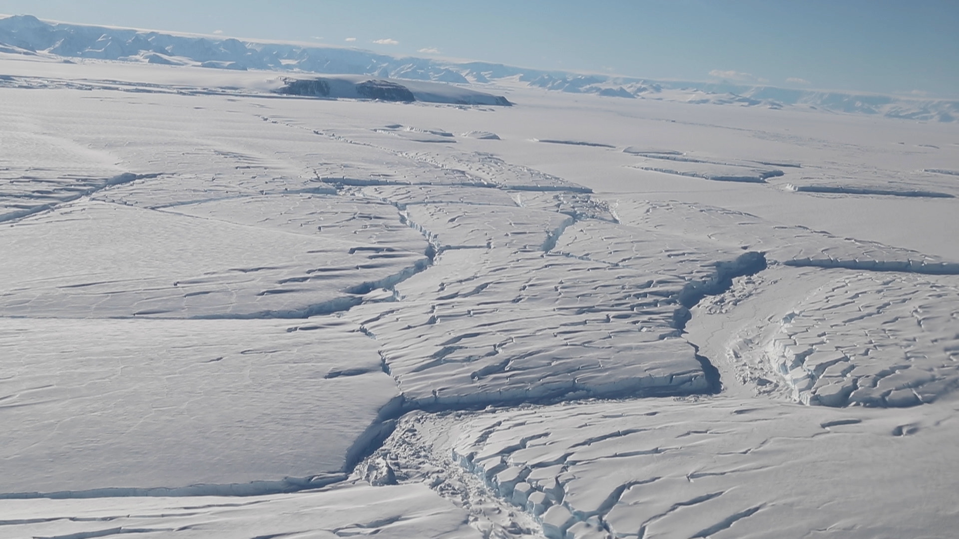
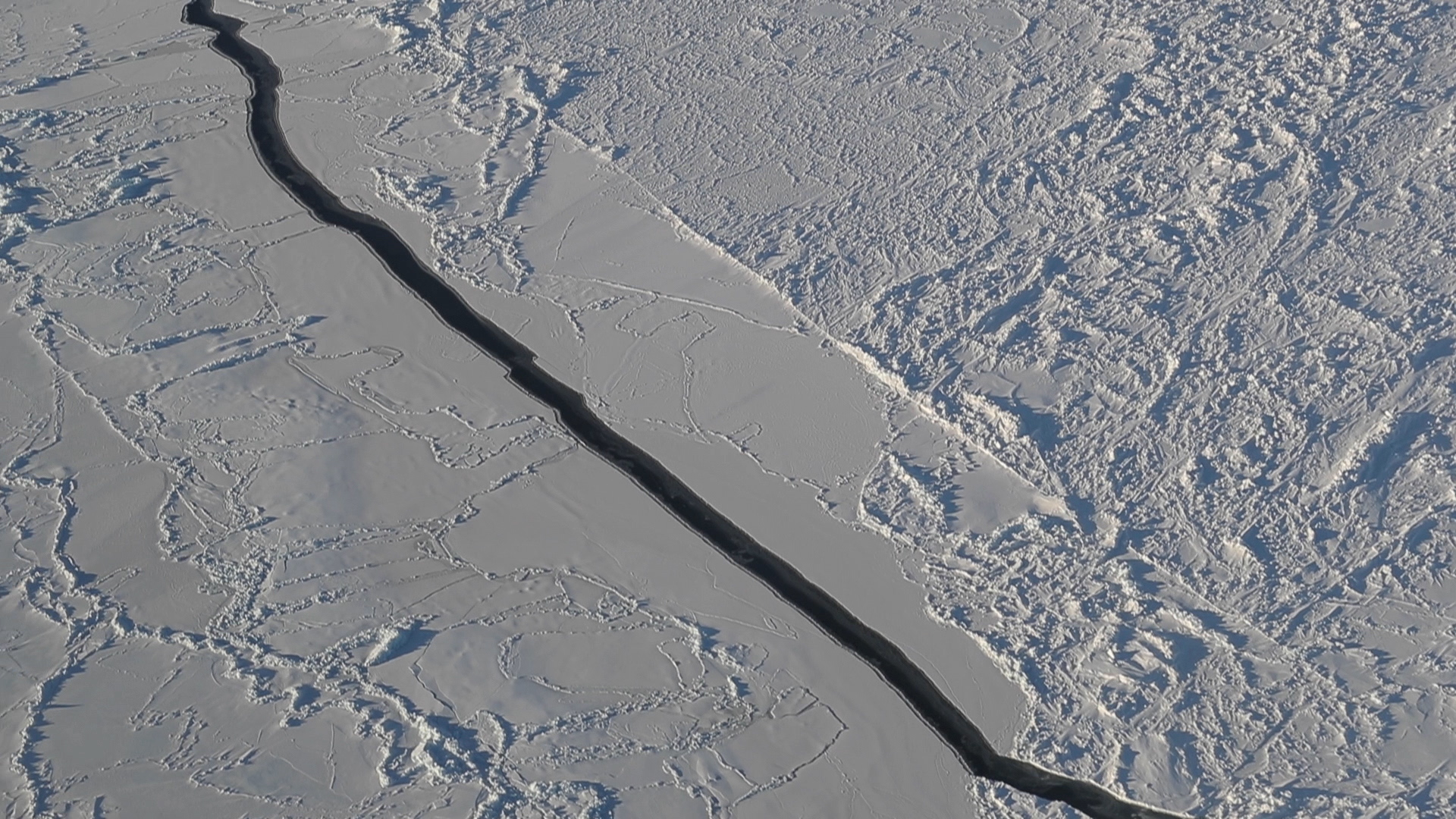
Antarctic
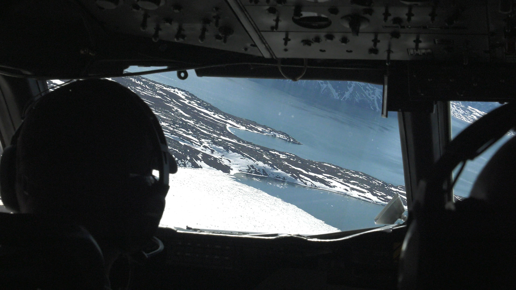
IceBridge conducted missions over Antarctica from a base of operations either in Punta Arenas, Chile, Ushuaia, Argentina, Hobart, Tasmania, or New Zealand.
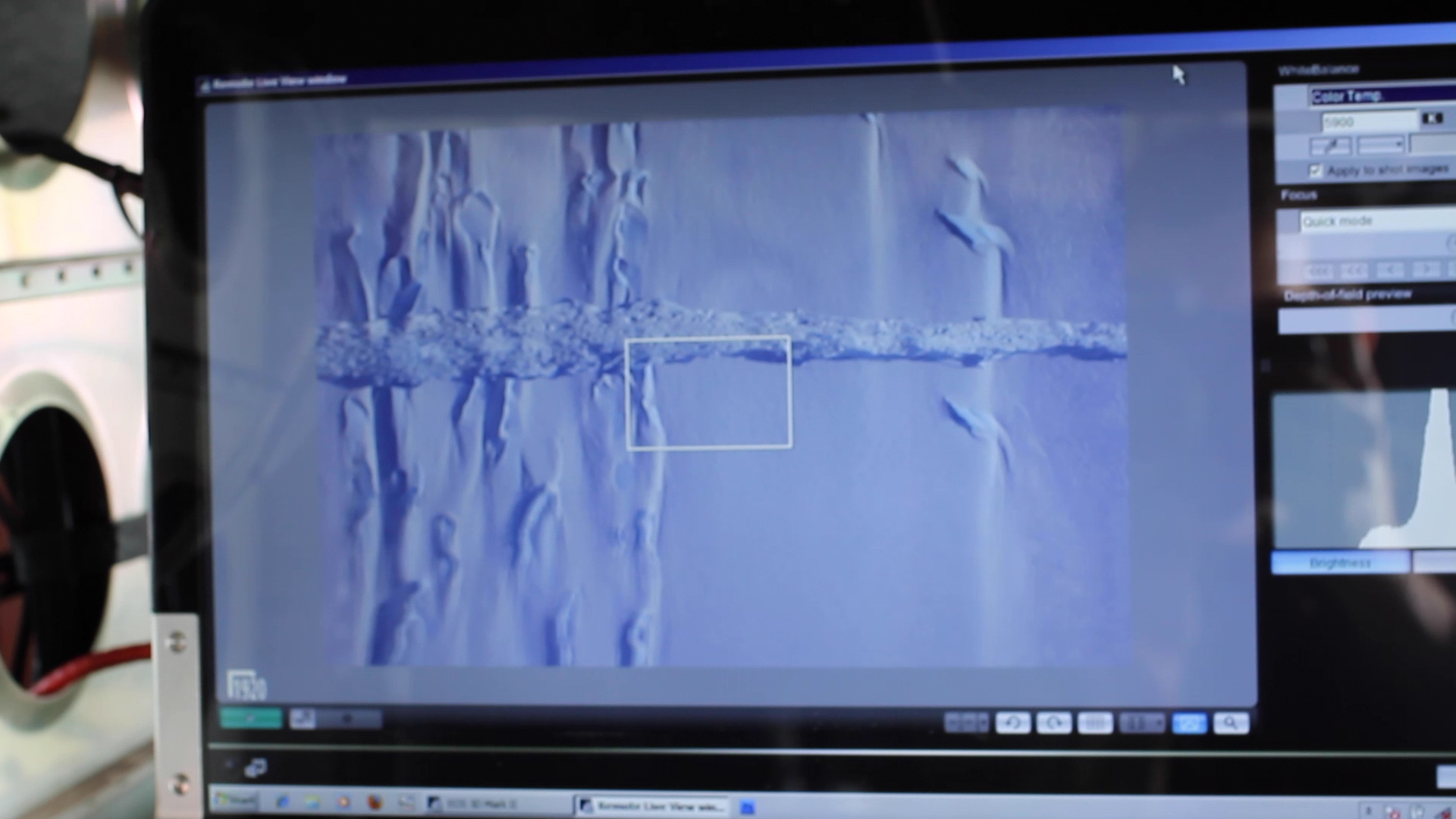
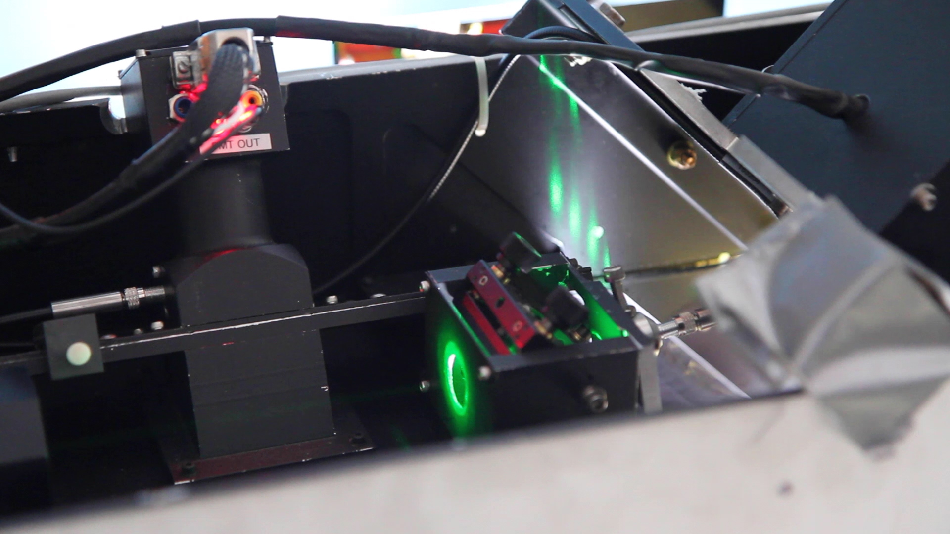
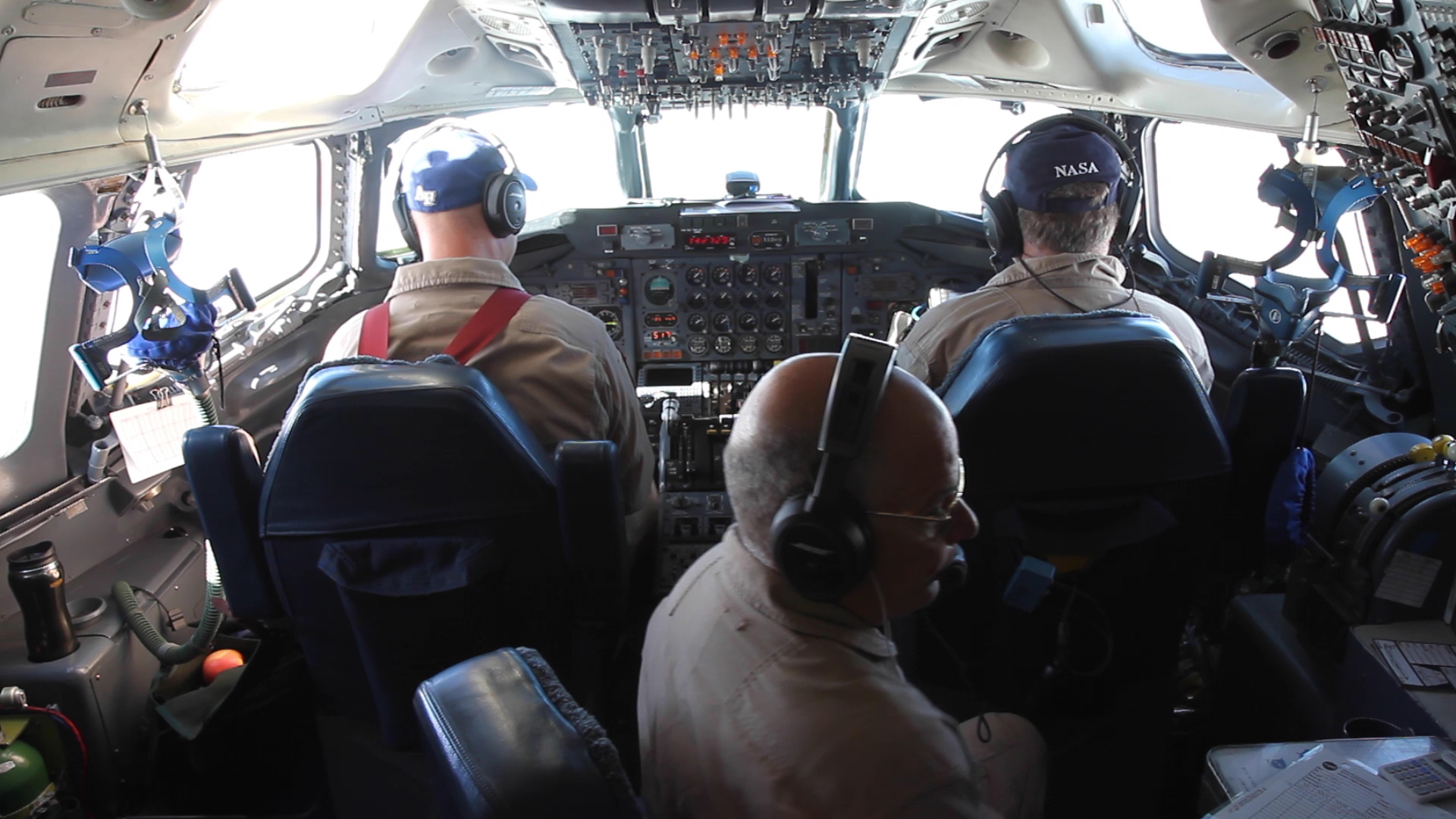
The surveys were conducted from NASA’s DC-8 airborne science laboratory and periodically NASA's GV, or P3-Orion aircraft. The DC-8, managed by NASA’s Armstrong Flight Research Center in Palmdale, California, carried IceBridge’s full instrument suite.
- ID: 13441
 Produced Video
 - ID: 13440
 Produced Video
 - ID: 13444
 Produced Video
 - ID: 13445
 Produced Video
 - ID: 13446
 Produced Video
 - ID: 13458
 Produced Video
 - ID: 13459
 Produced Video
 - ID: 13460
 Produced Video
 - ID: 13461
 Produced Video
 - ID: 13462
 Produced Video
 - ID: 40389
- ID: 40396

Alaska
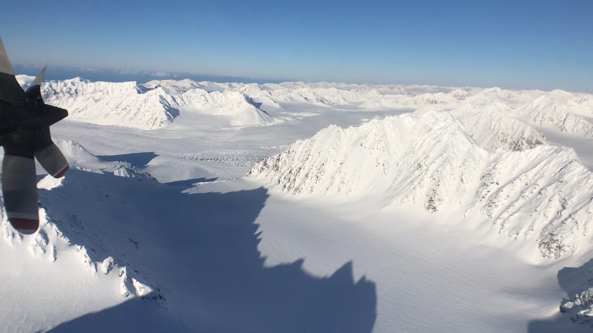
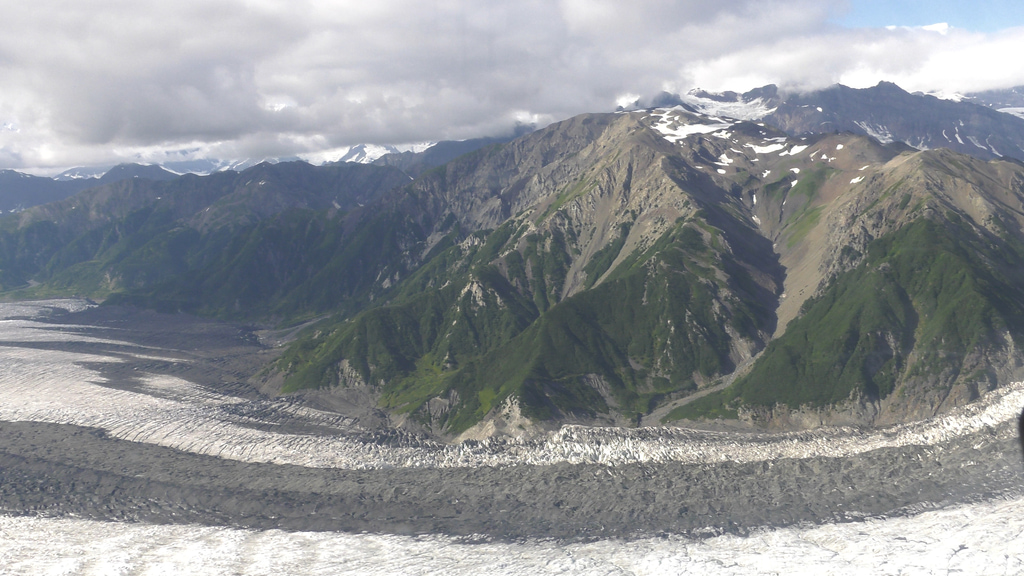
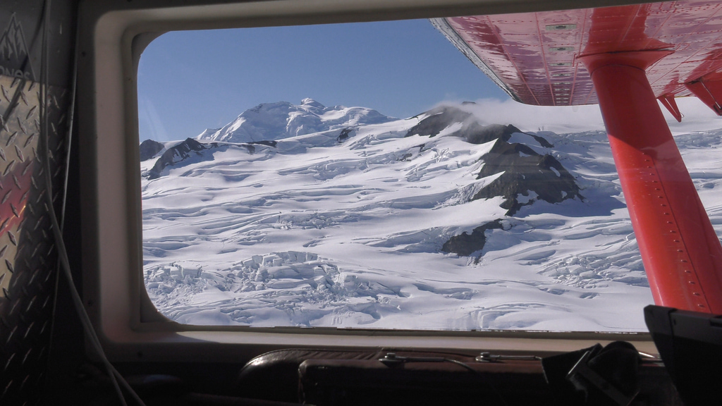
In Alaska, 5 percent of the land is covered by glaciers that are losing a lot of ice and contributing to sea level rise. To monitor these changes, a small team of NASA-funded researchers has been flying scientific instruments on a bright red, single-engine plane since spring 2009.
While scientists at the Goddard Space Flight Center managed the two larger yearly field campaigns in the Arctic and Antarctica, monitoring Alaskan glaciers fell on a smaller team based at the University of Fairbanks, Alaska.
- ID: 13299 Produced Video
Operation IceBridge - Alaskan Glaciers
Go to this pageIn Alaska, 5 percent of the land is covered by glaciers that are losing a lot of ice and contributing to sea level rise. To monitor these changes, a small team of NASA-funded researchers has been flying scientific instruments on a bright red, single-engine plane since spring 2009.While scientists at the Goddard Space Flight Center managed the two larger yearly field campaigns in the Arctic and Antarctica, monitoring Alaskan glaciers fell on a smaller team based at the University of Fairbanks, Alaska. ||
- ID: 13298 Produced Video
Operation IceBridge - Alaskan Landscape
Go to this pageIn Alaska, 5 percent of the land is covered by glaciers that are losing a lot of ice and contributing to sea level rise. To monitor these changes, a small team of NASA-funded researchers has been flying scientific instruments on a bright red, single-engine plane since spring 2009.While scientists at the Goddard Space Flight Center managed the two larger yearly field campaigns in the Arctic and Antarctica, monitoring Alaskan glaciers fell on a smaller team based at the University of Fairbanks, Alaska. ||
- ID: 13490 Produced Video
Operation IceBridge - Alaskan Operations
Go to this pageIn Alaska, 5 percent of the land is covered by glaciers that are losing a lot of ice and contributing to sea level rise. To monitor these changes, a small team of NASA-funded researchers has been flying scientific instruments on a bright red, single-engine plane since spring 2009.While scientists at the Goddard Space Flight Center managed the two larger yearly field campaigns in the Arctic and Antarctica, monitoring Alaskan glaciers fell on a smaller team based at the University of Fairbanks, Alaska. ||
- ID: 13162 Produced Video

Flying Alaskan Glaciers
Go to this pageFlying low over some of the most dramatic landscapes on the planet, a cadre of scientists and pilots have been measuring changes in Alaskan glaciers as part of NASA’s Operation IceBridge for almost a decade. The team has seen significant change in ice extent and thickness over that time. Data from the mission was used in a 2015 study that put numbers on the loss of Alaskan glaciers: 75 billion tons of ice every year from 1994 to 2013. Last summer, Chris Larsen and Martin Truffer, both of the University of Alaska Fairbanks, flew with University of Arizona's Jack Holt and University of Texas student Michael Christoffersen. || OIB_Alaska_Final.00010_print.jpg (1024x576) [109.9 KB] || OIB_Alaska_Final.00010_searchweb.png (320x180) [96.3 KB] || OIB_Alaska_Final.00010_thm.png (80x40) [6.8 KB] || OIB_Alaska_Final.mp4 (1920x1080) [939.1 MB] || YOUTUBE_1080_OIB_Alaska_Final_youtube_1080.mp4 (1920x1080) [977.3 MB] || OIB_Alaska_Final.webm (1920x1080) [76.9 MB] || OIB_Alaska_Final.en_US.srt [12.6 KB] || OIB_Alaska_Final.en_US.vtt [12.6 KB] ||
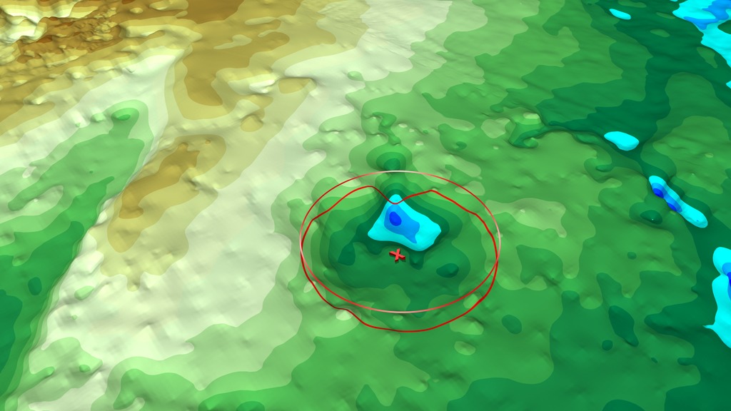
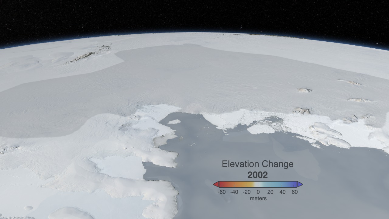
Data Visualizations
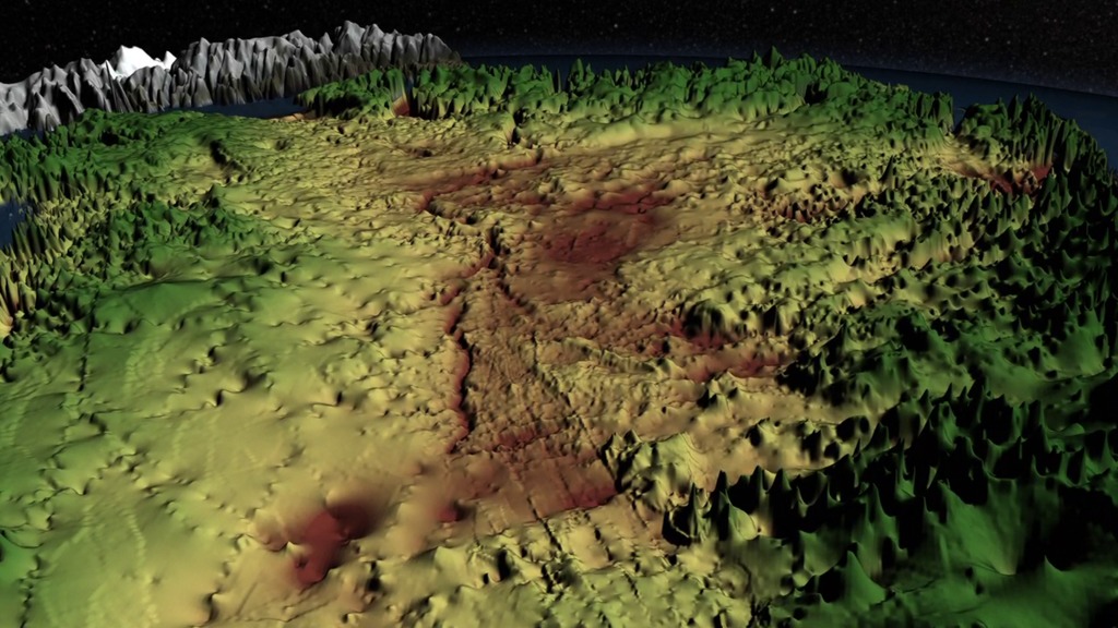
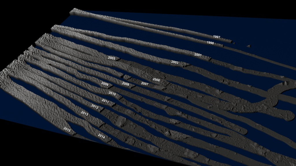
Throughout the mission, NASA's Scientific Visualization Studio worked closely with mission scientists to create a suite of visualizations, animations, and images in order to promote a greater understanding of data gathered during OIB campaigns.
- ID: 4774
 Visualization
 - ID: 4727
- ID: 4722
- ID: 4721
- ID: 4691
- ID: 3825
- ID: 3875
 Visualization
 - ID: 10588
 Produced Video
 - ID: 11354
 Produced Video
 - ID: 4249
 Visualization
 - ID: 4348
- ID: 40399